Tropical Storm Raymond continues to gain strength and is becoming better organized. The National Hurricane Center in Miami, Florida believes the system could pick up more strength before gradually weakening over time. While Raymond isn’t expected to be much of a storm at landfall, it should send significant moisture into the American west and help fuel a storm that’ll eventually impact the eastern United States.
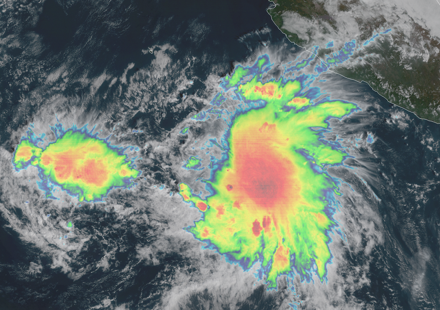
In the latest advisory from the National Hurricane Center (NHC), the center of Tropical Storm Raymond was located near latitude 14.1 North, longitude 108.8 West. Raymond is moving toward the north-northwest near 7 mph , and this general motion with a slight increase in forward speed is expected through today. A turn toward the north or north-northeast is forecast by late Saturday. Maximum sustained winds have increased to near 45 mph with higher gusts. Some additional strengthening is anticipated during the next day or so. Weakening is forecast to occur by Sunday, and the system is predicted to degenerate into a remnant low by late Sunday or early Monday.
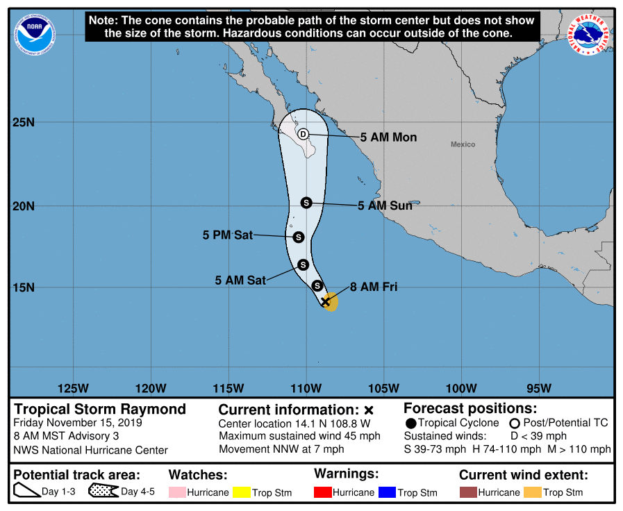
According to the NHC, the largest source of uncertainty in Raymond’s forecast is how its structure will evolve during the next 12 hours. Satellite data showed that Raymond’s circulation was still rather elongated overnight, but more recent microwave data indicate that the center may be reforming closer to the deep convection. If a new center is in fact consolidating to the east, Raymond should have an opportunity to strengthen today, but if the cyclone remains elongated, little intensification is likely. Beyond this potential period of intensification, stronger upper-level winds are likely to start a weakening trend before Raymond nears the Baja California peninsula late Sunday or early Monday. In fact, the NHC expects Raymond will only be a remnant low around that time.
Regardless of the strength of the system, Raymond will bring a large amount of moisture on-shore. Rainfall from this system is forecast to spread northward into southern portions of the Baja California peninsula during the next few days; heavy rains could cause life-threatening flash flooding. Soaking rains will make their way into the desert Southwest. An area of low pressure will form over the Rockies, with snow and rain from this new system expected to head east next week. By the middle to later part of next week, rain and snow from this storm should impact portions of the Great Lakes, the Mid Atlantic, and the Northeast.
