
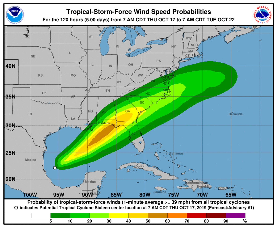
With the likelihood of a new tropical storm forming in the Gulf of Mexico, the National Hurricane Center has issued Tropical Storm Watches and Warnings for portions of the U.S. Gulf Coast. It hasn’t formed yet, but the National Hurricane Center believes there’s a 90% chance that the tropical storm will form in the next 48 hours.
Due to the threats posed by this potential tropical cyclone, a variety of watches and warnings are in effect. A Tropical Storm Warning is in effect for the area stretching from the Mississippi/Alabama border to the Ochlockonee River in Florida and from Grand Isle, Louisiana to the Mouth of the Pearl River. A Tropical Storm Watch is in effect for east of the Ochlockonee River to Yankeetown, Florida. A Storm Surge Watch is in effect for the area from Indian Pass to Clearwater Beach, Florida. A Tropical Storm Warning means that tropical storm conditions are expected somewhere within the warning area within 36 hours. A Tropical Storm Watch means that tropical storm conditions are possible within the watch area, generally within 48 hours. A Storm Surge Watch means there is a possibility of life-threatening inundation, from rising water moving inland from the coastline, in the indicated locations during the next 48 hours.
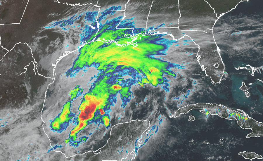
In the latest update from the National Hurricane Center, the disturbance was centered near latitude 22.6 North, longitude 95.5 West. The system is moving toward the north near 7 mph . A turn toward the northeast is expected this afternoon or tonight, and a northeastward motion at a faster forward speed is expected on Friday and Saturday. On the forecast track, the system will approach the northern Gulf Coast Friday and Friday night.
Maximum sustained winds are near 35 mph with higher gusts. The disturbance is expected to develop into a tropical or subtropical storm later today or tonight, with slow strengthening then expected through Friday night. For now, the estimated minimum central pressure is 1007 mb (29.74 inches).
When the next storm becomes named in the Atlantic hurricane basin, it’ll be called Nestor.
Many hazards will impact land in the coming days: storm surge, high winds, and heavy rain. It appears there could be a surge of 3-5′ from Indian Pass to Chassahowitzka in Florida and a 2-4′ surge from Chassahowitzka to Clearwater Beach. Surge-related flooding depends on the relative timing of the surge and the tidal cycle, and can vary greatly over short distances. Tropical storm-force wind conditions are expected to first reach the coast within the warning area by late Friday, making outside preparations difficult or dangerous. The system is expected to produce total rainfall accumulations of 2 to 4 inches this weekend from the central Gulf Coast and northern and central Florida to the eastern Carolinas, with isolated maximum amounts of 5 inches.
