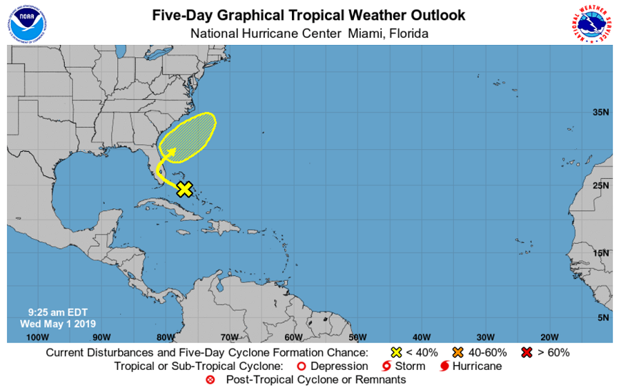
While the 2019 Atlantic Hurricane Season officially kicks off one month from today, an area of disturbed weather off the Florida coast has caught the eye of the National Hurricane Center for possible tropical development. A trough of low pressure located over the northwestern Bahamas is producing disorganized shower and thunderstorm activity. Little development is expected during the next couple of days as the system moves generally northwestward toward the Florida Peninsula.

While the National Hurricane Center says development isn’t expected for the next few days, they caution some slow development is possible as the disturbance turns northeastward and moves over the western Atlantic. Overall, the National Hurricane Center believes there’s a zero percent chance of tropical cyclone formation over the next 48 hours but that grows to 20% over the next five days.
Even if a tropical cyclone doesn’t form, locally heavy rains are possible over portions of the Bahamas and the Florida Peninsula during the next couple of days.
Hurricane experts believe the upcoming hurricane season will be an active one with near-normal number of storms. At the 2019 National Tropical Weather Conference in South Padre Island, Texas, hurricane forecast authority Dr. Phil Klotzbach took to the stage to unveil the CSU Tropical Meteorology Project’s seasonal forecast. That forecast calls for 13 named storms this season, up from the average of 12.
