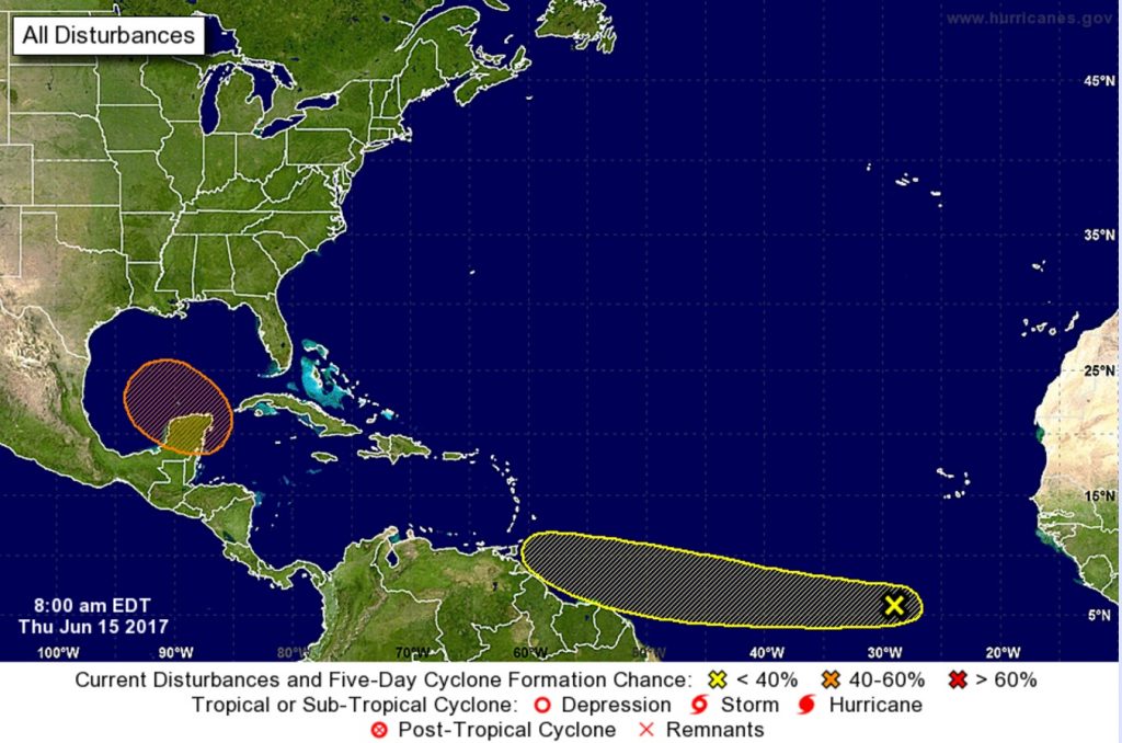
With the second week of the 2017 Atlantic Hurricane season in the books, the tropics are beginning to heat up. In their latest update, the National Hurricane Center points out two areas they are tracking for possible development.
A complex area of low pressure is expected to form over the northwestern Caribbean Sea and the Yucatan Peninsula this weekend. Conditions appear to be favorable for gradual development of this system while it moves slowly northwestward toward the southern Gulf of Mexico by early next week. Chance of formation is low over the next 48 hours but moderate over the next 5 days, 0% and 50% respectively. Computer forecast guidance is not yet aligned on the future track and intensity of this system; as such, residents of the entire Gulf Coast and the US East Coast should keep an eye on it as the weekend wraps-up and the new week begins.,
A tropical wave located several hundred miles south-southwest of the Cabo Verde Islands is producing disorganized showers and thunderstorms; some gradual development of this system is possible during the next few days while the wave moves westward near 20 mph over the tropical Atlantic. The chance of formation is low; it’s only 10% over the next 48 hours and only 20% over the next 5 days.
The 2017 Atlantic Hurricane season already had one named storm, Arlene, during the pre-season period. Many experts believe this will be an active season. On June 1, the first day of the season, Dr. Phil Klotzbach and the experts at Colorado State University, released a revised outlook that shows an above-average season. The National Oceanic and Atmospheric Administration released their own outlook at the end of May which also shows an above-average season likely.