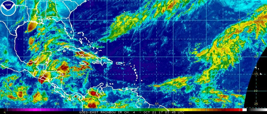
With just over five weeks of the 2017 Atlantic Hurricane Season left, the Atlantic hurricane basin has become quiet. While there are plenty of areas of clouds with showers and storms under them, the National Hurricane Center (NHC) expects no tropical development from any of them over the next five days.
A substantial high pressure system centered over North Carolina is producing surface ridging over the northern Gulf of Mexico. A surface trough is over the western Gulf, which is setting off a broad line of thunderstorm activity there. Further east, scattered moderate convection is over the Yucatan Peninsula, the Yucatan Channel, and western Cuba, all moving north from the Caribbean Sea. In addition, radar imagery shows scattered showers are over southern Florida and the Straits of Florida, moving southwest from the Atlantic. In the upper levels, an upper level trough is over Texas and the western Gulf of Mexico.
There are two tropical waves over the Caribbean Sea. In addition to those waves, the eastern extent of the eastern Pacific monsoon trough is over Costa Rica and Panama producing isolated moderate convection. The National Hurricane Center expects the tropical
waves to move west with convection, but even so, no tropical development is expected. Fortunately for those dealing with the aftermath of Hurricanes Irma and Maria, fair weather should continue over Puerto Rico and the Leeward Islands for the next 24
hours.
Out in the Atlantic Ocean. there are numerous areas of clouds and showers, but like the rest of the basin, none show any signs of organization or tropical development.