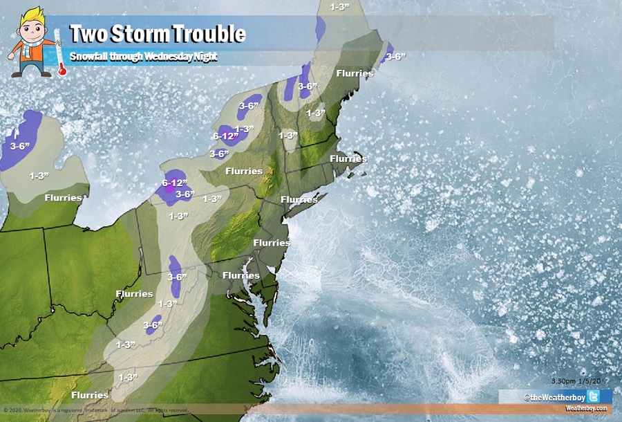
Two storm systems are forecast to move through the eastern United States in the coming days; one will swing down from Canada while the other will move up from the southeast. The result will be widespread light snow and flurries from both, with heavier amounts expected in lake effect snow bands and across higher terrain of West Virginia and New England.
Ahead of the storms arrival in the northeast, high pressure will build across the Gulf states tonight into Monday while low pressure moves across the Canadian Maritimes.
A cold front will move across the northeast late tonight into early Monday as an area of low pressure weakens across the Great Lakes region. This system will produce light snow across Michigan, Pennsylvania, upstate New York, and New England. Due to the forecast of lake effect snow bands, some heavier pockets of snow are expected over upstate New York. More moderate snowfall is also expected down-wind of Lake Superior on Michigan. As that system exits, high pressure will briefly return Monday night.
As the high moves in Monday night, a new area of low pressure will move across the central and southern Mid Atlantic region, strengthening as it lifts northward offshore of New Jersey and Delaware. This low will lift to the northeast through Wednesday before high pressure rebuilds across the Mid Atlantic and Northeast Wednesday night and Thursday. This system is expected to produce light snow over northwestern North Carolina, western Virginia, West Virginia, western Maryland, and western Pennsylvania. As the system moves northeast, it’ll likely create snow flurries and isolated snow squalls across the rest of Maryland, Delaware, New Jersey, and southeastern New England. Because the system will be starved for moisture, little to no snow accumulation is expected there. However, snow flurries can briefly lower visibilities and coat untreated surfaces with a light icy covering, leading to hazardous travel conditions. While no significant snow is expected, the scattered flurries could create some tricky travel conditions on Tuesday into early Wednesday.
Beyond these two light snow events, no other significant snowstorms are on the horizon in the northeast for the next 10 days.