Due to low-level volcanic ash emissions and the detection of explosion signals, scientists at the USGS Alaska Volcano Observatory (AVO) have upgraded the color code and alert level at the Semisopochnoi volcano. The color code was upgraded from YELLOW to ORANGE and the alert level was upgraded from ADVISORY to WATCH.
According to the AVO, several small explosions were detected in regional infrasound data yesterday and a small ash cloud was observed in a satellite image from 15:21 (23:21 UTC) on May 17 prompting the team of scientists to raise both the color code and alert level. AVO says that sulfur dioxide emissions were possibly detected in satellite data over the past 24 hours.
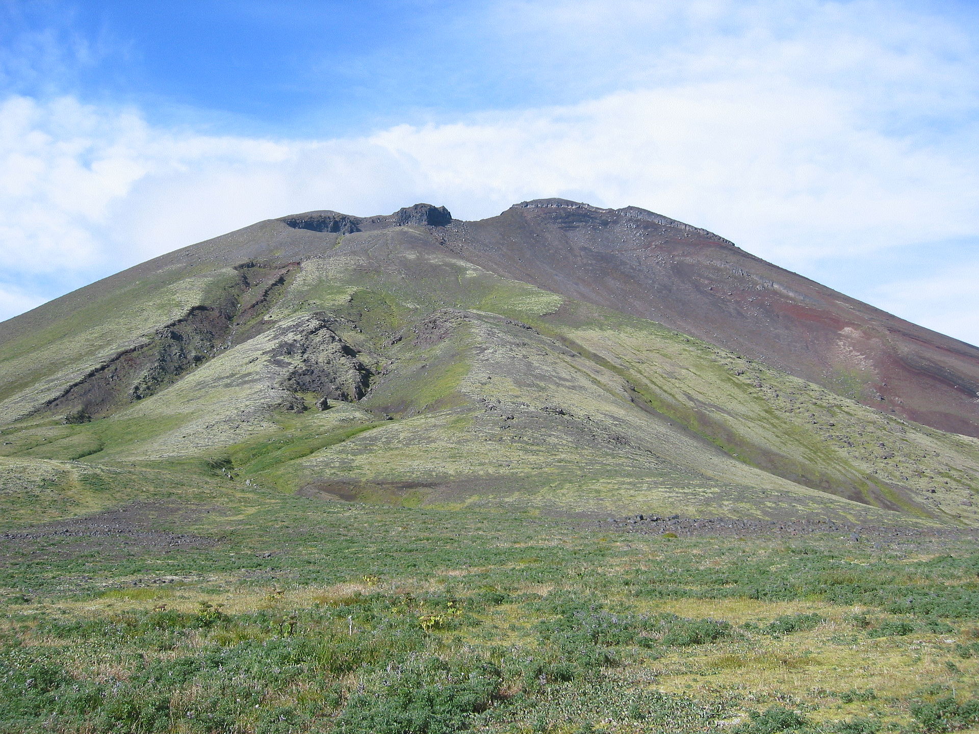
Small eruptions producing minor ash deposits within the vicinity of the active north crater of Mount Cerberus and ash clouds under 10,000 ft above sea level are typical of recent activity at Semisopochnoi.
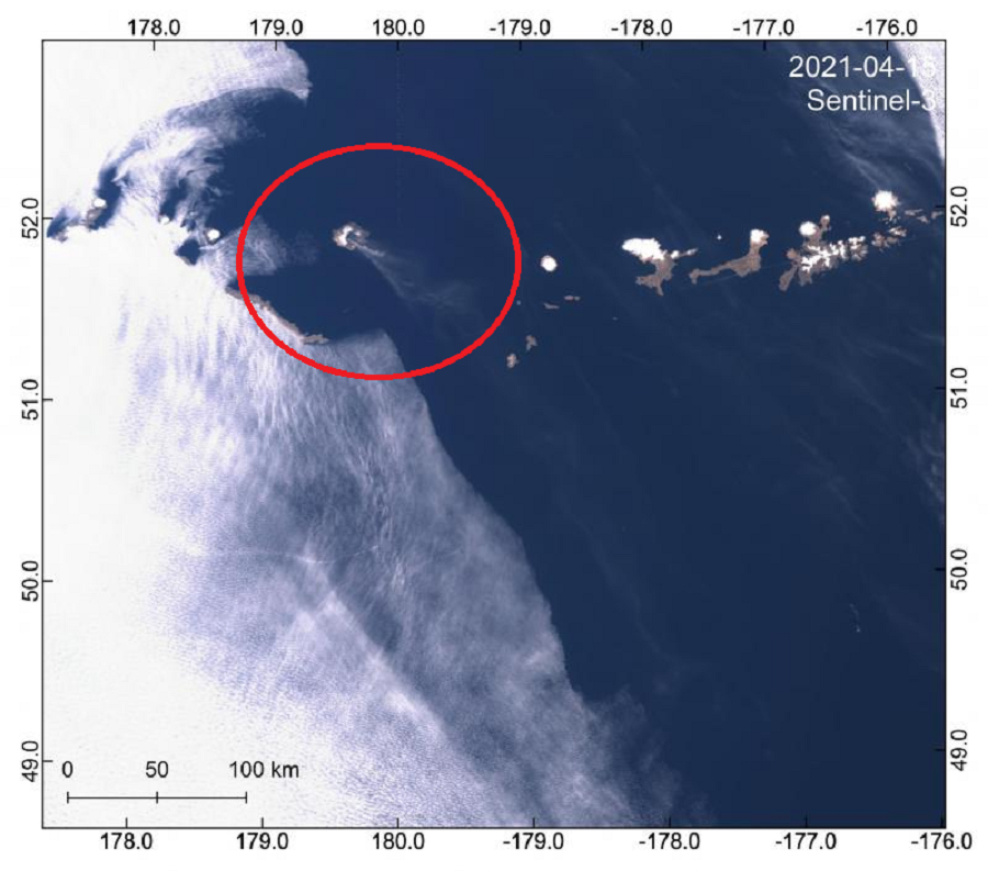
Based on its location on the globe at 179°46′ East, Semisopochnoi is the easternmost land location in the United States and North America, located just 9.7 miles west of the 180th Meridian in Alaska. Semisopochnoi is part of the Aleutian Islands, a chain of 14 large volcanic islands and 55 smaller other islands. These islands, with their 57 volcanoes, make the northernmost part of the Pacific Ring of Fire.
The Ring of Fire is a region around the rim of the Pacific Ocean where many volcanic eruptions and earthquakes occur. Caused by plate tectonics, lithospheric plates under and around the Pacific Ocean move, collide, and/or are destroyed, creating the seismic activity the Ring of Fire is famous for.
Volcanoes in this portion of the Ring of Fire are monitored by the Alaska Volcano Observatory (AVO), which is a joint program of the U.S. Geological Survey (USGS), the Geophysical Institute of the University of Alaska Fairbanks (UAFGI), and the State of Alaska Division of Geological and Geophysical Surveys (ADGGS). The AVO is similar to the Hawaii Volcano Observatory (HVO) which monitors Hawaii’s three active volcanoes: Kilauea, Mauna Loa, and Hualalai. In the case of AVO, they monitor Cleveland, Semisopochnoi, and Veniaminof; while Semisopochnoi is now under a WATCH, Cleveland is under an ADVISORY while Veniaminof has no assigned status.
Alaska is home to many volcanoes, though; there are more than 130 volcanoes and volcanic fields which have been active within the geologically young last 2 million years. 50 have been active since the mid 1700s and AVO studies those too. In the case of Semisopochnoi, the volcano is monitored by satellite data and lightning detection instruments. An infrasound array on Adak Island may detect explosive emissions from Semisopochnoi with a slight delay of approximately 13 minutes, if atmospheric conditions permit.
AVO is responsible for issuing Aviation Codes and Volcanic Activity Alert Levels. Aviation Codes are green, yellow, orange, or red. When ground-based instrumentation is insufficient to establish that a volcano is at a typical background level of activity, it is simply “unassigned.” While green means typical activity associated with a non-eruptive state, yellow means a volcano is exhibiting signs of elevated unrest above known background levels. When a volcano exhibits heightened or escalating unrest with the increased potential of eruption, it jumps to orange. Finally, when an eruption is imminent with significant emission of volcanic ash expected in the atmosphere or an eruption is underway with significant emission of volcanic ash into the atmosphere, the code becomes red. Volcanic Activity Alert levels are normal, advisory, watch, or warning. As with aviation codes, if data is insufficient, it is simply labeled as “unassigned.” When the volcano is at typical background activity in a non-eruptive state, it is considered normal. If the volcano exhibits signs of elevated unrest above background level, an advisory is issued. If a volcano exhibits heightened or escalating unrest, a watch is issued while a warning is issued when a hazardous eruption is imminent.
Volcanic ash can create significant harm to jet engines that fly through them or boat and automobile engines that ingest ash-filled air. Volcanic ash is hard and abrasive, and can quickly cause significant wear to various airplane parts such as propellers, turbo-compressor blades, and even cockpit windows. Because volcanic ash particles have a low melting point, it can melt in the combustion chamber of a jet engine, creating a ceramic or glass-like glaze that then sticks to turbine blades, fuel nozzles, and combustors. A jet engine that ingests just a small amount of ash could suffer from total engine failure. Overheating and engine failure is also possible in cars and trucks since volcanic ash can infiltrate nearly every opening in a vehicle. Ash is also very abrasive; ash caught between windshields and wiper blades will scratch and permanently mark the windshield glass, and windows are susceptible to scratching each time they are raised, lowered, and cleaned.
Volcanic ash rising from the Aleutians could be problematic for trans-Pacific aircraft traveling between Asia and North America.
