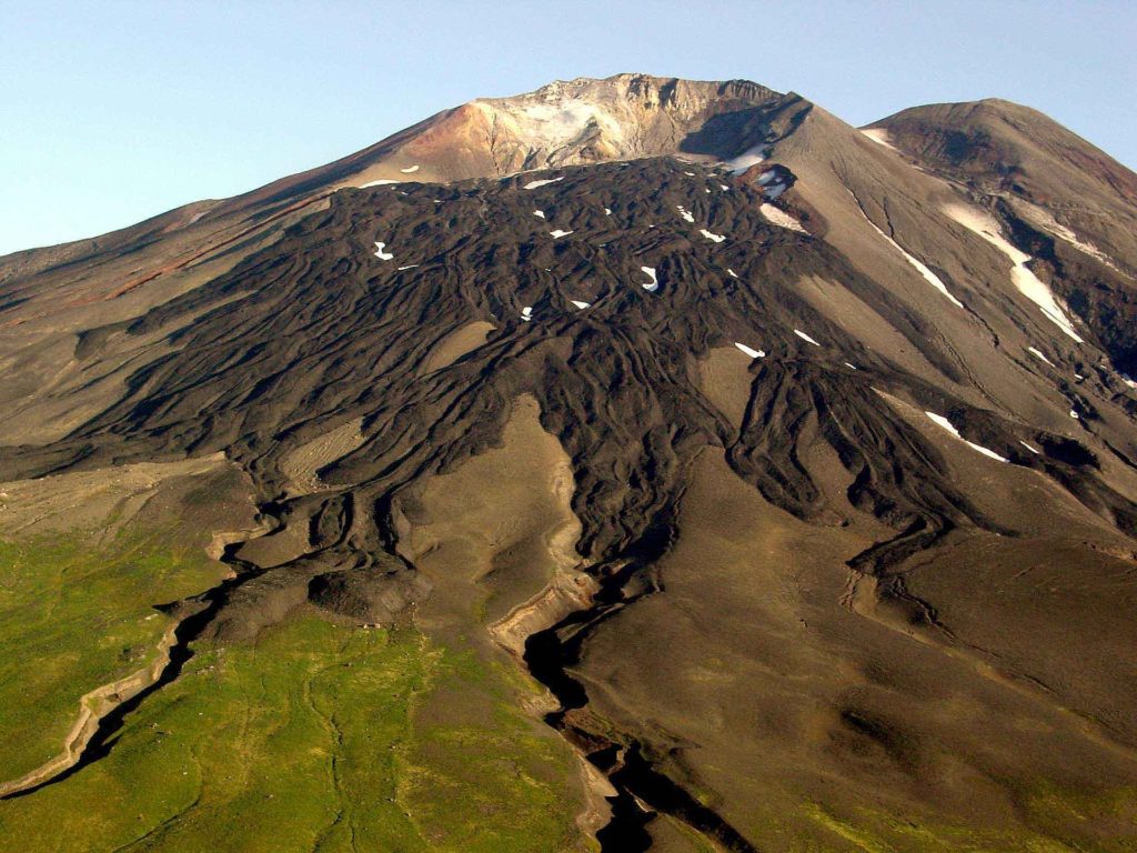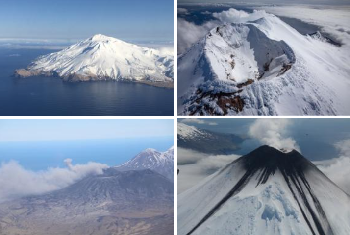
The USGS has posted an Orange code and Watch alert for one volcano and a Yellow code and an Advisory alert for six volcanoes they’re tracking across the country; USGS says these volcanoes are “exhibiting signs of elevated unrest above known background level.” The volcano with the highest alert code is Great Sitkin in Alaska; just days ago, the Alaska Volcano Observatory (AVO) raised its color and alert codes up to Orange and Watch. The six with the heightened level of alert of Yellow / Advisory include the world’s largest active volcano, Mauna Loa, and Kilauea, Gareloi, Semisopochnoi, and Cleveland. While Mauna Loa and Kilauea are both on Hawaii’s Big Island, the rest under the Yellow code are in Alaska.
Within the United States, the USGS tracks 169 potentially active volcanoes, most of which are in Alaska. Alaska is home to many volcanoes, though; there are more than 130 volcanoes and volcanic fields which have been active within the geologically young last 2 million years. 50 have been active since the mid 1700s and AVO studies those too. Another place famous for its volcanoes is Hawaii; on the Big Island of Hawaii, Kilauea, Mauna Loa, and Hualalai are considered active and potential threats, however none are erupting as of today. Kilauea did start a fresh eruption in December 2020, but that eruption came to an end just weeks ago. The Hawaii volcanoes are monitored by the Hawaii Volcano Observatory (HVO) while the Alaska volcanoes are monitored by the Alaska Volcano Observatory (AVO.) In addition to the AVO and HVO, there are also the California Volcano Observatory , Cascades Volcano Observatory, and the Yellowstone Volcano Observatory. Each of those additional volcano observatories within the USGS are monitoring volcanoes in their respective regions. At this time, none of those other observatories are reporting unusual activity or signs of anything more than background noise for now.
According to the U.S. Geological Survey (USGS), there are about 1,500 potentially active volcanoes worldwide, with about 500 of the 1,500 erupting in historical times. Most of the volcanoes in the world are located around the “Ring of Fire” around the Pacific Rim. The Ring of Fire is a region around the rim of the Pacific Ocean where many volcanic eruptions and earthquakes occur. Caused by plate tectonics, lithospheric plates under and around the Pacific Ocean move, collide, and/or are destroyed, creating the seismic activity the Ring of Fire is famous for.

In the U.S., the USGS and volcano observatory units are responsible for issuing Aviation Codes and Volcanic Activity Alert Levels. Aviation Codes are green, yellow, orange, or red. When ground-based instrumentation is insufficient to establish that a volcano is at a typical background level of activity, it is simply “unassigned.” While green means typical activity associated with a non-eruptive state, yellow means a volcano is exhibiting signs of elevated unrest above known background levels. When a volcano exhibits heightened or escalating unrest with the increased potential of eruption, it jumps to orange. Finally, when an eruption is imminent with significant emission of volcanic ash expected in the atmosphere or an eruption is underway with significant emission of volcanic ash into the atmosphere, the code becomes red. Volcanic Activity Alert levels are normal, advisory, watch, or warning. As with aviation codes, if data is insufficient, it is simply labeled as “unassigned.” When the volcano is at typical background activity in a non-eruptive state, it is considered normal. If the volcano exhibits signs of elevated unrest above background level, an advisory is issued. If a volcano exhibits heightened or escalating unrest, a watch is issued while a warning is issued when a hazardous eruption is imminent.
The next volcano to erupt in the U.S. could be the world’s largest at Mauna Loa in Hawaii. In a recent news release, Hawaiian Volcano Observatory (HVO) scientists with USGS cautioned, “While an eruption of Mauna Loa is not imminent, now is the time to revisit personal eruption plans. Similar to preparing for hurricane season, having an eruption plan in advance helps during an emergency.”
Mauna Loa is considered the largest active volcano on Earth, rising to 13,681 feet above sea level. Mauna Loa rises up from the ocean floor of the Central Pacific at a depth of about 3 miles. Because of the volcano’s significant mass, the ocean floor directly beneath Mauna Loa is depressed by another 5 miles. According to USGS, this places Mauna Loa’s summit about 56,000 feet above its base; the enormous volcano covers half of the island of Hawaii, also known simply as the “Big Island of Hawaii.”

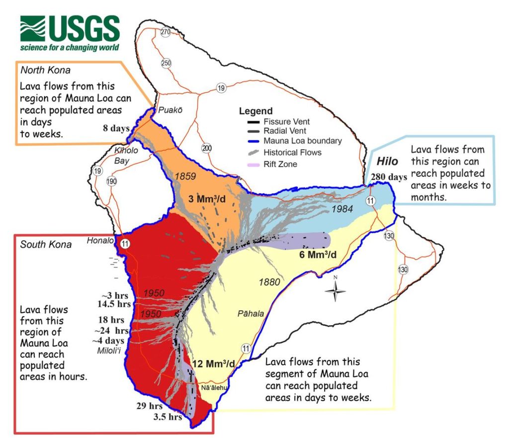
Mauna Loa eruptions tend to produce voluminous, fast-moving lava flows that can impact communities on the east and west sides of the Big Island from Kona to Hilo. Since the 1850s, Hilo in eastern Hawaii has been threatened by 7 Mauna Loa lava flows. On the south and west sides of the island, Mauna Loa lava flows have reached the coast there 8 times: in 1859, 1868, 1887, 1926, 1919, and three times in 1950.
According to USGS, while Mauna Loa is not erupting right now , rates of deformation and seismicity remain elevated above long-term background levels. GPS measurements continue to show slow, long-term summit inflation consistent with magma supply to the volcano’s shallow storage system. A slight increase in the rate of inflation that began in January continues.