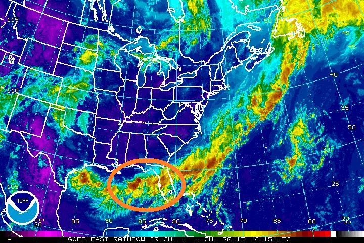
Meteorologists are watching an atmospheric disturbance near Florida for possible tropical development.
According to the National Hurricane Center (NHC) this afternoon, an area of low pressure is forecast to develop along a dissipating frontal boundary over the northeastern Gulf of Mexico during the next day or so. This system is forecast to move east across the Florida peninsula and into the western Atlantic by mid-week. In the latest tropical outlook from the NHC, any development should be slow to occur due to only marginally conducive upper-level winds and proximity to land.
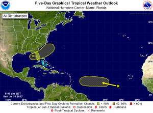
While the system will struggle to become a tropical cyclone, it’ll still be able to drop heavy precipitation with ease. The low is expected to produce locally heavy rainfall across portions of central and northeastern Florida through Wednesday. Should the system form into a tropical cyclone, significantly more rain could fall. However, those odds are low; NHC currently believes there’s only a 10% chance of formation over the next 48 hours and 20% over the next 5 days.
Meanwhile, a tropical wave located several hundred miles west-southwest of the Cabo Verde Islands is producing a large area of cloudiness and disorganized shower activity. Some slow development of this broad disturbance is possible over the next several days while the system
moves westward at 10 to 15 mph over the open waters of the Atlantic Ocean. The NHC believes formation chance is low; at about 0% for the next 48 hours and 30% for the next 5 days.
Experts believe this Atlantic Hurricane Season, which runs through to the end of November, will be a busy one. Dr. Phil Klotzbach and the experts at Colorado State University updated their seasonal outlook again on July 5, showing a much more active than normal season expected. The National Oceanic and Atmospheric Administration (NOAA) also released their own forecast which shows this hurricane season to be likely more active than others.
