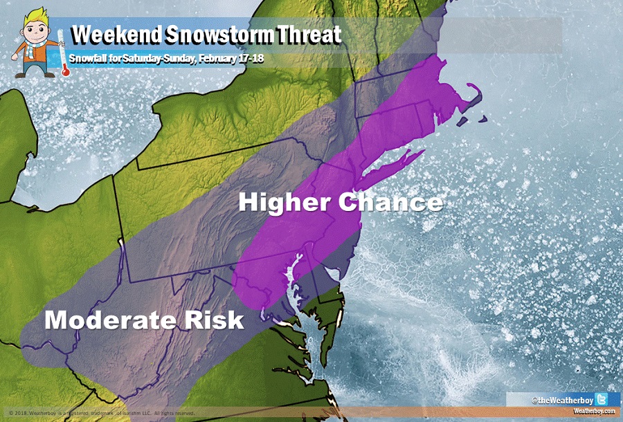
The threat of a weekend snowstorm is increasing with more computer forecast guidance on-board the concept of a storm coming up the Mid Atlantic coast. At this time, the best odds for the heaviest snow exists between Baltimore, MD up and along the I-95 corridor through Philadelphia, PA and New York City, NY into Boston, MA.
The weekend, also known as President’s Day weekend, has earned a reputation for producing big snow storms. The Blizzard of 2003 hit over President’s Day weekend, dropping 15-30″ of snow from Washington, DC to Boston, MA. A 1979 snowstorm also dropped 10-30″ of snow on President’s Day Weekend across the Mid Atlantic. Snow also hit this same region on 2015 and 2016.
While the weekend has a history of producing big snow, it is too early to know with certainty how much will fall. The European ECMWF, American GFS, and Canadian GEM forecast models all depict a winter storm in the region later Saturday into Sunday. While they’re somewhat aligned in the concept of the storm, there are still vast differences with how much snow will fall and where a rain/snow line will establish itself. The potential exists for many areas to see more than 6″ of snow, but a solid snowfall total forecast will likely be unknown until Thursday evening as more data is processed and the storm system is better understood.
The weekend snowstorm threat is made possible by an evolving weather pattern. A positively tilted upper-level trough centered in the vicinity of Hudson Bay will send several spokes of energy into the Eastern US this weekend. Significant short wave energy will help sharpen the southern part of the trough later Saturday into Sunday to help focus a surface low pressure near the Mid-Atlantic. With just the right amount of moisture and cold air, a snowstorm is likely to blossom here. However, the weather pattern is a fast-moving progressive one, so the threat of a high-end, high-impact snowstorm like what was seen in 2003 and 1979 is not expected at all.
While snow is likely for the region this weekend, a significant warm-up is also likely next week for this same region. A significant trough will develop in the West with a strengthening ridge in the East. This type of set-up will allow for warm air to surge from the south up the East coast as early as Tuesday. Record-breaking warmth is possible along the East Coast by the end of next week.
