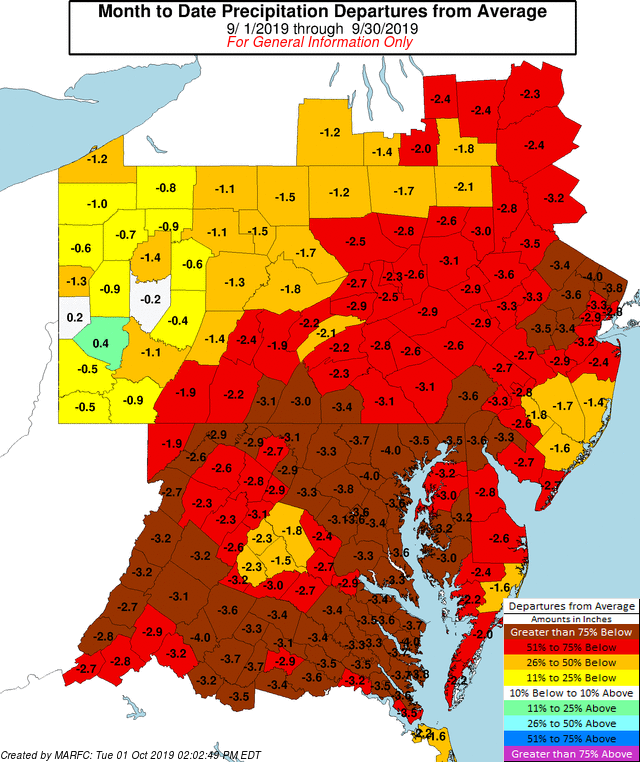
In the spring, people throughout the Mid Atlantic were complaining how wet the weather was: swampy backyards, muddy driveways, and soggy gardens were frequent reminders of just how wet it was. Now many months later, the same area is dealing with very dry conditions, wiping-out any moisture surpluses that existed earlier in the year.
After the extended period of above normal rainfall in the Mid Atlantic, the weather pattern has become much drier over the past two months that El Niño ended.
During an El Niño, the trade winds weaken in the central and western Pacific. With less upwelling of cold water to cool the surface, water temperatures on the surface off of South America warm up. With water temperatures and winds disrupted in the Pacific, clouds and rainstorms associated with warm ocean waters tend to shift to the east. This is why even in weak El Niño conditions, such as those that occured in the spring, the eastern United States saw more rain than usual.
The National Weather Service’s Middle Atlantic River Forecast Center believes area rivers and creeks , generally steady to slowly falling stages will occur through the upcoming weekend with a generally dry forecast in the near term.
With the dry weather here, drought conditions are beginning to expand.