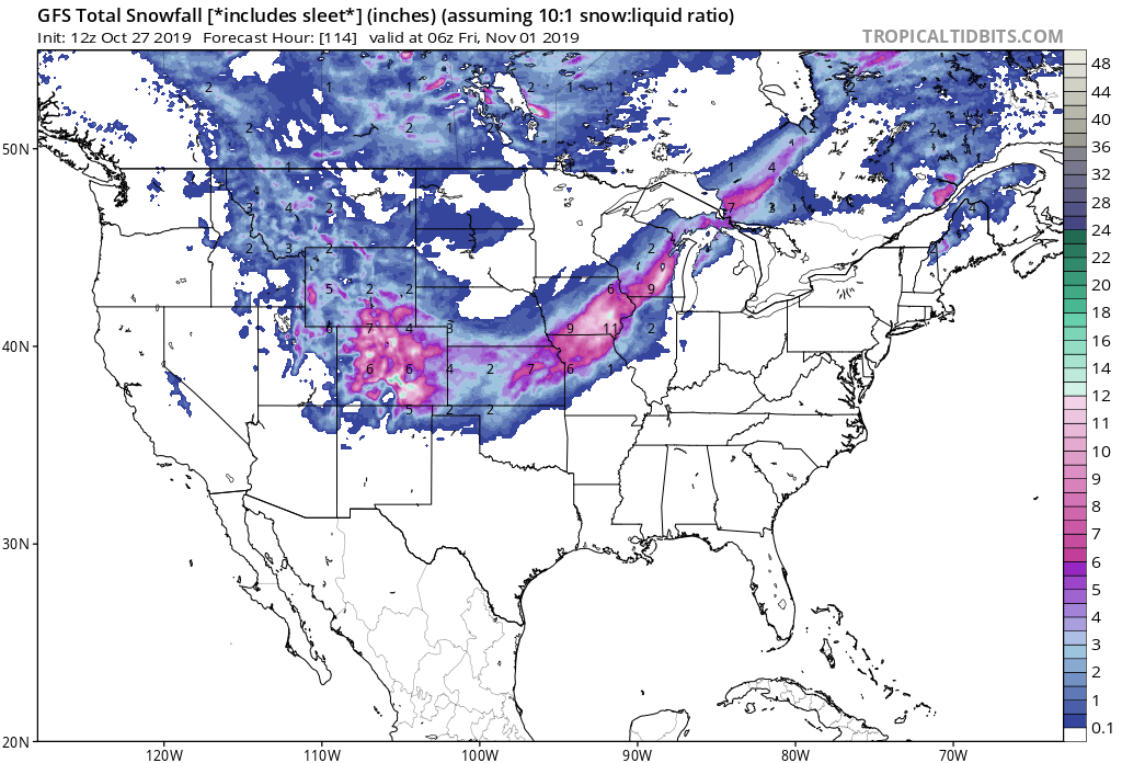
Many people across the United States, especially from Denver to Milwaukee, will experience early season snowfall in the coming days that’ll deliver a White Halloween. While a distant computer model suggested a storm could bring the East Coast snow for the holiday, the ghoulish modeled solution will not come to fruition this year.
The American GFS forecast model is one of many that meteorologists use to aid their forecasting work. Run several times each day, the deterministic model output runs through various scenarios of how the atmosphere will evolve over time, spelling out where highs and lows on a weather map will be featured. They also analyze the complicated physics and dynamics that occur well above the surface; they also incorporate data from the ground; lack of snow cover or the presence of snow cover could alter forecast output. On a short-term basis, models, including the GFS, can be especially accurate. But in the extended range, especially beyond five days, the accuracy begins to become unreliable. While the GFS and other global models like it can be right about conditions 10+ days in the future, it’s more likely than not that they’ll be off.
Now that we’re within an accuracy sweet spot of this and other models, it’s clear the earlier GFS run was very wrong. Instead of a weather system coming up the east coast bringing cold and snow to portions of the I-95 corridor, a low will instead move from the Rockies to the Great Lakes, throwing down snow on the northwest side of that system.
There are no east coast snowstorm threats suggested by any forecast model for the next 2 weeks.