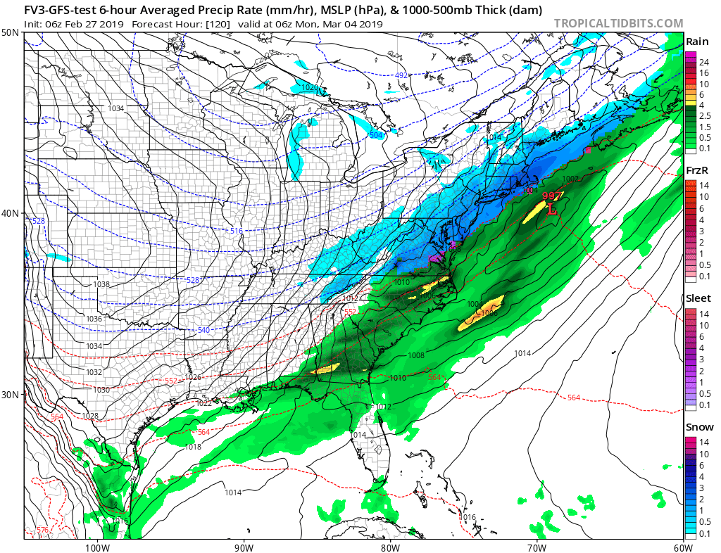
The big question on many minds in the eastern US is whether or not a substantial snowstorm will materialize before winter ends; some model output is suggesting winter could go out with a bit of a bang in early March.
The American GFS and FV3 computer forecast models are among those suggesting a snowstorm will materialize sometime between March 4 and 6. They reflect ample cold air sinking south and east into the Mid Atlantic as moisture from a developing wave of low pressure spreads over that cold air to produce snow from Washington, DC to Boston, MA. Such a scenario doesn’t usually produce blockbuster snow amounts, but it could put down a hefty 6″ or more of snow if it were to come to fruition as modeled.
Whether or not it comes to fruition will remain a big “IF” for the coming days. As more data is sampled and analyzed, a clearer forecast will be possible. People should be aware of the potential winter storm threat, but because there’s only a chance it would materialize, any specific storm preparations for this specific threat can wait for now.
Overall, the weather pattern remains unfavorable for big East Coast snows. While conditions could take a wintry turn in early March, it’s more likely that winter in the east will end with a whimper moreso than a bang.