A winter storm is likely to develop in the northeast later this week; however, locations along the I-95 corridor from Washington, DC north to Boston, and all points south, are likely to be on the rainy side of the storm. Nevertheless, heavy precipitation, strong winds, and coastal flooding and erosion concerns will likely pop-up on Thursday and Friday in the region.
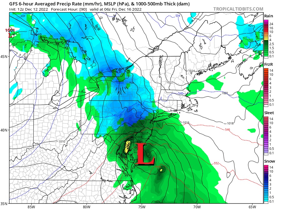
According to the National Weather Service, global guidance continues to show a fairly significant coastal storm impacting portions of the Mid Atlantic and Northeast on Thursday morning through at least early Friday. This system will have the potential to bring this region heavy precipitation, strong winds, and potentially even some coastal flooding issues. Leading global forecast models such as the American GFS and European ECMWF show a large, lumbering upper level system moving out of the central states with a primary low over the midwest giving way to a secondary low developing over the Southeast. This secondary low then tracks northeast right along the coast Thursday through Friday as it deepens. If this track were to verify, it would make it unlikely for the I-95 corridor to see a significant snow event but the potential is still there farther north and west towards the southern Poconos, northwestern New Jersey, and interior New England.
Timing of the start of the precipitation in the northeast will be critical on Thursday morning. Any precipitation beginning earlier in the day could run into the cold antecedent cold airmass, resulting in a period of a wintry mix of snow, sleet, and freezing rain mixed in with rain for the I-95 corridor early to mid morning before switching over to all rain by the afternoon. If there was a slower start to the precipitation, it would probably remain predominantly rain along and south of the I-95 corridor, but areas north and west could still see a wintry mix.
During the day Thursday, mainly rain should fall near and south of the I-95 corridor, with heavy rain ramping up into Thursday night across the south with still a potential for a wintry mix of precipitation north and west across extreme northeastern Pennsylvania, northwest New Jersey, Upstate New York, and interior New England. East winds will also ramp up through with the potential for gusts over 30 mph inland and over 40 mph along the coast. Wind and rain will continue through Friday morning before the system finally begins to depart the area from south to north.
While wind-swept rains are likely for the I-95 corridor, there could be substantial interior snows. The potential exists for more than 8″ of snow across the highest terrain of northeastern Pennsylvania, the upper elevations of Upstate New York south of Albany, western Massachusetts, southern Vermont, and central New Hampshire and Maine. It’s possible that some of the highest terrain over interior New England could get over a foot of snow before this system exits the region on Friday.
It’s also possible that some precipitation may turn to snow before the system exits; this will be most likely across portions of southeastern New England, including locations as far south as Boston. However, significant accumulations of snow are unlikely there for now.
