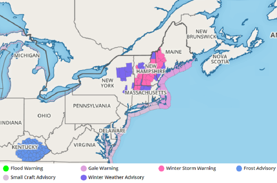
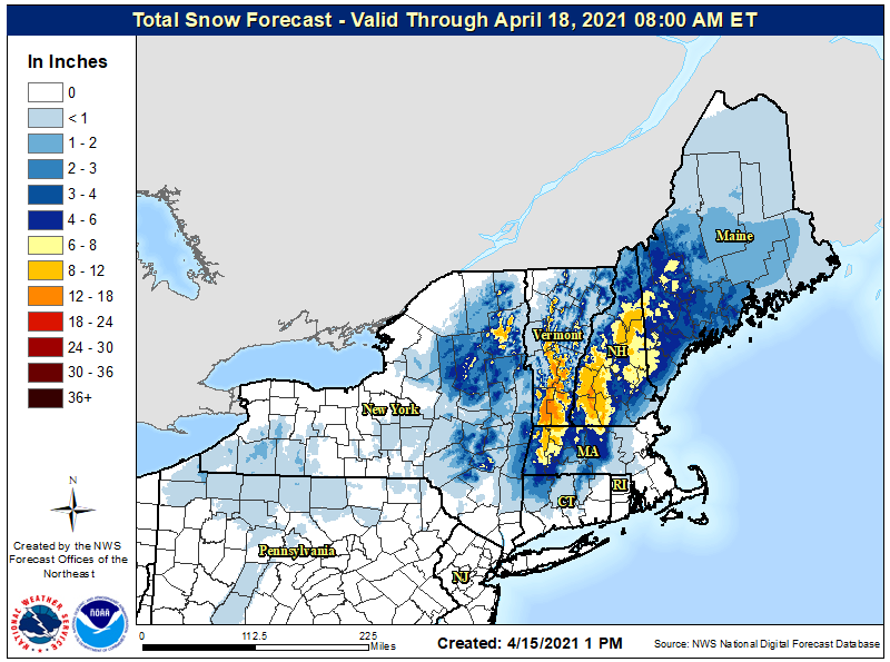
The National Weather Service has upgraded Winter Storm Watches to Winter Storm Warnings in portions of the northeast where up to 8-12″ of snow could fall tonight into tomorrow from this late-season, mid- April snowstorm.
Winter Storm Warnings are up for portions of Massachusetts, New Hampshire, Vermont, and Maine. Winter Weather Advisories have also been posted for areas around the Winter Storm Warnings plus Upstate New York.
An area of low pressure will slowly move up the northeast coast, bringing precipitation through much of New England. As colder air works its way in behind the low, rain falling will change over to snow, especially in the higher elevations above 1,200 feet. The snow that will fall will be of the heavy and wet kind. According to the National Weather Service, the weight of snow on trees may snap branches and lead to scattered power outages. The National Weather Service also cautions about driving in the Winter Storm Warning areas: “Travel will be very difficult due to low visibility and snow covered roads.”
The National Weather Service advises that if people must travel, they should keep an extra flashlight, food, and water in their vehicle in case of an emergency.
The snow could briefly end as rain early Saturday before all precipitation ends as the system in the Gulf of Maine begins to exit out to sea. Winds will back to the north during the day on Saturday; with fresh snow on the ground in many locations, temperatures will be much cooler than normal. There will be little in the way of dry air advecting into the region as the storm continues its exit through the Canadian Maritimes on Sunday. As such, many clouds will linger in the northeast and there could be a sprinkle or two in some locations as a weak upper level wave crosses the region. While there will be a risk for sprinkles, the threat of accumulating snow will not exist beyond Saturday morning this weekend.
