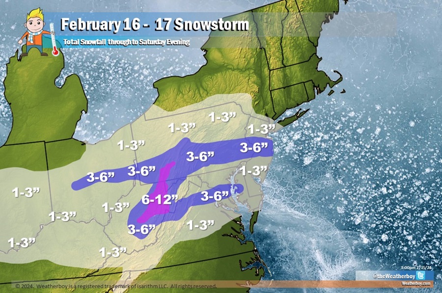
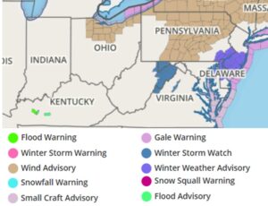
A fast-moving weather system is forecast to bring another around of accumulating snow to portions of the Mid Atlantic Friday into Saturday, prompting the National Weather Service to issue Winter Weather Advisories for portions of New Jersey, Pennsylvania, Maryland, and Delaware. Winter Storm Watches have been posted for portions of West Virginia, Maryland, and Virginia where heavier snow amounts are expected.
An area of low pressure will develop over the southern Plains on Friday and approach the southern Appalachians by Friday evening. The area of low pressure will track slightly north of due east tracking offshore the Carolina/Virginia coast by Saturday morning. The system will be accompanied by plentiful of energy aloft with sufficient moisture at low-levels across the Mid Atlantic area. High pressure will be stationed over southern Canada, so with a subtle northerly flow, unlike for the last weather system to impact the region, temperatures will be below freezing across most areas on Friday night. As such, forecast atmospheric profiles support a widespread light snowfall event across the region.
Snow will spread from west to east Friday into Saturday, with snow arriving near the I-95 corridor during the late evening hours Friday night and ending by the mid-morning hours Saturday morning.
A widespread 1-3″ will fall across the region from central Indiana through Ohio, Pennsylvania, New Jersey, Maryland, West Virginia, Delaware, and northern Virginia. For this storm, New York City and northern New Jersey will be on the northern fringe of this system, so only an inch or two of snow is expected there. In portions of central Pennsylvania and central New Jersey, including the Philadelphia metro area, 2-4″ is expected. 3-5″ is expected around the Washington DC metro area while heavier amounts closer to 6-8″ are expected in the highest terrain of central Pennsylvania and West Virginia.
