New Jersey was especially hit hard by today’s snowstorm, with snowfall rates in excess of 3″/hr reported during the day. In the Middlesex County community of South Brunswick, Police Chief Hayducka went on to Twitter to warn people that the damage “may be worse than Hurrican Sandy.” The township reported at least 4,000 without power, 79 locations with wires down, and more than 100 trees collapsed under the weight of the heavy snow. “All major roads are impassable,” South Brunswick warned online. Major roads Route 1 and Route 27 pass through the central New Jersey community.
“This is an unprecedented snowstorm; it has crippled our roadways. Fallen trees and heavy snow have blocked roads and caused widespread power outages. We are working on generator power in our command center. Our 911 lines have been flooded. Please stay off the roads.” Due to the extensive damage from the snowstorm in the community, schools are closed for tomorrow.
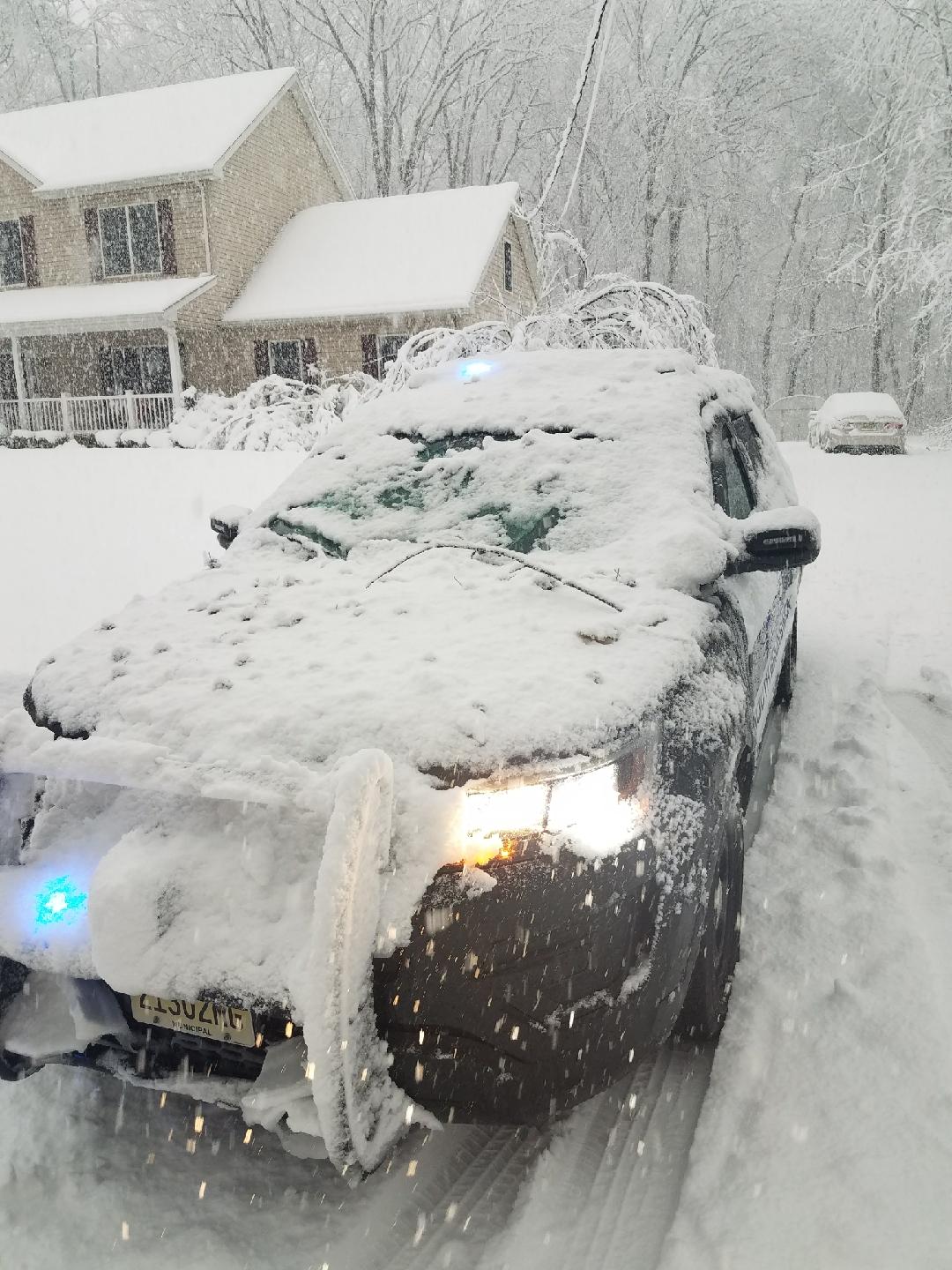
During the storm, South Brunswick Police say a tree fell on a patrol car. The weight of the tree shattered the windshield of the car, but the police say there were no injuries as a result of the incident.
While the wet snow was extremely heavy, it wasn’t that deep in Middlesex County. According to the National Weather Service office in Mount Holly, NJ responsible for the forecast area that South Brunswick sits in, a storm spotter only measured 4″ of snow there. Elsewhere in Middlesex County, 9.4″ was reported in Cranbury, 9″ in Middlesex, 7″ in Edison and South Planfield, and 5″ in East Brunswick and Monroe Township.
While the snow has ended, the National Weather Service warns there could be additional power outages in New Jersey and Pennsylvania due to the heavy wet snow. ” The heavy wet snow from Wednesday`s storm remains on many trees and powerlines. The weight of the snow will lead to falling limbs in many areas, likely resulting in additional power outages overnight. Also, as temperature fall overnight, untreated surfaces will likely freeze in some spots leading to icy spots. Drivers should be alert for fallen trees, limbs, and power lines overnight, in addition to icy spots on roadways,” warns the National Weather Service in a special bulletin issued at 9pm this evening.
