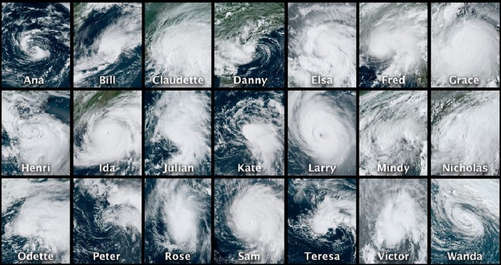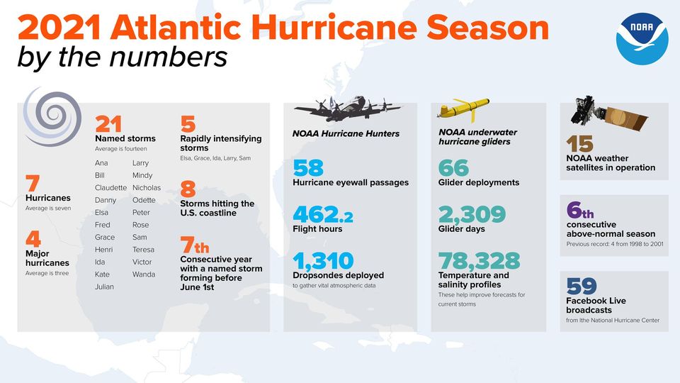
The 2021 Atlantic Hurricane Season, which ran from June 1 to November 30, comes to an end today. The very active season produced 21 named storms including seven hurricanes of which four were major hurricanes with winds of 111 mph or greater. This year was the third most active year on record in terms of named storms, it marks the sixth consecutive above-normal Atlantic hurricane season, and this was the first time on record that two consecutive hurricane seasons exhausted the list of 21 storm names.
While it was a busy season, it wasn’t a very deadly one due to the advance warning and accurate forecasts of the National Hurricane Center and the National Weather Service offices located around the country. “The hard-working forecasters at NOAA’s National Weather Service weather and water forecast offices and national centers, along with the National Hurricane Center, provided reliable forecasts and advanced warnings around the clock to safeguard communities in the pathway of destructive storms throughout this active hurricane season,” said National Weather Service Director Louis W. Uccellini, Ph.D. “Their dedication and service are a recognized asset to the nation’s resilience to these extreme events.”

This season’s storm activity started early and quickly ramped up. 2021 was the 7th consecutive year with a named storm forming before the official June 1 start date; 2021 also held the earliest fifth named storm on record. As to why, Matthew Rosencrans, lead seasonal hurricane forecaster at NOAA’s Climate Prediction Center says, “Climate factors, which include La Niña, above-normal sea surface temperatures earlier in the season, and above-average West African Monsoon rainfall were the primary contributors for this above-average hurricane season.”
NOAA aircraft flew more than 462 mission hours to support hurricane forecasting and research. Data collected by these high-flying meteorological laboratories help forecasters make accurate storm predictions and allow hurricane researchers to achieve a better understanding of storm processes, which ultimately improves their forecast models. Thanks to data from these aircraft, NOAA satellites, and other sources, the National Hurricane Center accurately forecasted Hurricane Ida — which is tied for the fifth strongest hurricane to ever make landfall in the United States — hitting Louisiana as a major hurricane.
Beyond aircraft, more than 1,300 dropsondes were deployed into hurricanes from above while NOAA gliders were deployed under hurricanes in the ocean to collect more than 78,000 temperature and salinity profiles that were used for forecasts.