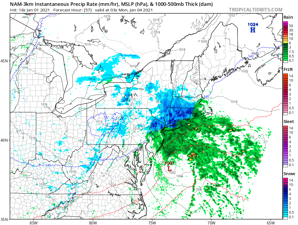
The first weekend of 2021 could end with a compact snowstorm over portions of the northeast. An area of low pressure is expected to form over the southeast on Sunday and move up into the Mid Atlantic during the day. By Sunday night, the low pressure system should be just off-shore the Delaware and New Jersey coast. With just enough cold air wrapped in on the back-side of the system, accumulating snow could fall from Pennsylvania and New Jersey northeast into New York, Connecticut, and Massachusetts.
Before the system exits the coast by Tuesday morning, more than 6″ could fall over portions of the northeast from this compact low.
South of the rain/snow line over and including New York City, central New Jersey, Long Island, and southeastern Pennsylvania including the city of Philadelphia and points south and east, plain rain should fall. It doesn’t appear that this small low will intensify enough to drag much in the way of colder air to the coast to produce something other than rain.
Fortunately, the system shouldn’t develop too much; this means strong winds and coastal flooding / beach erosion won’t be a primary concern with this storm. However, slick roads in places that are cold enough for snow will be the primary problem with this system.