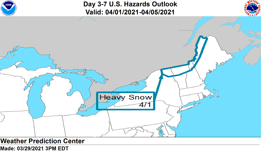
The National Weather Service is warning that the start of April may feel more like the middle of winter for some in the Northeast, where a snowstorm is likely to kick off the month.
Today’s Hazards Outlook from the National Weather Service’s Weather Prediction center has outlined an area of heavy snow in the forecast over portions of the northeast on Thursday. Low pressure over the Northeast will move northeastward into Southeastern Canada by Friday. While this system will bring heavy rain and the threat of strong to severe thunderstorms along the I-95 corridor, heavy accumulating snow is expected across portions of northern New York, Vermont, New Hampshire, and Maine. Light snow is also expected to fall over the higher terrain from there south to parts of the Central Appalachians.
Behind the system responsible for the precipitation , high pressure over the Southern Plains northeastward to the Upper Mississippi Valley/Upper Great Lakes will move eastward to Mid-Atlantic by Saturday. Part of the high will advance off the Mid-Atlantic Coast on Sunday, while the other half settles over the Southeast on Sunday, nudging northward to the Central Appalachians by Monday. Even though it is at the very beginning of the growing season over parts of the country, the high will bring temperatures below normal over parts of the Ohio Valley to the Gulf Coast and the Southeast to the Mid-Atlantic on Thursday and Friday. The minimum temperatures will be in the mid to upper 20s to low 30s over the Ohio Valley and the upper 20s to low to mid 30s over the Tennessee Valley and the low to mid 30s over the Gulf Coast States on Thursday and Friday morning.