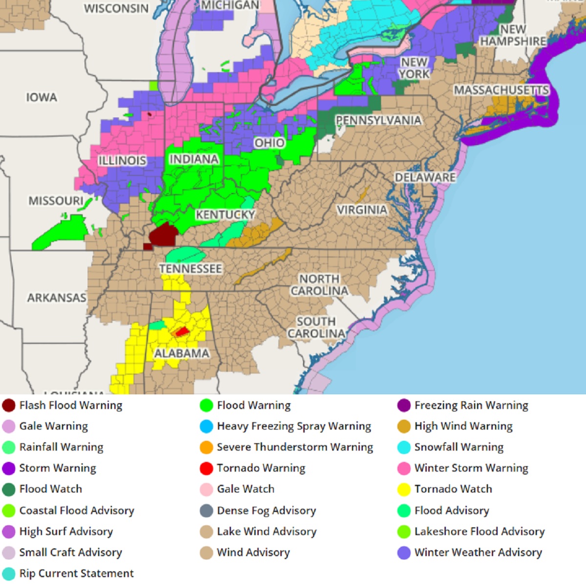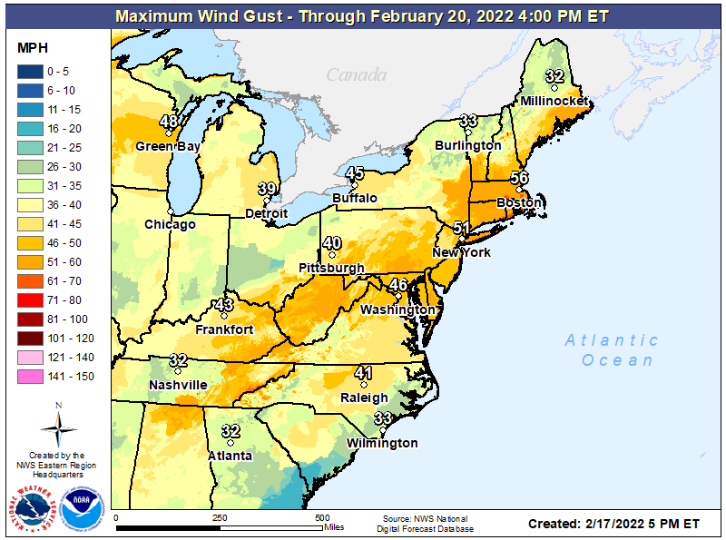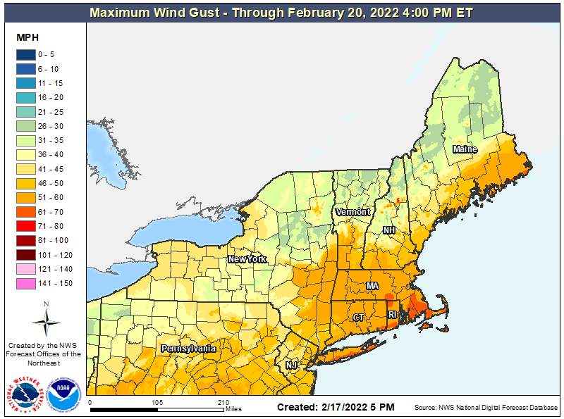
A widespread windstorm is expected to impact most of the eastern United States tonight into tomorrow morning, prompting the National Weather Service to place a large part of the country under a Wind Advisory or High Wind Warning.
A deepening low-pressure system and accompanying cold front sweeping across the eastern half of the country over the next 12 hours is responsible for the windy weather. A large temperature gradient will help fuel the development and continuation of precipitation along the surface boundary, with mixed precipitation and snow occurring in the cold sector of the system, north of the boundary, and the threat of heavy rains and severe thunderstorms ahead of the advancing cold front. The potent storm system and associated hazards are expected to clear the eastern region during the early Friday hours, with colder air spilling in behind it. Before the storm clears though, winds will blow strong across a large area.
To prepare for the wind event, the National Weather Service can issue a Wind Advisory, High Wind Watch, or High Wind Warning when strong winds are in the forecast.

A Wind Advisory means that sustained winds of 30 mph for one hour and/or frequent gusts of at least 45 mph are occurring or expected within the next 36 hours. According to the National Weather Service, these winds will make it difficult to drive high profile vehicles; also, small, unsecured objects may be blown about by these winds.
A High Wind Watch means that sustained winds of 40 mph for one hour and/or frequent gusts of at least 58 mph are expected within the next 12 to 48 hours. “Check to make sure all loose objects outside are secured,” the National Weather Service advises. “Plan to postpone any unnecessary driving during this time since these winds will make driving difficult, especially for high profile vehicles. These winds may damage trees, power lines and small structures.”

A High Wind Warning means that sustained winds of 40 mph for one hour and/or frequent gusts of at least 58 mph are occurring or expected within the next 36 hours. In these areas, the National Weather Service encourages people to make sure that all objects outside are secured. “Refrain from any unnecessary driving during this time since these winds will make driving very difficult, especially for high profile vehicles,” the National Weather Service Warns. As with the criteria for a Watch, Warning Winds this strong may damage trees, power lines and small structures.
Wind Advisories are up for a broad area of the eastern United States from eastern Missouri and Arkansas east to Virginia and the Carolinas and north into southern New England. High Wind Warnings are up for eastern Kentucky and Tennessee, portions of western Virginia, Long Island, Rhode Island, and portions of Connecticut and Massachusetts.
Widespread 30-50 mph gusts are possible, with gusts to near hurricane force possible across southeastern Long Island, coastal Connecticut and Rhode Island, and eastern Massachusetts.