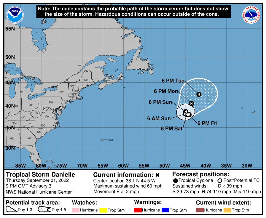
Newly formed Tropical Storm Danielle is expected to be growing into Hurricane Danielle in the coming hours; fortunately, it is of no threat to land.
According to the latest advisory issued by the National Hurricane Center (NHC), Danielle is located about 950 miles west of the Azores, where it is drifting to the east. A strong anticyclone over the system is creating light and variable steering flow and Danielle should continue to meander for the next few days. Based on the NHC forecast, in about 4 days, the anticyclone is expected to weaken and move eastward and a mid-latitude trough should turn and accelerate Danielle to the northeast. Despite this movement, Danielle is not expected to impact any land mass over the next 5 days.
According to the NHC, atmospheric and oceanic conditions appear to be conducive for additional strengthening during the next few days. Because Danielle is located over anomalously warm waters with decreasing vertical wind shear, the storm is expected to strengthen and reach hurricane status soon. As the storm does wander into northern, cooler waters, it will weaken over time.