USGS continues to monitor volcanoes around the United States; four of which are capturing much of their attention today . In addition to providing an update on the recent surge of seismic activity at Kilauea on the Big Island of Hawaii, USGS also has two other volcanoes at ORANGE / WATCH status and one other volcano at YELLOW / ADVISORY status.
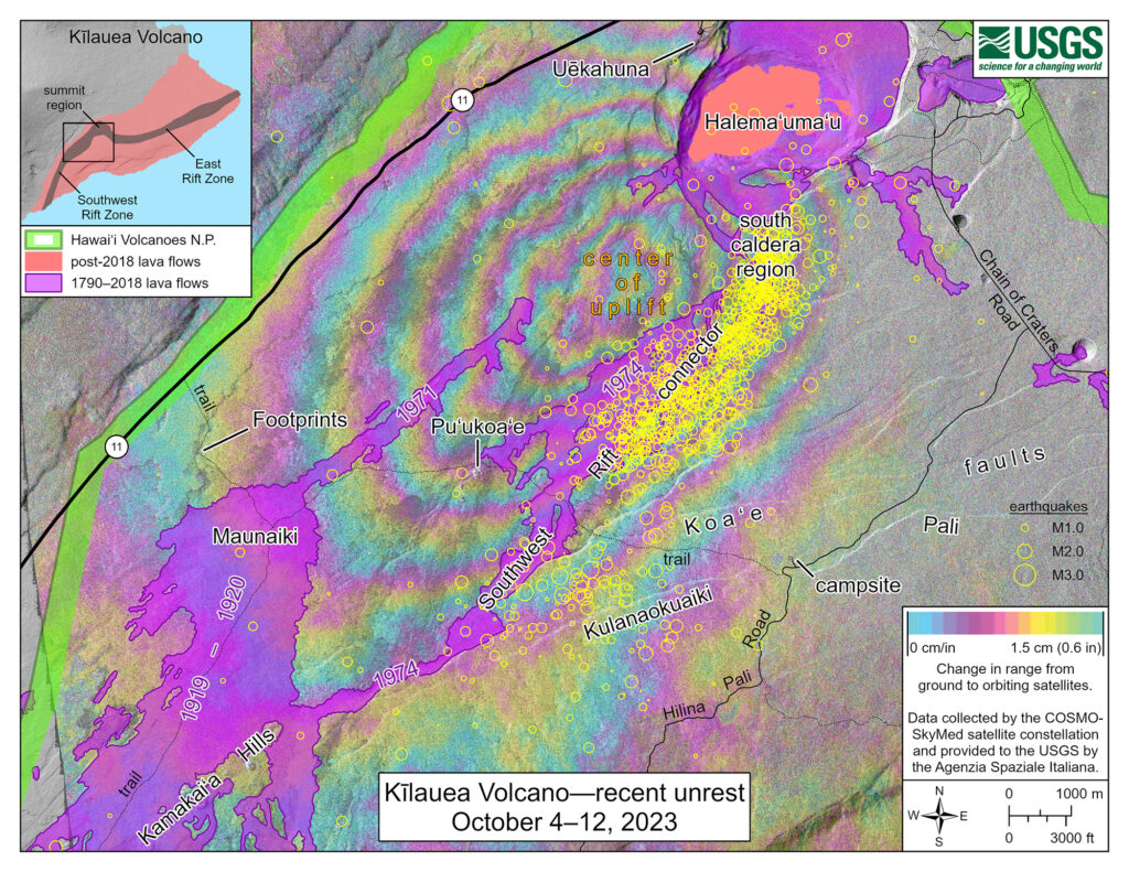
While Kilauea volcano is not erupting, recent activity suggested that an eruption could occur with as little as 1-2 hours advance notice. However, today, the Hawaiian Volcano Observatory (HVO) unit of USGS, announced that earthquake and ground deformation rates beneath the southern part of Kilauea’s summit caldera and extending to the southwest have decreased dramatically over the past several days, suggesting the intrusive event that began last week is coming to an end.
The major intrusive event that has been ongoing beneath the area extending from the southern part of Kilauea caldera southwest to the Koaʻe fault zone appears to have slowed significantly or stopped. HVO also reports there’s been a dramatic drop in earthquakes, from a peak of over 250 per day last week, to only 23 recorded in the past 24 hours. These earthquakes were at depths of about 0.6-3 miles beneath the surface.

Summit tiltmeters recorded a change in tilt magnitude and direction, in the past several days, away from the seismically active area, thus signaling ground deformation associated with the intrusive event ceased. These observations suggest that new magma supply to the intrusion below the surface south of Kilauea’s summit caldera has slowed greatly or stopped. However, inflation at the summit of Kilauea remains high and has nearly returned to the level seen just before the last eruption on September 10th.
A radar interferogram, which took measurements from the morning of September 24 until the morning of October 10, shows approximately 4 inches of uplift or inflation of the area southwest of Kilauea’s summit caldera over that time.
Currently, the Uēkahuna summit tiltmeter located north of the caldera recorded very slight deflation over the past 24 hours. The Sand Hill tiltmeter, located just south of the caldera, is showing a flat tilt trend. Sulfur dioxide (SO2) emission rates remain low and were measured at a rate of about 100 tonnes per day on October 6. Other monitoring data streams, including webcam views, do not show any significant changes.
While things have become somewhat stable on Hawaii’s Big Island, HVO cautions that inflation at the summit of the volcano remains high, and seismicity and ground deformation rates are likely to begin increasing again in the near future. HVO continues to monitor the summit region of Kilauea volcano closely and will issue fresh alerts should a volcanic eruption seem imminent.
While the Hawaiian volcanoes are monitored by the Hawaii Volcano Observatory (HVO), Alaskan volcanoes are monitored by the Alaska Volcano Observatory (AVO.) In addition to the AVO and HVO, there are also the California Volcano Observatory , Cascades Volcano Observatory, the Yellowstone Volcano Observatory, and the Northern Mariana Islands Volcano Observatory. Each of those additional volcano observatories within the USGS are monitoring volcanoes in their respective regions. At this time, only HVO and AVO are tracking unrest; none of those other observatories are reporting unusual activity or signs of anything more than background noise for now.

In the U.S., the USGS and volcano observatory units are responsible for issuing Aviation Codes and Volcanic Activity Alert Levels. Aviation Codes are green, yellow, orange, or red. When ground-based instrumentation is insufficient to establish that a volcano is at a typical background level of activity, it is simply “unassigned.” While green means typical activity associated with a non-eruptive state, yellow means a volcano is exhibiting signs of elevated unrest above known background levels. When a volcano exhibits heightened or escalating unrest with the increased potential of eruption, it jumps to orange. Finally, when an eruption is imminent with significant emission of volcanic ash expected in the atmosphere or an eruption is underway with significant emission of volcanic ash into the atmosphere, the code becomes red. Volcanic Activity Alert levels are normal, advisory, watch, or warning. As with aviation codes, if data is insufficient, it is simply labeled as “unassigned.” When the volcano is at typical background activity in a non-eruptive state, it is considered normal. If the volcano exhibits signs of elevated unrest above background level, an advisory is issued. If a volcano exhibits heightened or escalating unrest, a watch is issued while a warning is issued when a hazardous eruption is imminent.
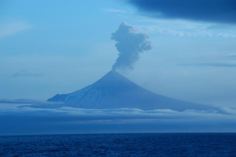
According to AVO, clear web camera views of Shishaldin from yesterday and today show a robust vapor cloud at the volcano’s summit. This vapor plume likely consists primarily of steam and other volcanic gases. The vapor cloud does not indicate that an eruption is in progress and probably reflects the interaction of hot material and snow and ice. Due to that activity, the current volcano alert level here is WATCH while the current aviation color code is ORANGE. Shishaldin Volcano is located on Unimak Island in the Aleutian Islands chain of Alaska; it is the highest mountain peak of the Aleutians, rising to 6,500 feet. It is a large stratovolcano; in 1967, it was designated as a National Natural Landmark by the National Park Service.

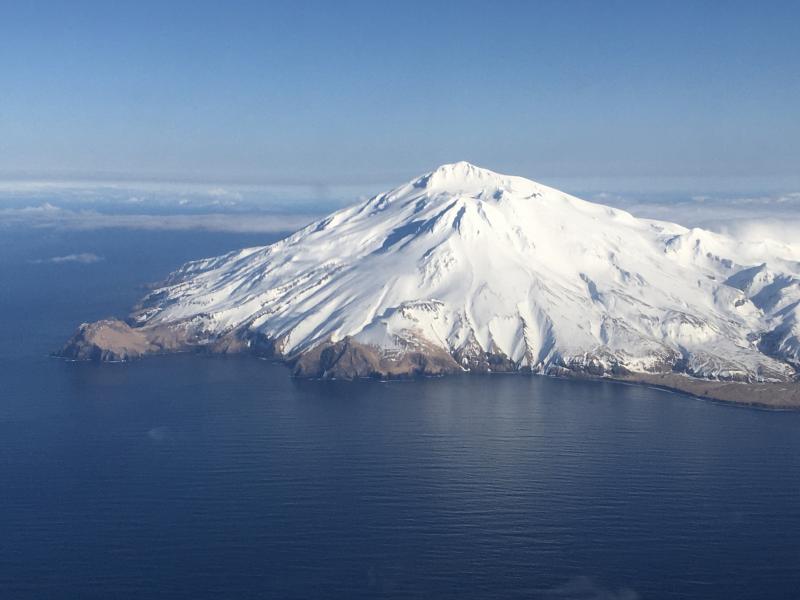
The Great Sitkin Volcano is a basaltic andesite volcano that occupies most of the northern half of Great Sitkin Island, a member of the Andreanof Islands group in the central Aleutian Islands. It’s located roughly 26 miles east of Adak, which is 1,192 miles southwest of Anchorage. According to the AVO, the volcano has a composite structure consisting of an older dissected volcano and a younger parasitic cone with a 1.8 mile diameter summit crater. A steep-sided lava dome, emplaced during an eruption in 1974, occupies the center of the crater. Within the past 280 years, a large explosive eruption here produced pyroclastic flows that partially filled the Glacier Creek valley on the southwest flank.
According to AVO, a slow eruption of lava in the summit crater of Great Sitkin Volcano likely continues. No significant earthquake activity was detected over the past day. Clouds have also obscured the volcano in satellite and web camera views over the past day; nothing noteworthy was observed. “The current lava flow at Great Sitkin Volcano began erupting in July 2021,” wrote AVO in today’s update. “No explosive events have occurred since a single event in May 2021.” Due to the active eruption, AVO has the Volcano Alert Level here at WATCH while the current Aviation Color Code is ORANGE.

The Trident Volcano is on the Alaska Peninsula inside of the Katmai National Park. There are 23 domes that make up the complex stratovolcano, with the greatest elevation at 6,115 feet. According to USGS, the volcano earned its name from Robert Fiske Griggs of the National Geographic Society; he named it because of the three major peaks he saw there in 1916, similar to the three prongs of a trident fork.
Today, AVO says elevated seismic activity continues at the volcano, but no volcanic activity was observed. “Seismicity was low over the past day. No activity observed in satellite or web camera images,” said AVO in today’s update. The volcano is being monitored by satellite and remote webcams. As a result, the advisory level is at ADVISORY and the aviation color code is YELLOW.