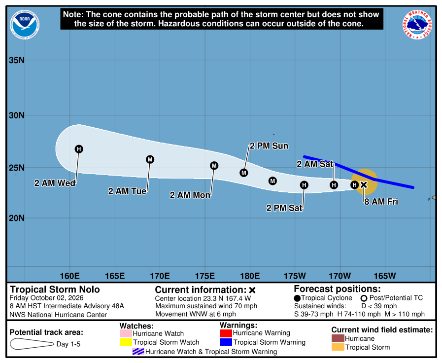
After brushing the Big Island of Hawaii with heavy rain and gusty winds last week and after bringing heavy rains to portions of Kauai and Oahu, it appears Nolo will have a second life as a major hurricane over the open waters of the Central Pacific. While it is forecast to grow, it is no longer forecast to bring impacts to Hawaii.
According to the latest advisory from the National Hurricane Center, Nolo is a tropical storm located about 80 miles west-southwest of the French Frigate Shoals and about 240 miles southeast of Maro Reef. Maximum sustained winds are up to 70 mph while the minimum central pressure is down to 987 mb or 29.15″.
A Tropical Storm Warning is in effect for The Papahanaumokuakea Marine National Monument from Nihoa to Lisianski Island, including French Frigate Shoals and Maro Reef. A Tropical Storm Warning means that tropical storm conditions are expected somewhere within the warning area within the next 36 hours. The National Hurricane Center warns that interests elsewhere within the Papahanaumokuakea Marine National
Monument west of Lisianski Island should monitor the progress of Nolo.
Nolo is moving toward the west-northwest near 6 mph for now; the National Hurricane Center says a westward or west-northwestward motion with an increase in forward speed is expected during the next few days. On the forecast track, the center of Nolo will continue to move through the Papahanaumokuakea Marine National Monument but remain just south of the Northwestern Hawaiian Islands west of French Frigate Shoals As it heads west, strengthening is forecast, and Nolo is expected to become a hurricane later today and a major hurricane by early Sunday.
Large waves associated with Nolo will continue to affect the Papahanaumokuakea Marine National Monument over the next several days. The surf will likely inundate some of the low-lying atolls, especially from French Frigate Shoals to Maro Reef into the weekend, then from Maro Reef to Lisianski Island during the weekend.
