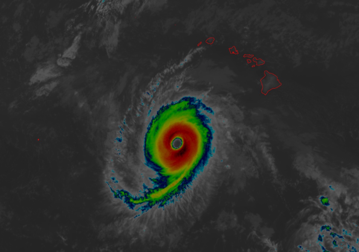
Hurricane Nolo has intensified further today and is now a category 4 hurricane on the 5-point Saffir-Simpson hurricane wind scale; it is moving away from the main Hawaiian Islands but continues to threaten sensitive marine areas to the north and west of the islands.
According to the latest advisory from the National Hurricane Center, Hurricane Nolo now packs maximum sustained winds of 145 mph with higher gusts while the minimum central pressure is down to 939 mb or 27.73″.
Nolo is located about 655 miles southeast of French Frigate Shoals and about 380 miles south-southwest of Honolulu on the island of Oahu in Hawaii.
While the storm is no longer a threat to the State of Hawaii, a Hurricane Watch is in effect for the Papahanaumokuakea Marine National Monument from Nihoa to French Frigate Shoals. A Hurricane Watch means that hurricane conditions are possible within the watch area. A watch is typically issued 48 hours before the anticipated first occurrence of tropical-storm-force winds, conditions that make outside preparations difficult or dangerous. The National Hurricane Center says additional watches may be required for portions of the Papahanaumokuakea Marine National Monument.
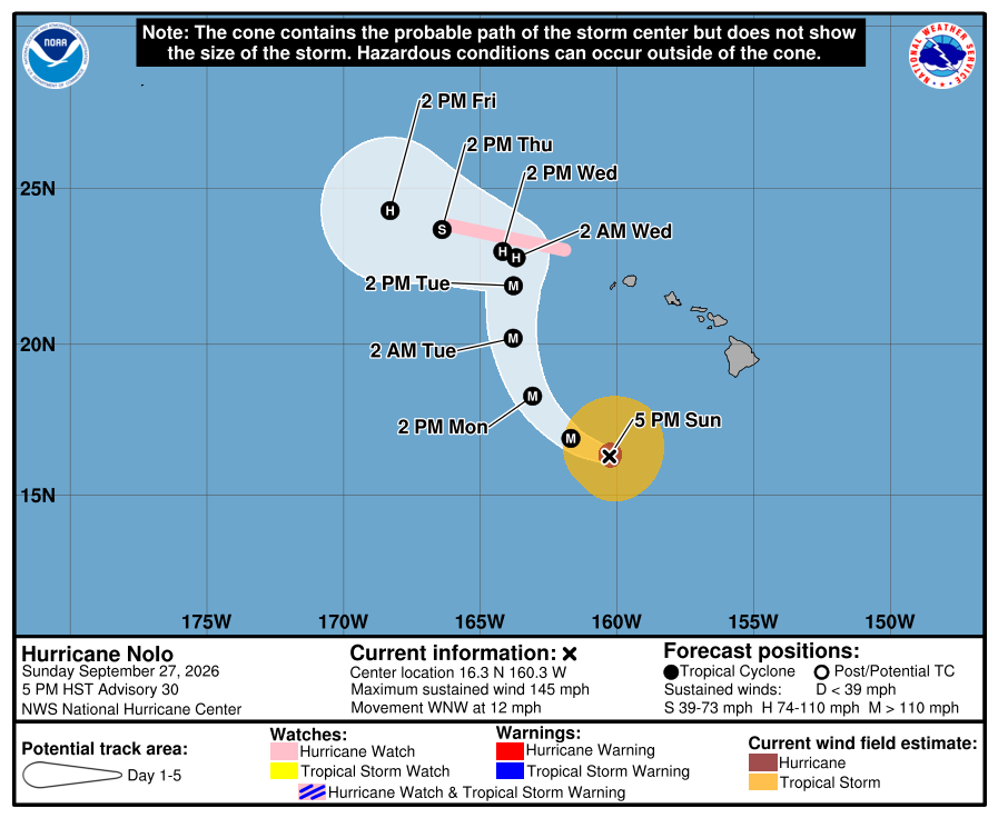
Nolo is moving toward the west-northwest near 12 mph now and a gradual turn toward the northwest is forecast tonight; the storm should continue that forward motion tomorrow. On the forecast track, the center of Nolo will remain well south and southwest of the main Hawaiian Islands but will approach the Papahanaumokuakea Marine National Monument on Tuesday. Additional strengthening is forecast over the next day or so and the hurricane could become a category 5 hurricane with 160 mph winds by morning.
Hurricane-force winds extend outward up to 35 miles from the center and tropical-storm-force winds extend outward up to 150 miles.
Swells generated by Nolo are affecting south-facing shores of the main Hawaiian Islands through the next few days. These swells are likely to cause life-threatening surf and rip current conditions. Large surf associated with Nolo will affect the Papahanaumokuakea Marine National Monument beginning on Monday. These large waves will likely inundate some of the low-lying atolls, especially from French Frigate Shoals to Nihoa.
