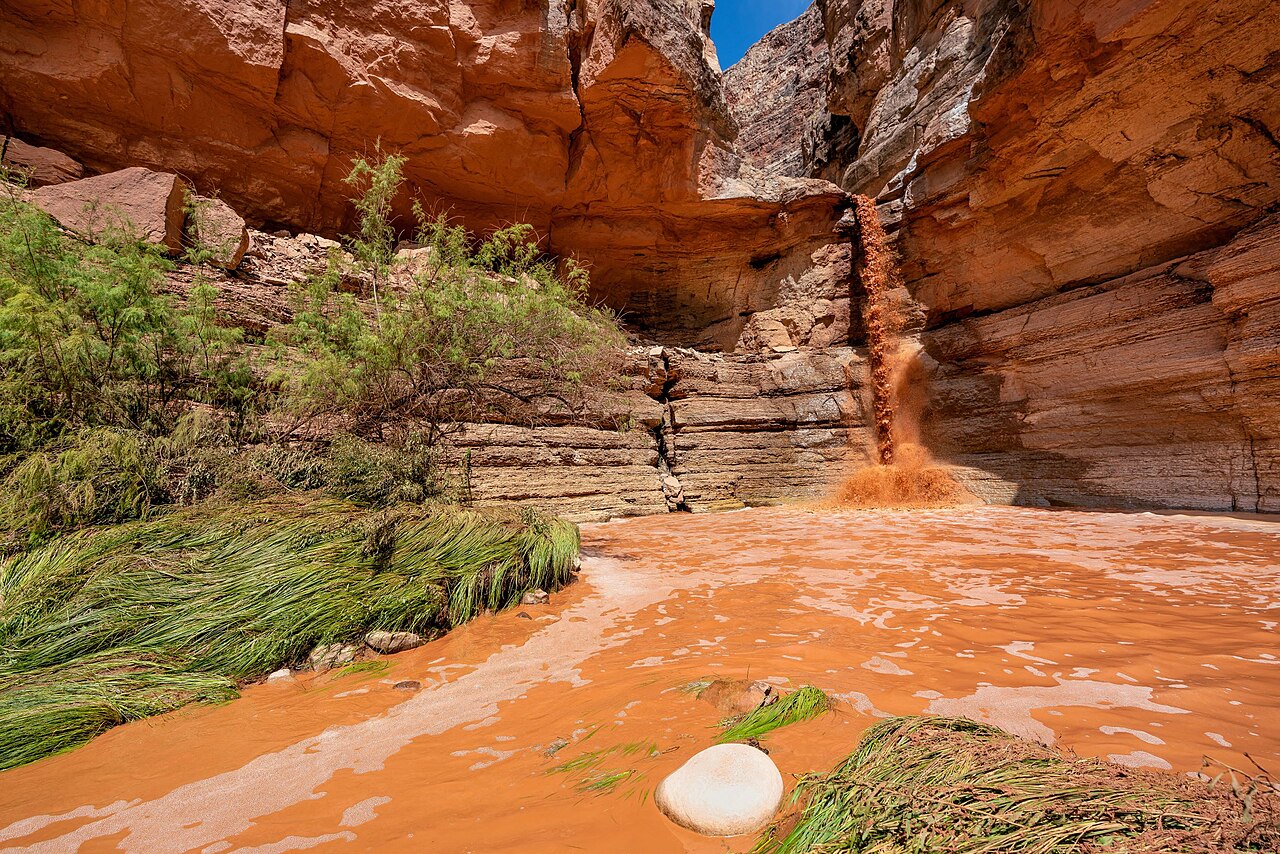
NPS Photo/M. Jenkins (2018)
A moisture-laden storm riding an atmospheric river is expected to drench Arizona from Halloween night into Monday, bringing the threat of widespread flash flooding to a state where soils are already soaked from storms that stranded drivers in Phoenix-area washes on Friday, the National Weather Service said.
Flood watches stretched Saturday from the Grand Canyon to the Mexican border. The weather service office in Flagstaff placed all of northern and central Arizona under a watch from 11 p.m. Saturday through 5 a.m. Monday, warning of “flash flooding caused by excessive rainfall over saturated soils” and forecasting an additional 1 to 3 inches of rain.
“This is a serious situation,” forecasters in Flagstaff wrote in their Saturday morning discussion. “Stay away from waterways. Turn around, don’t drown.”
The Flagstaff office said high-resolution models showed 4 to more than 6 inches of rain possible on slopes facing the incoming moisture, with at least 1 to 3 inches, and locally 4 inches, elsewhere. Forecasters said larger waterways, especially the Little Colorado and Verde rivers, “may be flooding for days after the event.”

The Weather Prediction Center, a branch of the weather service in College Park, Maryland, issued a Slight Risk of excessive rainfall for parts of central Arizona for Saturday night and a Moderate Risk, level 3 of 4, for parts of the Four Corners region on Sunday. The center said the heaviest rain would fall across central Arizona and the Mogollon Rim, where it expected “widespread 3 inch totals north and east of Phoenix, with localized higher amounts.”
“A higher-end Moderate Risk may be needed given the impacts that have occurred from the lesser rainfall amounts that have fallen there over the past couple days,” the center wrote. It added that “all of this rainfall will convert to runoff due to already well-saturated soils.”
Friday’s Storms Set the Stage
The weekend storm follows a round of thunderstorms that flooded streets and washes across the Phoenix area Friday evening.
At about 6:30 p.m. Friday, Phoenix firefighters were sent to a reported water rescue near 40th Street and Camelback Road, where crews found six people trapped in four vehicles stuck in a wash, Phoenix Fire Department spokesperson Capt. Todd Keller told The Arizona Republic. Keller said firefighters used a “shallow water entry” technique to reach them. All the drivers and passengers were evaluated and declined to be taken to a hospital, he said.
In Scottsdale, a driver went into 3 to 4 feet of fast-moving water in a wash near Hayden Road and McCormick Parkway, and crews rescued one person and helped two others walk out of a second vehicle that followed, according to Arizona’s Family. Scottsdale Fire Capt. Dave Folio said drivers in the area had other options.
“When you drive in the 2 to 4 inches of water, it’ll start sweeping your vehicle away,” Folio told the station.
“If you can’t see the pavement, don’t drive into it. You could have had a manhole moved. You could have a curb there,” he said.
Parts of the Paradise Valley area received 2 to 3 inches of rain in the three hours from 5 p.m. to 8 p.m. Friday, while much of north Scottsdale received 1 to 2 inches, KTAR News reported. More than 5,000 Salt River Project and Arizona Public Service customers lost power at the height of the storms, and about 1,000 APS customers were still without service around 9 p.m., the station said.
Scottsdale police closed Shea Boulevard between 64th and 70th streets because of downed power lines and closed the intersection of Scottsdale and Deer Valley roads because of flooding, the station reported.
Runoff was still causing problems early Saturday. The weather service issued a flood warning for Indian Bend Wash in Scottsdale after gauges showed water above alarm stage, saying 1 to 3 inches of rain had fallen. In Gila County, a gauge on Tonto Creek north of Tonto Basin rose above action stage overnight, and forecasters urged residents to use the Tonto Creek Bridge, warning that the Bar X Crossing and other low-water crossings would likely become impassable.
A Record-Challenging Surge of Moisture
Forecasters said the coming storm is fueled by a subtropical jet stream stretching from near Hawaii to Baja California that is merging with a trough of low pressure moving inland along the West Coast.
The Phoenix office said the amount of moisture in the atmosphere would surge “in excess of climatological maxima for this time of year” Saturday night into Sunday, consistent with “an inland penetrating atmospheric river.” The Tucson office described the system as a level 3 atmospheric river on a 1-to-5 scale and said moisture levels could approach or reach records for November.
“We are looking at rainfall records for November 1st falling across much of the area,” Tucson forecasters wrote.
In the Phoenix area, forecasters expect 0.75 inch to 1.75 inches of rain, with 2 to 4 inches, and locally more, over the foothills and higher terrain to the north and east.
Gabriel Lojero, a weather service meteorologist in Phoenix, told KTAR that rain would increase Saturday evening and especially Sunday.
“It’s going to be a pretty substantial rainfall event,” Lojero said. “You have to be very careful … because that amount of rain could actually create some flooding issues.”
Halloween Plans and the Weekend Timeline
The Phoenix office advised residents to wrap up trick-or-treating and other outdoor Halloween activities “on the earlier side” Saturday evening. Forecasters expected an initial shield of rain to spread northeast across the region and reach much of the area by 7 p.m. to 9 p.m. Saturday. High temperatures in the low deserts were forecast in the mid- to upper 70s, a few degrees below normal for the date.
The Phoenix area’s flood watch runs from Saturday evening through late Sunday night and covers the metro area, rural Maricopa County and northwest Pinal County, where forecasters said 1 to 2 inches of additional rain would fall “on top of already moist soil.”
In southeast Arizona, a watch covering Tucson, Nogales, Sierra Vista, Safford and the surrounding mountains runs from 11 p.m. Saturday to 5 a.m. Monday. The office put Tucson’s chance of more than 1 inch of rain at 84% and its chance of more than 2 inches at 35%. Wind gusts could top 40 mph, especially in lines of storms, forecasters said.
Tucson forecasters said there is potential for “significant rises” on the San Francisco and Blue rivers, the Gila River and Sabino Creek, with minor to major flood stages possible.
Verde Valley Braces Again
In Yavapai County, the Office of Emergency Management urged residents to prepare for another round of heavy rain, saying additional rainfall could lead to rapid runoff and renewed flooding in vulnerable areas, the Verde Independent reported. The weather service is forecasting significant rises along Oak Creek, Wet Beaver Creek, West Clear Creek and the Verde River, with some locations reaching minor or moderate flood stage, the newspaper said.
The Yavapai-Apache Nation issued a public safety advisory last week urging community members to stay away from the Verde River and nearby waterways after recent heavy rain and flooding in the Verde Valley.
Forecasters said drier weather should arrive quickly early next week, with temperatures warming closer to normal by midweek.
