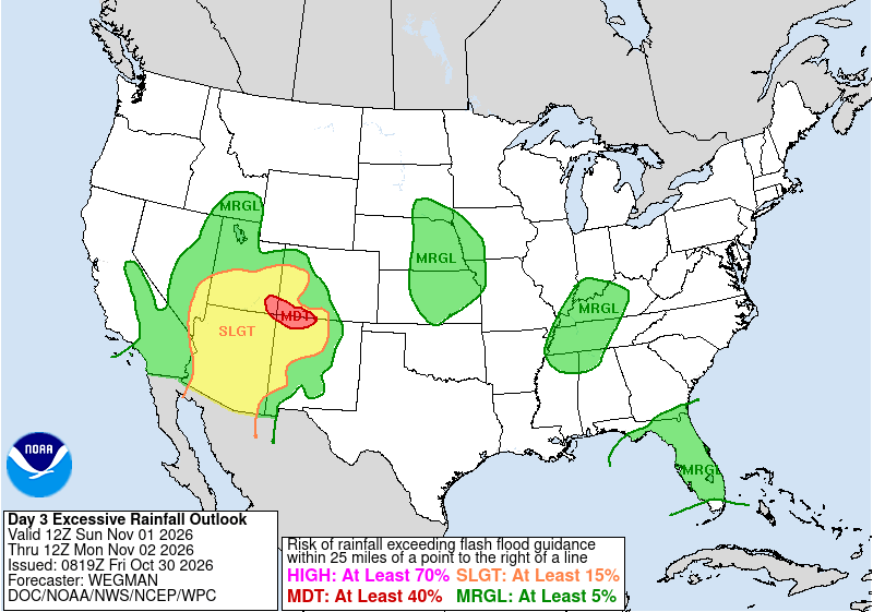
Communities along New Mexico’s rivers were still cleaning up from deadly flooding Friday when forecasters warned that a powerful Pacific storm would dump another round of heavy rain on the same saturated ground beginning Sunday.
The Weather Prediction Center said in its Friday excessive rainfall discussion that “a high-impact heavy rainfall event is likely to unfold across the Four Corners region on Sunday,” and placed the area under a moderate risk of flooding rain, the second-highest level on its four-tier scale. The center said the moisture streaming into the region would be “4-5 sigma above normal,” meaning far wetter than normal for the season.
“In a near-repeat of last week’s heavy rain event, the still saturated soils will quickly convert nearly all of the rain into runoff,” forecasters wrote, warning of “fast and steep rises along area streams and creeks as well as the larger San Juan river.”
The center said the short gap between “this area’s big rainfall events” was a key reason for the moderate risk, which was coordinated with the National Weather Service office in Albuquerque.
Socorro County Still Flooding
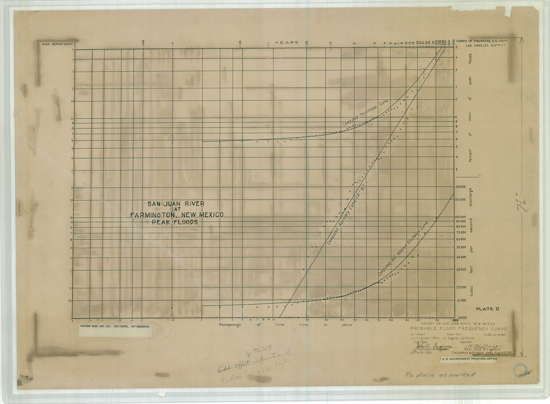
The new threat comes as floodwater lingers in Socorro County, about 75 miles south of Albuquerque.
The weather service in Albuquerque kept flood warnings in effect until noon MDT (1 p.m. CDT) Friday for parts of the county. One warning said “flooding caused by a levee breach is occurring in the San Francisco area near Bernardo” and listed La Joya, Bernardo, San Francisco and Contreras among affected locations. A second warning covered south-central Socorro County, citing flooding in the Escondida and Pueblito communities and impassable roads near San Pedro.
The trouble began last weekend on the Rio Puerco, a tributary that meets the Rio Grande near Bernardo. El Defensor Chieftain reported that the river broke its banks around 3:30 p.m. Sunday, and residents of the San Francisco community off U.S. Highway 60 were told to evacuate about an hour later.
Socorro County Emergency Manager Fred Berger told the newspaper that water was running about 5 feet deep across roadways and that the flooding was more severe than an event weeks earlier.
A woman was swept away when floodwater overtook a vehicle; four other people in the vehicle escaped, the Chieftain reported. Crews searched with a helicopter and drones, and her body was recovered Monday. A weather service storm report filed by fire and rescue officials listed one fatality near Bernardo, describing an adult woman “swept away in truck in early hours.”
Boat teams and the New Mexico National Guard evacuated nine residents and about 11 dogs on Monday, according to the Chieftain. The newspaper reported that U.S. 60 was closed just east of the Interstate 25 Bernardo exit and that a BNSF rail line was washed out.
Levee Breach on the Rio Grande
Flooding spread south along the Rio Grande as the week went on. In a delayed storm report, the county emergency manager told the weather service that a levee breach late Tuesday forced evacuations in Escondida and Pueblito. Nine rescues were carried out and 31 homes were evacuated, according to the report, which said Bosquecito Road, Quebradas Road and U.S. Highway 380 near San Pedro were impassable.
Socorro County’s Office of Emergency Management posted Oct. 27 that the Rio Grande was flooding the Pueblito area east of Escondida and recommended evacuation for everyone there. The county opened an emergency shelter at Finley Gym in Socorro.
By Thursday, the state Department of Transportation had reopened one lane of U.S. 380 near mile marker 2 with flaggers, the county said, warning of standing water on the road.
Northwest New Mexico Counts the Cost
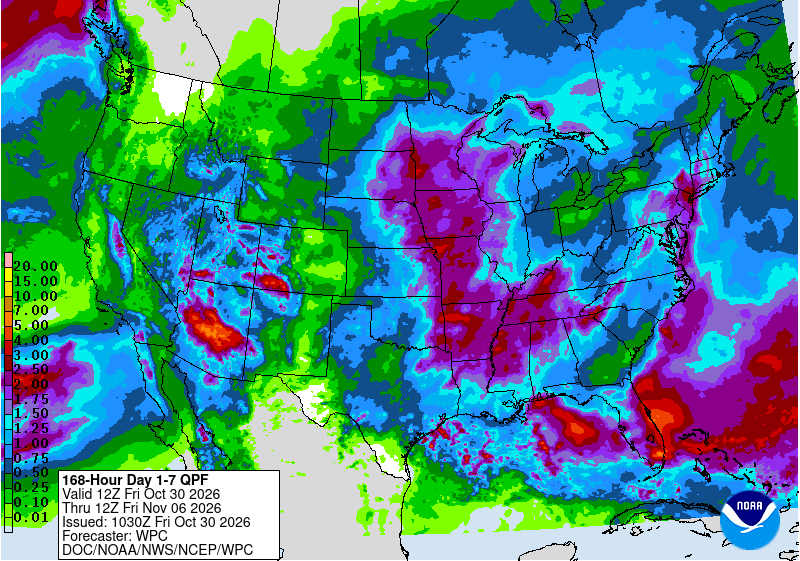
The Socorro flooding followed a larger disaster in northwest New Mexico, where heavy rain late last week sent the San Juan River and its tributaries out of their banks.
KSUT reported that the San Juan River at Farmington rose from about 3.5 feet to 14 feet in roughly 36 hours, breaking a record set in 1909, with surges coming from Gobernador Canyon and Cañon Largo. Devin Neeley told the station, “This is a catastrophic flood of historic proportions,” and said 200 to 300 people had been rescued.
The weather service recorded at least one death in that event: a storm report from the Rio Arriba County emergency manager said a man was swept away in his truck at a low-water crossing about 13 miles south of Pagosa Junction on the night of Oct. 23.
President Donald Trump signed an emergency declaration covering San Juan, Cibola, Rio Arriba and Sandoval counties along with several pueblos and tribes, with the federal government covering 75% of eligible costs, the Albuquerque Journal reported. Gov. Michelle Lujan Grisham estimated recovery would cost $200 million to $300 million and approved $8.25 million in state funds, the newspaper said.
About 1,500 residences were under evacuation orders at one point, and about 500 homes were damaged in the Shiprock area, according to the Journal, which cited the Navajo Nation.
Lujan Grisham urged displaced residents not to rush home. “We don’t want you back till the next rainstorm that we are predicting at the end of this upcoming weekend has passed,” she said, according to the Journal.
What to Expect Sunday and Monday
The weather service in Albuquerque issued a flood watch from early Sunday through Monday morning for northwest, west-central and north-central New Mexico, including the Chuska Mountains, the Jemez Mountains and the Tusas Mountains near Chama.
Rainfall of 1 to 2 inches is expected near and west of the Continental Divide, falling “over very saturated soils which will increase runoff,” the watch said. Forecasters noted these “are also areas that are still recovering from the last flood event,” though river rises “are not expected to be as high as the last flood event.”
A hydrologic outlook from the Albuquerque office said a strong Pacific storm “will interact with a atmospheric river,” with the heaviest rain expected in the San Juan Mountains of Colorado. That rain will feed the Animas and La Plata rivers, which flow into the San Juan, “which saw record flooding last week,” the office said. The outlook named Aztec, Bloomfield, Farmington and Shiprock and rated confidence in widespread rain as high but confidence in river flooding as low.
In its forecast discussion, the Albuquerque office said most areas would likely receive half an inch to 2 inches of rain, with up to 3 inches possible in the Tusas Mountains. Rivers in San Juan County are expected to rise but stay below flood stage, forecasters said.
Weather service offices in Grand Junction and Pueblo, Colorado, issued flood watches for southwest Colorado, southeast Utah and the Upper Rio Grande Valley.
The storm could also bring severe thunderstorms with hail, damaging wind and tornadoes to central and eastern New Mexico on Sunday night, the Albuquerque office said. Colder air arriving Monday is expected to drop snow levels to 8,000 to 9,000 feet, with 1 to 4 inches of snow possible in the northern mountains and wind gusts to 50 mph.
