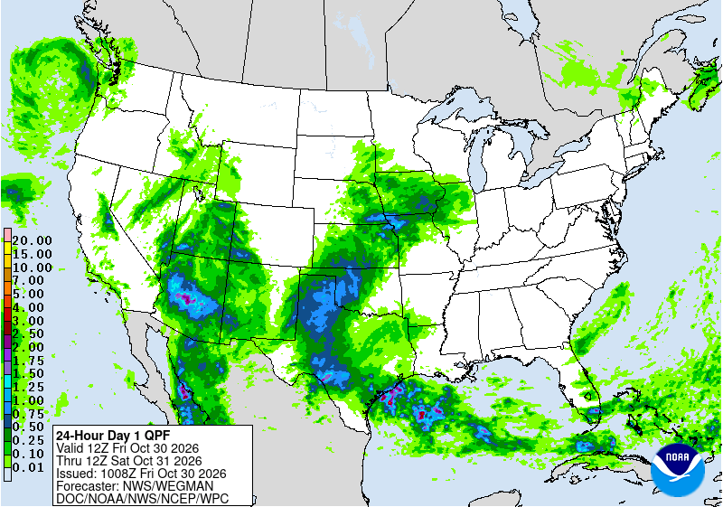
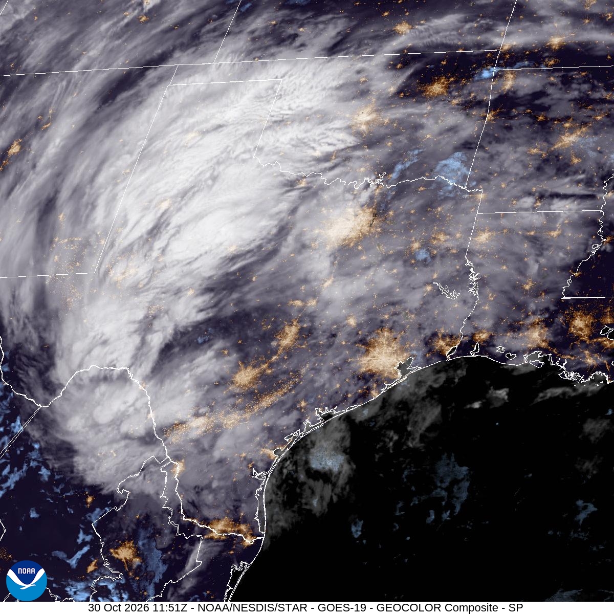
Heavy rain fed by moisture from former Tropical Storm Vance flooded streets across the Permian Basin early Friday, prompting a string of flash flood warnings for Midland, Odessa and surrounding communities as forecasters warned more rain was possible through the morning.
The National Weather Service in Midland/Odessa said in a warning issued at 7:04 a.m. CDT that “flash flooding is ongoing” in Ector and Midland counties. Doppler radar and observers indicated 1 to 1.5 inches of rain had fallen, and up to 1 additional inch was possible, the weather service said. The warning, in effect until 10 a.m. CDT, covered Midland, Odessa, Greenwood, Goldsmith, West Odessa, Warfield and Midland International Air and Space Port.
It was at least the third flash flood warning of the night for the two counties. Forecasters issued an earlier warning for the area at 3:16 a.m. and another at 5:27 a.m. for east-central Ector and northwestern Midland counties before expanding the alert shortly after 7 a.m.
Warnings Spread Across the Region
The flooding was not limited to the twin cities. At 7:02 a.m. CDT, the weather service issued a flash flood warning for Dawson and Gaines counties, where 1 to 2 inches of rain had fallen. That warning included Lamesa, Seminole and Seagraves.
Two minutes earlier, at 7 a.m., forecasters warned of flash flooding in Howard, Mitchell and Scurry counties, including Big Spring, Snyder and Colorado City, where half an inch to 1 inch of rain had fallen. A separate warning for central Andrews County, issued at 5:32 a.m. and in effect until 9:30 a.m., said 1 to 2 inches had already fallen there.
Farther south, the weather service issued a flash flood warning at 1:04 a.m. for southwestern Brewster County, including Lajitas, Terlingua and parts of Big Bend National Park, after 0.5 to 1.5 inches of rain fell over the rugged desert terrain.
The Midland Reporter-Telegram reported that the city of Midland closed several low-water crossings as the rain fell, including crossings at Scharbauer and Edwards, Barber, Magnolia, Pine, Benton and Golf Course.
Where the Moisture Came From
Vance formed as a tropical storm in the eastern Pacific Ocean off Mexico’s west coast, and the National Hurricane Center said it would weaken into a post-tropical remnant low. Its moisture, however, did not stay offshore.

The Midland/Odessa office said in its flood watch that “deep moisture has spread over the entire area ahead of an approaching upper level storm system.” The weather service in Austin/San Antonio said in its forecast discussion that the moisture had “ties back to Vance,” with precipitable water values, a measure of how much water is available in the atmosphere, near 2 inches along the Rio Grande.
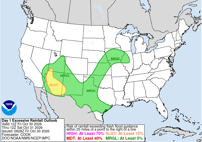
The Midland/Odessa office’s flood watch, which covers much of the Permian Basin, the Big Bend region and Lea and Eddy counties in southeastern New Mexico, calls for 1 to 3 inches of rain “with locally higher totals,” and remains in effect through Friday afternoon.
Watches Stretch from the Panhandle to the Border
The weather service in Lubbock kept a flood watch in effect until 8 p.m. CDT for the South Plains and southern Panhandle. In its forecast discussion, the Lubbock office said “higher amounts previously expected are less likely,” but precipitable water values near 1.5 inches meant localized street flooding remained possible.
In the Concho Valley and western Hill Country, the San Angelo office issued a flood watch until 4 p.m. CDT for Irion, Crockett, Schleicher, Sutton and Kimble counties. Forecasters said 2 to 4 inches of rain was likely there, with “isolated 6 inches or more possible.”
Along the Rio Grande, the weather service in Austin/San Antonio warned of “potential for life threatening flooding” in a watch for Val Verde, Edwards, Real, Kinney, Uvalde and Maverick counties until 1 p.m. CDT. The office said 2 to 5 inches of rain had already fallen in parts of that area and that another 1 to 3 inches, with isolated amounts up to 5 inches, remained possible.
Tornadoes Reported Thursday Evening
The same moisture-rich air fueled rotating storms Thursday evening south and west of the Hill Country.
According to preliminary storm reports from the weather service in Austin/San Antonio, a tornado was captured on video at 6:04 p.m. CDT Thursday about 14 miles west of Uvalde, near U.S. Highway 90 and Ranch to Market Road 1022. Radar later showed tornado debris signatures at 6:25 p.m., about 15 miles south of Montell in Uvalde County, and at 6:54 p.m., about 13 miles southwest of Montell near Alamo Village in Kinney County.
A funnel cloud was reported near Hondo at 6 p.m.
In far West Texas, the Midland/Odessa office logged a landspout tornado at 5:18 p.m. Thursday about 22 miles north of Van Horn, near the Blue Origin site. No damage was reported.
State Resources on Standby
Gov. Greg Abbott directed the Texas Division of Emergency Management on Wednesday to activate state emergency response resources ahead of the flood threat.
“The State of Texas is prepared to respond to the threat of heavy rainfall and flash flooding,” Abbott said in a statement. “Texans should monitor local forecasts, heed guidance from state and local officials, and avoid flooded roadways.”
The resources made available included Texas A&M Task Force 1 swiftwater rescue boat squads and high-profile vehicles; Texas Parks and Wildlife Department game wardens, rescue boat teams and helicopters with hoist capability; and Texas Department of Public Safety helicopters and its Tactical Marine Unit, according to the state agency.
A Dry Halloween Ahead
Relief is on the way. The Midland/Odessa office said in its forecast discussion that the upper-level trough would push the rain into the eastern Permian Basin by late morning and “mostly out of the area by late this afternoon,” leaving only scattered showers behind.
“Saturday will be dry,” forecasters wrote, adding that “the weather for Halloween will be pleasant for trick or treating.”
Farther southeast, the Austin/San Antonio office said rain chances would linger through Saturday afternoon, mainly north of U.S. 90, but would dry out in time for evening Halloween festivities.
Warmer weather is expected Sunday and Monday before a cold front moves through Monday night and brings cooler temperatures Tuesday, according to the Midland/Odessa office. The San Angelo office said showers and thunderstorms could develop along that front Monday afternoon and Monday night.
Safety Reminders
Forecasters urged drivers not to travel through flooded roadways, noting that low-water crossings and poorly drained urban streets flood quickly during heavy rain.
“Turn around, don’t drown,” the state emergency management agency reminded Texans in its release.
