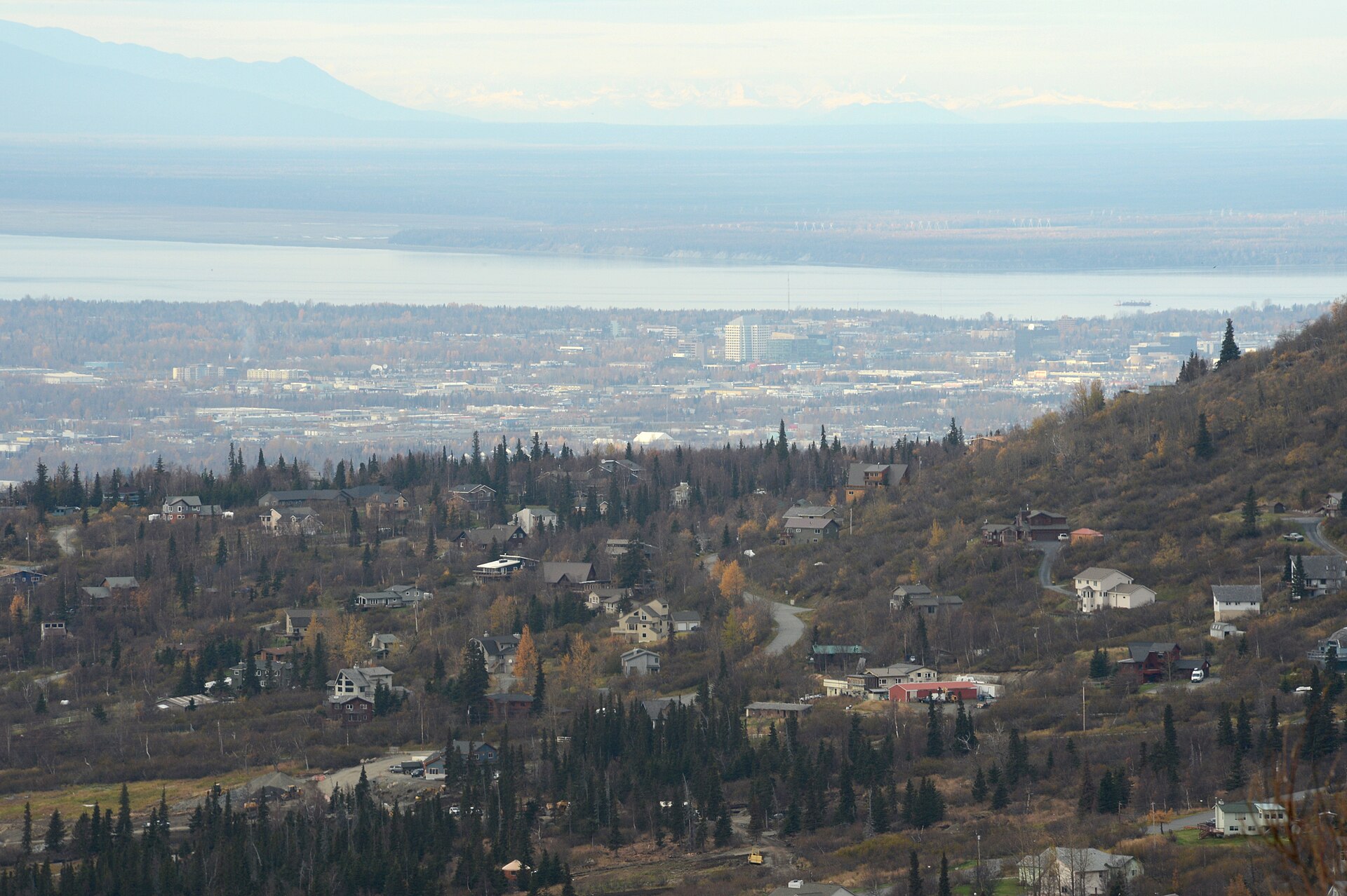
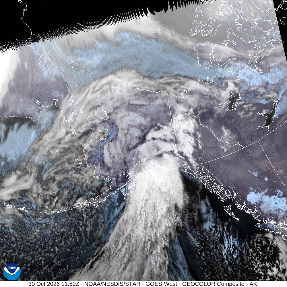
A powerful storm carrying the remnants of former Typhoon Champi swept across Southcentral Alaska overnight into Friday, whipping the Anchorage hillsides with high winds, burying mountain passes in heavy snow and soaking the coast with several inches of rain.
The National Weather Service in Anchorage described the system as “a warm, wet, and windy storm system” in its Thursday afternoon forecast discussion. A front associated with what remained of Champi, then centered in the Bering Sea, “will bring no shortage of weather as it moves across Southcentral,” forecasters wrote.
A high wind warning remained in effect until 11 a.m. AKDT (2 p.m. CDT) Friday for the Anchorage and Eagle River hillsides, mainly above 1,000 feet. The weather service forecast southeast winds of 30 to 45 mph with gusts of 60 to 75 mph, with the strongest gusts likely in the Bear Valley, Potter Creek and Rabbit Creek areas.
“High winds may move loose debris, damage property, and cause power outages,” the warning said.
An Unusually Tight Pressure Gradient
Forecasters said wind in Anchorage was the biggest uncertainty heading into the storm. The question, according to the forecast discussion, was whether the lower atmosphere would be too stable to bring the strongest winds aloft down to the ground, and how much of the wind funneling through Turnagain Arm would reach lower parts of the city.
“Given the unusually tight east-west pressure gradient, have leaned towards higher-end model solutions and issued a High Wind Warning for the Anchorage and Eagle River Hillsides,” forecasters wrote. They said confidence was too low to issue a wind advisory for the lower elevations of the Anchorage Bowl but warned that winds would “likely be quite breezy” across much of the city.
Preliminary weather service observation data showed a peak gust of about 45 mph at Ted Stevens Anchorage International Airport at 3:50 a.m. AKDT (6:50 a.m. CDT) Friday. At Palmer Municipal Airport, a gust of about 53 mph was recorded Thursday evening. A wind advisory for the Lower Matanuska Valley, including Butte and Palmer, called for gusts up to 55 mph until 11 a.m. AKDT.
Alaska’s News Source meteorologist Aaron Morrison wrote that the Anchorage Bowl could see winds of 30 to 50 mph, “with the strongest aimed towards South Anchorage.”
The warning said winds would steadily taper off through early Friday afternoon.
Heavy Snow on the Passes
While warm air kept rain falling in Anchorage, higher terrain where moist air was forced upslope stayed cold enough for heavy snow.
A winter storm warning was in effect until 2 p.m. AKDT (5 p.m. CDT) Friday for the Northern Susitna Valley, including the Parks Highway corridor through Broad Pass, where 7 to 15 inches of snow was forecast. Visibility could drop to a quarter mile or less, and travel “could be very difficult, with low visibility and rapidly accumulating snow along the Parks Highway,” the weather service said. Forecasters said the snow could mix with or change to rain Friday afternoon as temperatures warmed.
At Thompson Pass on the Richardson Highway north of Valdez, a winter weather advisory called for 10 to 15 inches of snow through 10 p.m. AKDT Friday. The weather service said lower parts of the pass would change to rain as temperatures rose, but the top of the pass would likely stay all snow.
Farther north, the weather service in Fairbanks forecast 4 to 8 inches of snow in the southern Denali Borough, with the heaviest amounts between mileposts 215 and 225 on the Parks Highway, and 6 to 12 inches in the eastern Alaska Range south of Trims Camp.
Rain and Flooding Concerns in Seward
The heaviest rain targeted coastal areas where the storm’s moisture slammed into the mountains. Forecasters said the eastern Kenai Peninsula and Prince William Sound would see 36-hour rain totals of 2 to 5 inches from Thursday afternoon through early Saturday.
A flood advisory for Seward remained in effect until 4:15 p.m. AKDT (7:15 p.m. CDT) Friday. The weather service said rainfall rates of up to a quarter inch per hour were possible through mid-morning, with a storm total of 3 to 4 inches likely. “Prolonged heavy rain may lead to areas of flooding along smaller streams and creeks, in low-lying and poor drainage areas, and ponding of water on roadways,” the advisory said.
Offshore, a barrier jet was expected to bring gale- to storm-force winds along the northern Gulf of Alaska coast, the Anchorage office said.
Damaging Gusts in the Interior
Some of the strongest winds were expected in the Interior, where southerly winds raced through gaps in the Alaska Range.
The weather service in Fairbanks issued a high wind warning until 4 p.m. AKDT Friday for Delta Junction and Fort Greely, calling for southeast winds of 35 to 45 mph with gusts up to 70 mph. “Damaging winds could blow down trees and power lines,” the warning said.
Preliminary observation data from Allen Army Airfield at Fort Greely showed a gust of about 71 mph at 1:15 a.m. AKDT (4:15 a.m. CDT) Friday.
In the eastern Alaska Range north of Trims Camp, a high wind warning called for south winds of 40 to 50 mph with gusts up to 85 mph through 7 a.m. AKDT Saturday.
Western Alaska and the Aleutians Hit Hard
The storm’s broad circulation also affected western Alaska and the Aleutian Islands.
A coastal flood advisory remained in effect until 7 a.m. AKDT Saturday for the Kuskokwim Delta coast, including Kipnuk, Kwigillingok and Kongiganak. Water levels could reach about 2.5 feet above the normal highest tide line at Kipnuk and about 2 feet at Kwigillingok, the weather service said. At Hooper Bay, a high surf advisory called for water levels 2.5 to 3.5 feet above normal high tide.
In the Aleutians, the Anchorage office said a strong Bering Sea low prompted a high wind warning for Adak and Atka, where gusts as high as 75 mph were forecast. A wind advisory was set for Unalaska and Nikolski from Friday afternoon into Saturday morning, with gusts up to 60 mph.
Jason Laney, warning coordination meteorologist for the weather service, told KNOM earlier this week that former tropical storms often grow larger as they move into high latitudes. “As they move up into the high latitudes and begin to impact parts of Alaska, that wind field it really expands,” Laney said. “We’re talking not just 10, 20 miles from the center. We’re talking 100, 200 miles from the center.”

A Warm, Stormy Pattern Continues
Champi is one of a series of fall storms affecting Alaska. Laney told KNOM that another low-pressure system, possibly stronger than Champi, could enter the Bering Sea early next week.
The Anchorage office said in its long-range forecast that the pattern would “remain active” through next week, with rain the main precipitation type for most populated areas of southern Alaska and temperatures above normal.
Alaska’s News Source said inland Southcentral should dry out over Halloween weekend under mostly cloudy skies, with highs in the 30s and 40s, while most of the rain stays near the coast.
