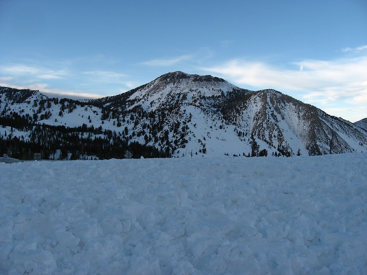
An early-season storm is set to bring the heaviest snow of the season so far to the Sierra Nevada on Halloween night, with up to 18 inches possible on the highest peaks and slippery travel expected over mountain passes into Sunday morning, the National Weather Service said.
Winter weather advisories took effect at 8 a.m. Saturday and run until 7 a.m. Sunday across a broad stretch of the range, from the Interstate 80 corridor near Donner Summit south through Lake Tahoe and Mono County to Yosemite, Kings Canyon and Sequoia national parks.
Forecasters said areas above 8,000 feet would receive “the heaviest snowfall this season so far,” according to a Saturday morning discussion from the weather service office in Reno, Nevada.
How Much Snow and Where
In the northern Sierra, the weather service office in Sacramento forecast up to 10 inches of snow above 7,000 feet, with up to 18 inches on the highest peaks, and minor accumulations of up to 3 inches possible down to 6,000 feet. The advisory covers the Sierra in Nevada, Placer, El Dorado, Amador, Alpine, Calaveras and Tuolumne counties, including the Highway 50 and I-80 corridors.
Snow levels were expected to start at 7,000 to 8,000 feet Saturday before falling to 6,000 to 7,000 feet Saturday night into Sunday, with the heaviest snow Saturday evening into Sunday, the Sacramento office said.
Around Lake Tahoe, the Reno office forecast 2 to 5 inches above 7,000 feet, with up to 12 inches along the highest peaks and up to 2 inches possible down to 6,000 feet. The office warned of wind gusts as high as 50 mph that “could bring down tree branches.” In Mono County, forecasters expect 3 to 7 inches above 8,000 feet, up to 15 inches on the highest peaks and gusts to 45 mph.
Farther south, the weather service in Hanford forecast 4 to 8 inches between 7,500 and 9,500 feet and up to 18 inches above 9,500 feet for Yosemite outside the valley, Kings Canyon and Sequoia national parks and nearby high country, warning that “travel could be very difficult to impossible.”
The Hanford office said areas above 9,000 feet had a 60% to 80% chance of at least 8 inches of snow by early Sunday, and that the highest elevations of the southern Sierra had a 50% to 90% chance of a foot or more through Monday morning.
The Reno office said snowfall rates could reach a half inch to 1 inch per hour at the highest passes, possibly more for brief periods Saturday night. Forecasters put the chance of more than 6 inches above 8,000 feet at 20% to 80%, and said there is a 20% to 50% chance of more than 1 inch above 6,000 feet.
Because warm and cold air masses are merging over the region, a few thunderstorms are possible, especially in the Sierra, where forecasters put the chance at 10% to 15%. That raises the possibility of brief thundersnow, which could locally inflate snow totals, the Reno office said.
Passes Already Closing
Several high mountain routes closed ahead of the storm. Sonora Pass on State Route 108 and Monitor Pass on State Route 89 were closed Friday, and Yosemite National Park closed Tioga Road on Thursday evening, the San Francisco Chronicle reported.
Travel was expected to deteriorate Saturday afternoon and evening on I-80 over Donner Summit, Highway 50 over Echo Summit and Highway 88 over Carson Pass, with chain controls, delays and even temporary closures possible as the snow picks up, the newspaper reported.
The Sacramento office urged drivers to check the latest road conditions from Caltrans online at quickmap.dot.ca.gov or by dialing 511, and to slow down on slippery roads.
KCRA-TV in Sacramento said rain would fall at pass level during daylight hours Saturday before a switch to snow after dark, with chain controls possible over the Tahoe-area summits Saturday night into Sunday morning. The station said the snow level could briefly drop to about 5,000 feet just before sunrise Sunday, though not much would stick that low.
Rain for Trick-or-Treaters Below the Snow Line
Below the mountains, the storm is mostly a rainmaker, and its timing overlaps with Halloween evening.
In Reno, the weather service expected a high of 53 degrees and a low of 36 on Halloween, with rain likely through the day, the Reno Gazette Journal reported. Snow flurries could mix with the rain early Sunday, but most of the snow was expected in the surrounding hills and the Sierra, the newspaper said.
The Reno office said most of western Nevada and northeast California would see rain Saturday, turning to a rain and snow mix overnight before switching to snow Sunday morning as snow levels drop to 4,500 to 5,500 feet. Valley accumulations were expected to be little to none, and rain totals in the Nevada and northeast California valleys were generally forecast below a quarter inch. Foothills in western Nevada, including Virginia City, had a 10% to 30% chance of up to an inch of snow, forecasters said.
In the Sacramento Valley, KCRA said many places would stay dry for trick-or-treating, though showers would be persistent in the foothills, especially above 2,000 feet. The Sacramento office forecast 0.5 inch to 2.5 inches of rain over the mountains, with the most south of I-80, and 0.2 inch to 1 inch in the foothills.
In the San Joaquin Valley, the Hanford office said there was a 90% chance of at least a quarter inch of rain in the foothills by 11 p.m. Saturday and a 40% to 50% chance in Fresno, Madera and Merced counties.
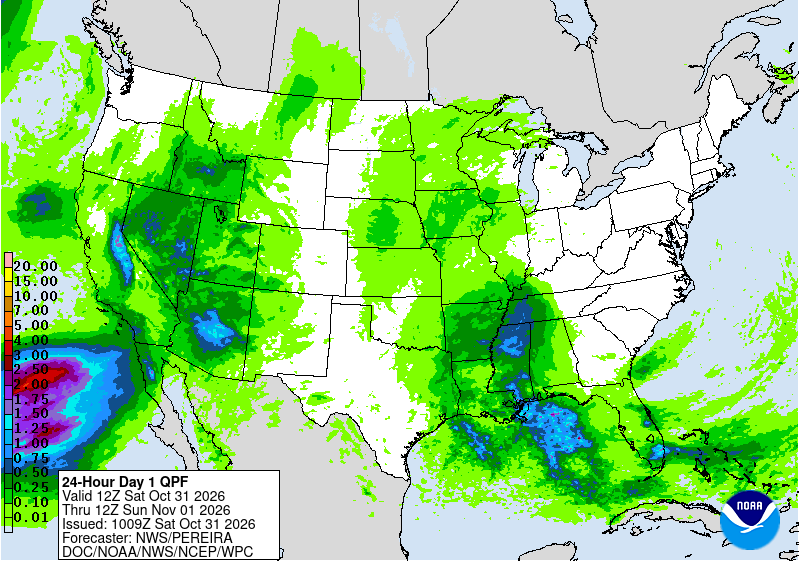
The Weather Prediction Center, a branch of the weather service in College Park, Maryland, expanded a Marginal Risk of excessive rainfall to include the Sierra foothills and much of Nevada. The center said river valleys draining the Sierra could see 1 to 3 inches of precipitation, which could lead to isolated flash flooding.
What’s Driving the Storm
Forecasters said the snow is the product of a broad, deep low-pressure system over the northeastern Pacific interacting with a second low in the eastern Pacific as both move east across California through Sunday. As they merge, colder air aloft is moving over the mountains, lowering snow levels and making the atmosphere more unstable.
The Chronicle noted that the early-season storm comes as El Niño continues to strengthen in the Pacific, and that long-range models show above-average precipitation for California this winter.
A Quick Exit
The storm will not linger. The Reno office said an upper-level ridge would return by Sunday evening, clearing precipitation for a couple of days and bringing warmer, drier conditions. Lake Tahoe-area highs Sunday are expected only in the upper 30s to low 40s, the Chronicle reported.
The Sacramento office said temperatures will stay below normal for early November even as conditions dry out, and that gusty east to northeast winds could develop across the region, strongest over the Sierra. The Hanford office said fog is possible in the San Joaquin Valley on Monday and Tuesday as high pressure traps moisture near the surface.
Forecasters said another upper-level trough could approach around Tuesday or Wednesday, though the Reno office said it currently looks like a quick passage with light precipitation, and the Sacramento office said there is a lot of uncertainty in its timing and position.
