Image: NOAA/National Weather Service Sacramento
A colder, wetter Pacific storm is expected to bury Northern California’s mountains under 1 to 3 feet of snow from Tuesday night into Friday, forecasters said Monday, following a weekend system that already brought rain, mountain snow and chain controls to the region.
The National Weather Service office in Sacramento said in its Monday morning forecast discussion that confidence “remains high” in a strong storm arriving Tuesday night that will bring widespread rain, gusty southerly winds and heavy mountain snow through early Friday.
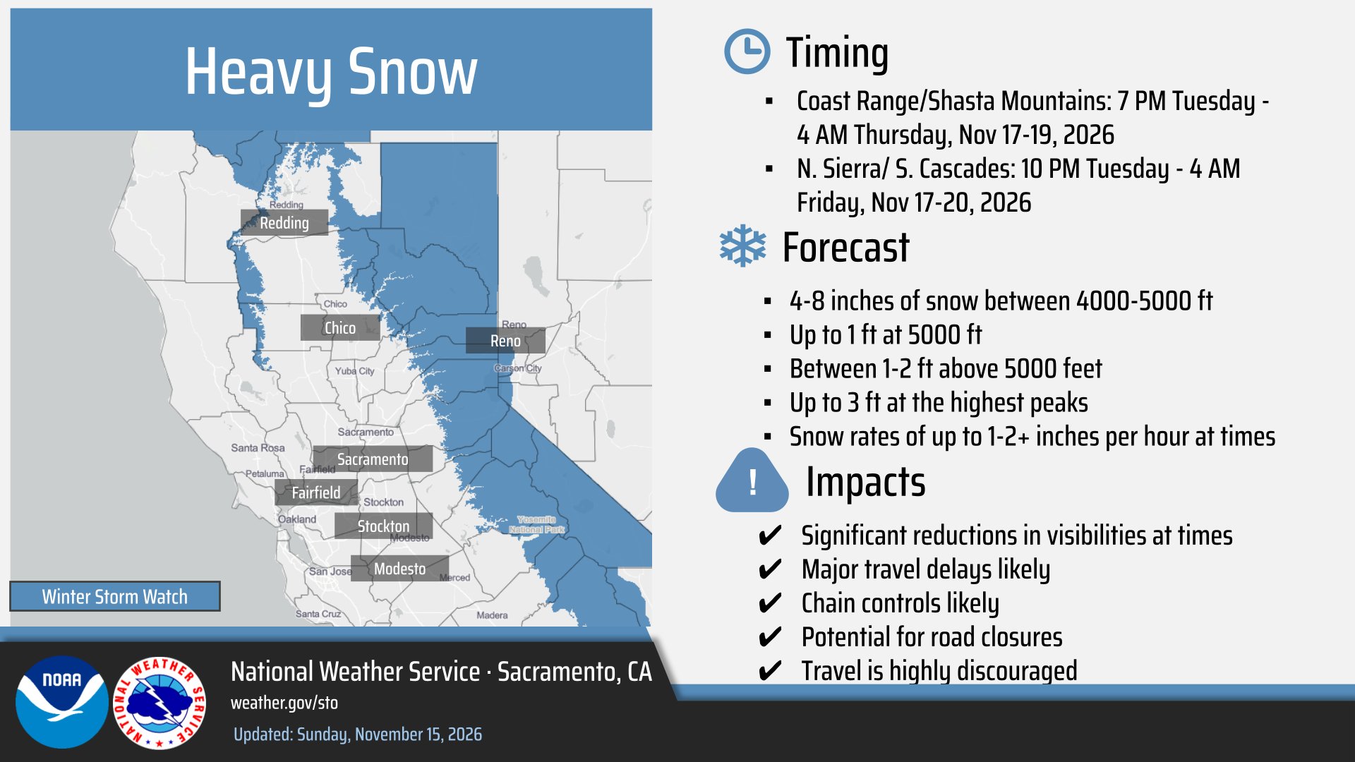
Winter storm watches cover elevations above 4,000 feet in the northern Sierra Nevada and southern Cascades from 10 p.m. Tuesday to 4 a.m. Friday, and the Coast Range and Shasta County mountains from 7 p.m. Tuesday to 4 a.m. Thursday.
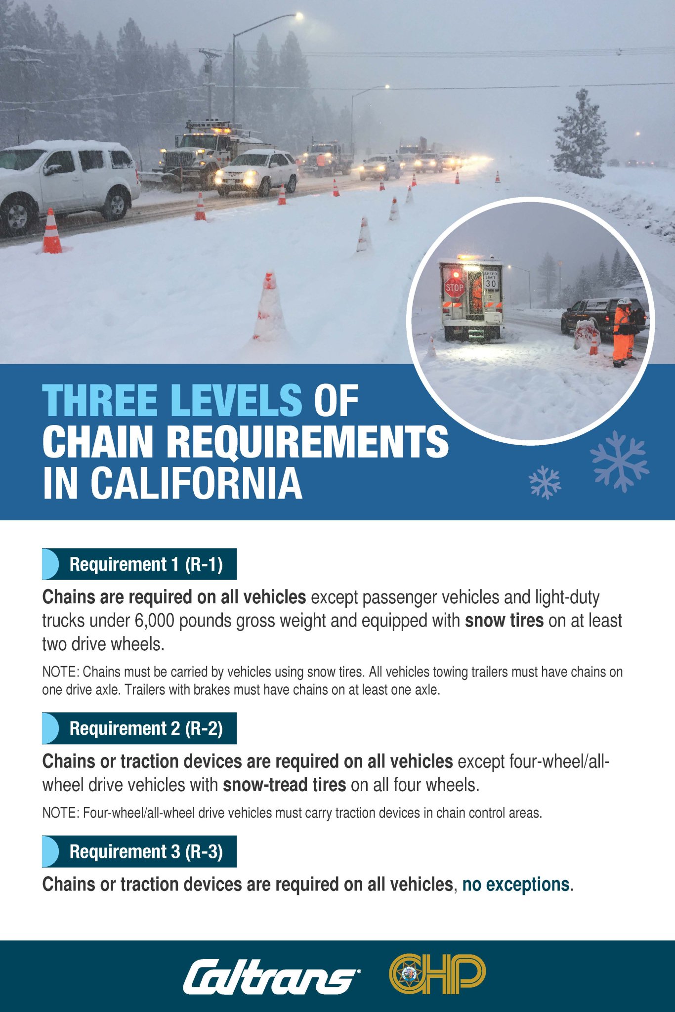
Image: Caltrans/California Highway Patrol
“Travel could be very difficult to impossible Tuesday night through early Friday morning,” the Sacramento office said in the watch.
Forecasters said 1 to 2 feet of snow is possible above 5,000 feet in the Sierra and southern Cascades, with up to 3 feet at the highest peaks. Between 4,000 and 5,000 feet, the agency said 4 to 8 inches could fall, with up to a foot near 5,000 feet. In the Coast Range and Shasta County mountains, the watch calls for 8 to 12 inches above 4,000 feet and up to 2 feet over the highest peaks.
Snow levels are forecast to start between 3,500 and 4,500 feet Tuesday night before rising to between 4,500 and 6,000 feet by late Wednesday morning. The heaviest snow is expected Wednesday morning north of Interstate 80 and then Wednesday afternoon and evening along I-80 and points south, with snowfall rates of 1 to 2 inches per hour or more, the Sacramento office said.
The watch areas include Interstate 80, U.S. Highway 50 and state routes 4 and 108. Winds in the Sierra could gust to 50 mph, forecasters said, which “could bring down tree branches” and sharply reduce visibility.
The outlook is even snowier around Lake Tahoe. The weather service office in Reno, Nevada, said early Monday that it had increased expected snow totals and now calls for 2 to 4 feet above 7,000 feet and 1 to 2 feet around lake level from late Tuesday night through late Thursday night. Ridgetop winds could reach 80 mph, and the office warned that “strong winds could cause damage to trees and power lines.”
In a social media post Sunday, the Reno office said heavy snowfall rates with gusty winds could produce periods of whiteout conditions, especially Wednesday, and advised travelers to “finish travel by Tuesday evening to avoid the worst conditions.”
Farther south, the weather service office in Hanford said a winter storm watch for the Sierra above 5,000 feet, including Yosemite, Kings Canyon and Sequoia national parks, calls for 1 to 2 feet of snow and about 4 feet above 8,000 feet from late Tuesday night through late Thursday night, with gusts as high as 45 mph.
To the north, the weather service office in Medford, Oregon, issued a watch for Siskiyou County above 4,000 feet and down to 3,500 feet near Mount Shasta City, where forecasters said upslope flow could drive snow levels down to the Interstate 5 corridor. The office said 6 to 12 inches “look like a good bet” above 4,000 feet. It put the chance of more than 6 inches on Highway 89 east of Mount Shasta near Snowman Summit at 90% to 100%, and the chance near Black Butte Summit on I-5 at 30% to 50%.
Medford forecasters said models show the storm’s surface low sliding south-southeast offshore and then moving ashore somewhere near San Francisco on Thursday, a track that favors heavy precipitation over Northern California.

Image: NOAA/National Weather Service Reno
Below the snow line, the Sacramento office forecast 1.25 to 2 inches of rain in the Sacramento Valley and Delta, 1.5 to 2.75 inches in the foothills and 2 to 3.5 inches of liquid in the mountains. Thunderstorms are possible Wednesday and Thursday, with chances of 15% to 30% on Thursday, and could bring locally heavy rain, small hail and gusty outflow winds, forecasters said. Ponding on roads and rising small streams are also possible.
The midweek storm follows one still moving through the region Monday.
The Sacramento office said rainfall from the first system had ranged from about 0.2 inch in the northern San Joaquin Valley and Delta to 0.75 to 1 inch in the Sacramento metro area and 1.70 inches at Redding Airport by early Monday. Mountains and foothills north of I-80 had received 1 to 2 inches. Another 1 to 1.5 inches was expected in the Sierra and foothills Monday, with showers ending by midnight.
A winter weather advisory remained in effect until 10 p.m. Monday for the Sierra above 6,000 feet and Lassen Volcanic National Park, where forecasters said up to 16 inches could fall. Around Tahoe, the Reno office forecast 3 to 8 more inches above 7,000 feet through Monday evening, with ridgetop gusts to 70 mph.
At 4:10 a.m. Monday, the California Highway Patrol’s Truckee office said R2 chain controls were in effect on eastbound I-80 from Kingvale to Truckee and on westbound I-80 from Truckee to Rainbow, with trucks at maximum restrictions.
Under California’s system, R2 requires chains or traction devices on all vehicles except four-wheel or all-wheel drive vehicles with snow-tread tires on all four wheels, according to Caltrans and the CHP. R3, the highest level, requires chains on every vehicle with no exceptions.
The storms continue an active start to the Sierra season. The Reno office said a fast-moving storm Friday, Nov. 13, brought snowfall rates topping 2 inches per hour at times, with 7 to 14 inches near and above 7,000 feet. The office reported 13 inches at Sugar Bowl, Homewood and Mammoth Mountain and 11.6 inches at the Central Sierra Snow Lab.
A brief lull is forecast Tuesday. The Sacramento office said clearing skies could bring morning lows in the mid-30s in the northern Sacramento Valley and from the teens to low 30s in the mountains, with possible frost.
The broader pattern is affecting much of the West Coast. The Weather Prediction Center said Monday that an upper-level trough, atmospheric river moisture and a frontal boundary would bring rain and mountain snow from the Pacific Northwest to California, with heavy snow possibly affecting travel in the Sierra Nevada, Cascades and Olympics.
Along the coast, the weather service in Medford said dangerous breaking waves peaked at 25 to 30 feet early Monday on the south-central Oregon coast and Curry County coast, including Charleston, Port Orford, Gold Beach and Brookings. Forecasters warned waves could inundate beaches and surge into normally dry areas, with possible infrastructure damage and significant beach erosion. A high surf advisory covered the coasts of Del Norte, Humboldt and Mendocino counties in California through Monday night.
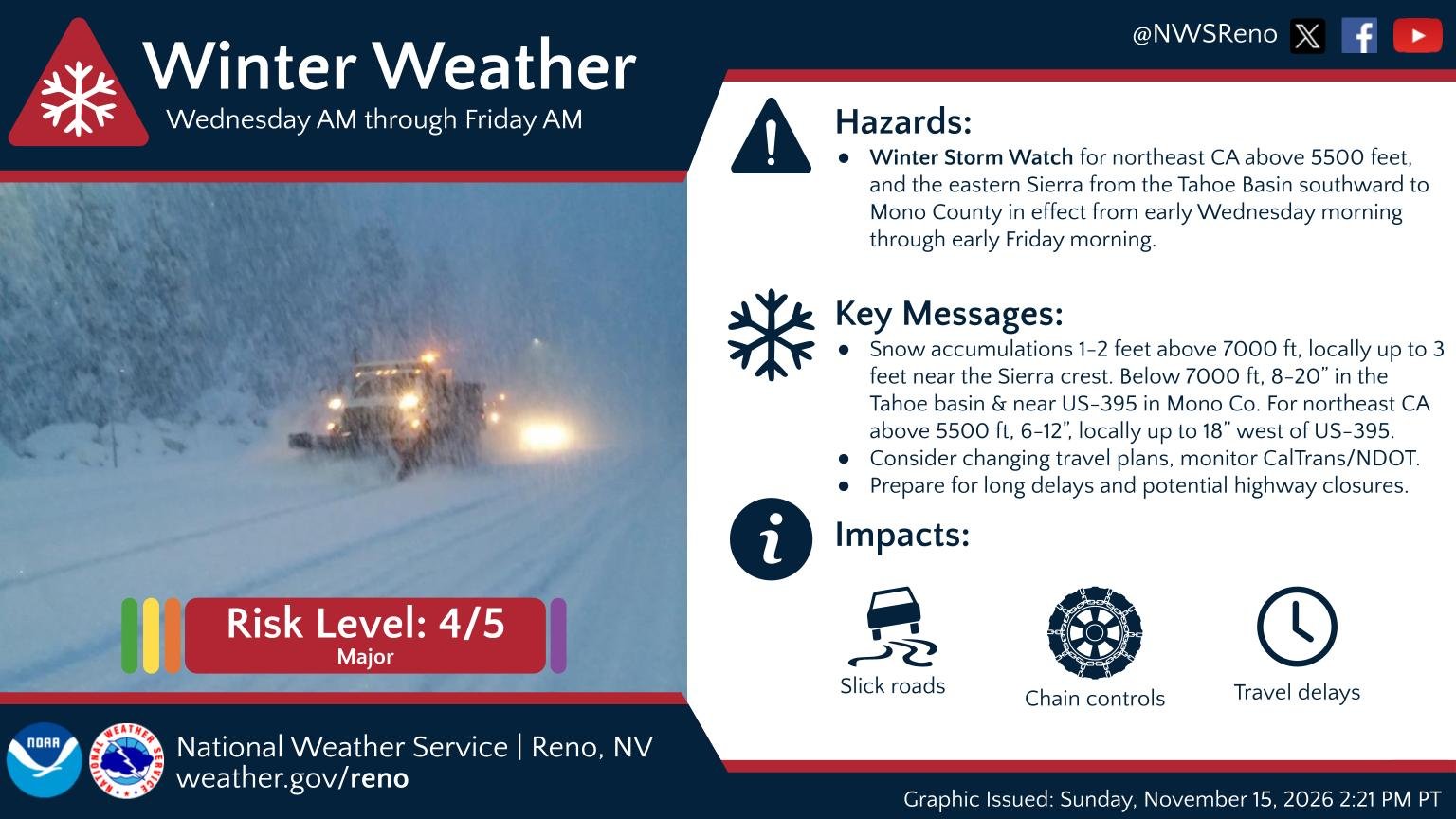
Image: NOAA/National Weather Service Reno
Medford forecasters also said long-range guidance showed another front possibly reaching the coast Friday night or Saturday with snow levels near 4,000 feet, meaning winter weather concerns could continue “as we head into a period of heightened travel for the holidays.”
The Sacramento office urged people to plan ahead and reconsider mountain travel during the midweek storm. Caltrans provides road conditions at quickmap.dot.ca.gov or by calling 511.
