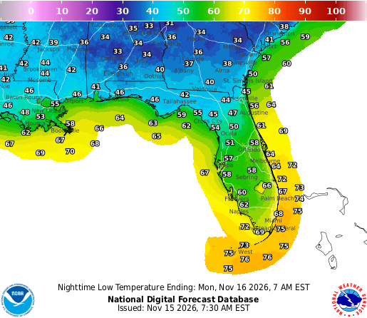
Image: NOAA/National Weather Service
A hard freeze settled over much of the Southeast early Sunday as clear skies and calm winds let temperatures plunge into the upper 20s from Alabama to the Carolinas, prompting freeze warnings across a wide swath of the region and what forecasters said was likely the last such warning of the fall in much of Georgia.
National Weather Service offices issued freeze warnings for all of central and northern Alabama, nearly all of north and central Georgia, central Mississippi, central South Carolina, much of central and eastern North Carolina and parts of southeastern Virginia. Frost advisories extended farther south into the Florida Panhandle and Big Bend, northern Florida and the South Carolina coast.
The warnings were set to expire at 8 a.m. CST in Alabama and Mississippi and at 8 or 9 a.m. EST farther east.
“Temperatures have fallen below freezing across large portions” of north and central Georgia, the weather service office in Peachtree City said in a forecast discussion issued before dawn. With dew points in the 20s, temperatures had “plenty of room to keep going down in many locations,” forecasters said, predicting lows in the mid to upper 20s in parts of far north Georgia.
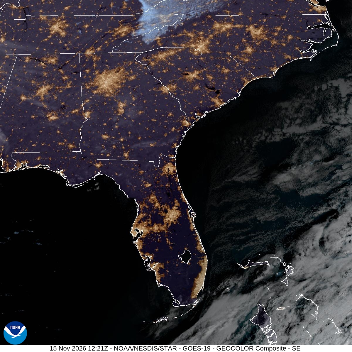
Image: NOAA/NESDIS/STAR
Readings in The 20s
Preliminary hourly observations from airport weather stations through about 7 a.m. EST showed temperatures at or below freezing across much of the region. The Greenville-Spartanburg airport in South Carolina reported about 27 degrees. Birmingham and Huntsville in Alabama, Athens, Macon and Augusta in Georgia and Columbia, South Carolina, all reported about 28 degrees.
Montgomery and Tuscaloosa in Alabama, Raleigh-Durham and Greensboro in North Carolina and Nashville, Tennessee, reported about 30 degrees. Chattanooga, Tennessee, dipped to about 31, and Atlanta’s Hartsfield-Jackson International Airport reported 32. Temperatures were expected to keep falling until shortly after sunrise in some areas, so official lows could end up slightly colder.
The readings are preliminary and may change when the weather service publishes its daily climate reports.
Not every area got as cold as forecast. Jackson, Mississippi, reported a low of about 36 at its airport, although the freeze warning for central Mississippi called for temperatures as low as 28 in some areas, and Columbus, Georgia, was forecast by local media to bottom out near 33.
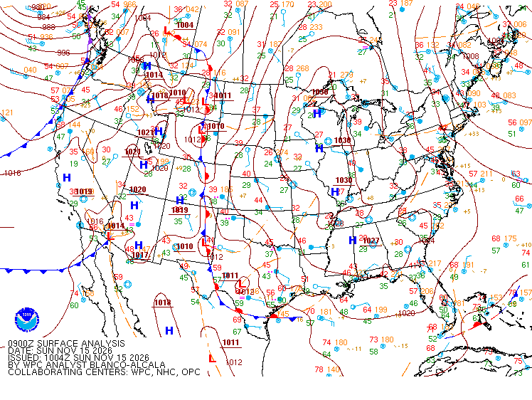
Image: NOAA/National Weather Service/Weather Prediction Center
Why it Got So Cold
Forecasters said a large dome of high pressure centered over the eastern United States set up nearly ideal conditions for a freeze.
“Tonight, light winds and clear skies associated with the weakening surface pressure gradient along the ridge axis will promote strong radiational cooling,” the weather service office in Birmingham, Alabama, said in its discussion Saturday night. It forecast “a widespread frost and freeze” by Sunday morning, with lows in the upper 20s to lower 30s across central Alabama.
The Peachtree City office described the conditions as “perfect” for a strong temperature inversion near the ground, with winds “light to near calm across large portions of north and central Georgia” under clear skies.
Satellite imagery early Sunday showed almost no clouds over the region, allowing heat to escape from the ground overnight.
Warnings Across the Region
The individual warnings painted a broad picture of the cold:
In Alabama, the weather service in Huntsville forecast lows as low as 27 degrees across the northern part of the state, while the Birmingham office expected lows as low as 28 across all of central Alabama. The Mobile office warned of lows of 29 to 32 in several southwest Alabama counties and Wayne County, Mississippi.
In Georgia, the Peachtree City office forecast lows as low as 27. The Tallahassee office issued a freeze warning for parts of southeast Alabama and southwest Georgia, including Albany, Enterprise and Ozark, with lows as low as 30, while the Jacksonville office warned of lows near 31 in Appling, Bacon, Coffee and Jeff Davis counties.
In the Carolinas, the Columbia office forecast lows as low as 29 in central South Carolina and east-central Georgia, and the Raleigh office expected lows as low as 29 in the North Carolina Piedmont, Sandhills and Coastal Plain. The Wilmington office forecast lows as low as 28 in parts of southeast North Carolina and northeast South Carolina, while the Newport/Morehead City office warned of lows near 30 in much of eastern North Carolina.
The Wakefield, Virginia, office issued a freeze warning for Bertie and Gates counties in North Carolina and the city of Suffolk, Virginia, with lows as low as 30.
Near the coast, the Charleston, South Carolina, office forecast lows in the upper 20s to lower 30s in inland parts of southeast Georgia and southeast South Carolina, with a frost advisory for Charleston, Beaufort and nearby coastal counties, where lows in the mid-30s were expected to produce frost away from the water. The Wilmington office issued a frost advisory for the coasts of southeast North Carolina and northeast South Carolina, including Myrtle Beach’s Horry County, with lows as low as 33.
In Florida, frost advisories from the Tallahassee and Jacksonville offices covered parts of the Panhandle, the Big Bend and northern Florida, with lows as low as 33 to 34 degrees. Forecasters warned that sensitive outdoor plants could be killed if left uncovered.
The warnings said the freeze could kill crops and other sensitive vegetation and could damage unprotected outdoor plumbing. Forecasters urged people to wrap or drain exposed pipes, let faucets drip slowly and drain in-ground sprinkler systems.
The Jacksonville office also reminded residents that young children, older adults and people experiencing homelessness are especially vulnerable to the cold.
End of the Warning Season
For much of Georgia, Sunday’s freeze warning is expected to be the last of the season.
The Peachtree City office said in its hazardous weather outlook that its frost and freeze program ends Nov. 15, “so no additional products are expected to be issued until the Spring,” even though below-freezing temperatures remain possible.
Forecasters explained in their discussion that many areas would experience a hard freeze Sunday that would end any agricultural growth, and that Nov. 15 is the traditional cutoff in those parts of Georgia because most produce has been harvested by then.
“This always creates some confusion, as the Frost/Freeze program is an agricultural program, and not intended to warn the public of every time the temperatures may get below freezing,” the office said.
Sunday’s freeze followed another cold morning Saturday, when freeze warnings were also in effect for parts of east Alabama and west Georgia.
Another Cold Night, Then a Warmup
Monday morning is expected to be cold again, though probably not as cold as Sunday. The Peachtree City office forecast lows from the upper 20s to the mid-30s across north and central Georgia, with highs Sunday and Monday in the 50s and low 60s.
The Birmingham office said the dry air mass will stay in place, with afternoon temperatures gradually moderating through Tuesday and highs climbing into the low 70s from Wednesday through Friday as an upper-level ridge expands over the region. Dry weather is expected to continue through next Saturday, the office said, with afternoon humidity dropping to 25% to 35% through Tuesday.
“Just another great Fall day,” the Peachtree City office wrote of Sunday’s forecast.
