
Image: Brocken Inaglory/Wikimedia Commons
Californians got only a brief break Sunday from a string of Pacific storms, after towering waves flooded streets in Pacifica and damaged a landmark wharf in Capitola on Saturday, and forecasters warned that another round of rain, high surf and mountain snow was moving in ahead of a stronger storm later in the week.
The National Weather Service office in the San Francisco Bay Area said breaking waves of 20 to 25 feet, with occasional sets of 25 to 35 feet at favored breakpoints, were still reaching the coast early Sunday. A high surf warning expired at 4 a.m. PST, but a high surf advisory for all Pacific beaches from the North Bay to Big Sur remains in effect until 4 a.m. Tuesday.
The Sunday waves are “less energetic than the ones we saw on Saturday, which ended up flooding portions of Pacifica and damaging Capitola Pier,” the weather service said in its morning forecast discussion. It said the surf would still be hazardous to swimmers, could knock unaware people into the water and would keep the risk of rip currents high.
Damage Reported Up and Down the Coast
Storm reports compiled by the weather service described damage across several coastal counties Saturday.
In San Mateo County, a San Francisco Chronicle media partner shared photos of seawater flooding residential streets in Pacifica at 12:55 p.m., the report said. In Santa Cruz County, KSBW-TV video taken about 12:30 p.m. showed large waves breaking over the Capitola Wharf and damaging its railing.
On the Monterey Peninsula, an emergency manager at Pebble Beach reported damage at the Spyglass Hill Golf Course, saying a boardwalk was damaged and debris from the surf covered a road and turnouts, according to the weather service.
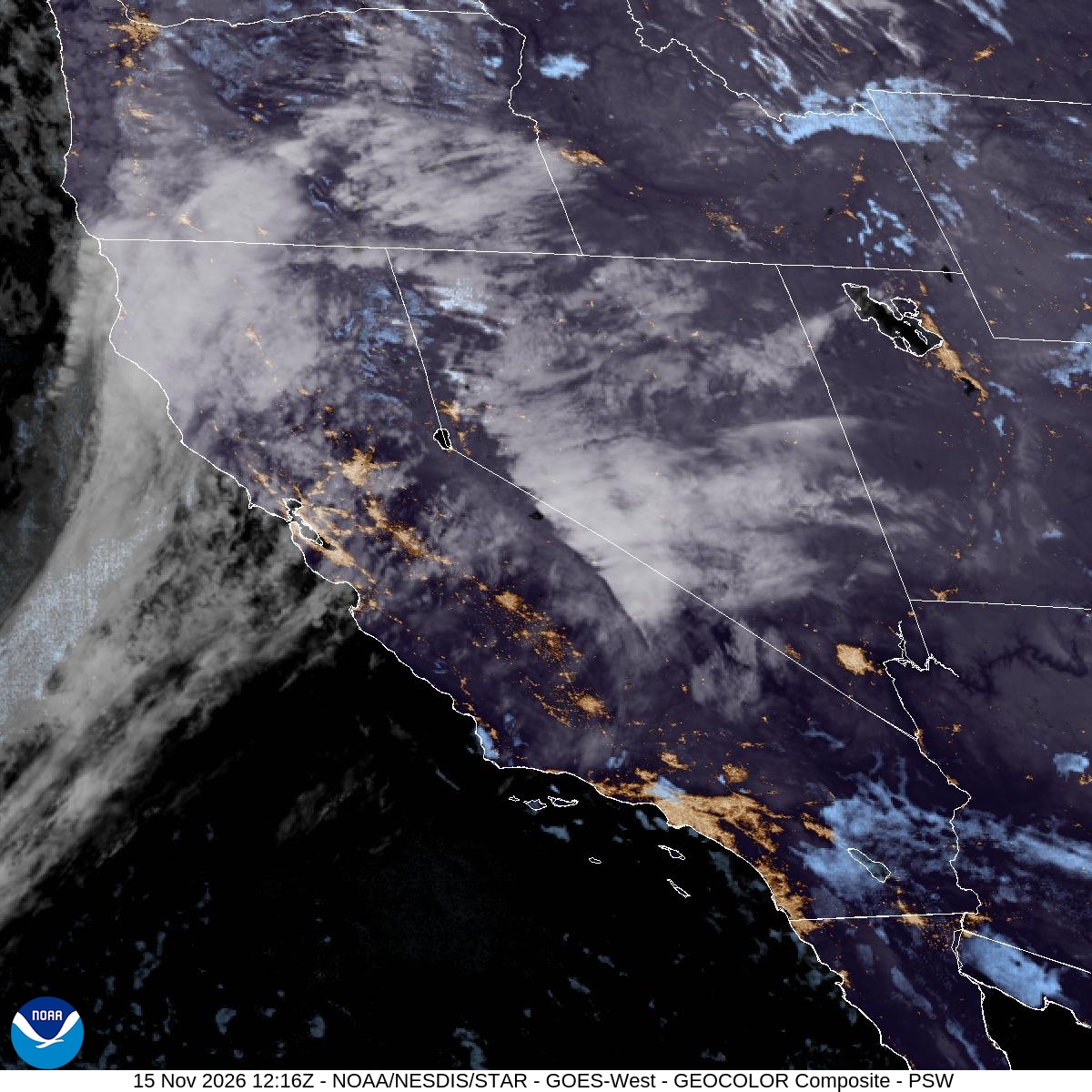
Image: NOAA/NESDIS/STAR
Farther north in Mendocino County, debris washed onto Highway 1 near Seaside Beach, about 8 miles north of Fort Bragg, blocking both lanes Saturday morning. Flooding from the surf was reported at a campground at Caspar Beach south of Fort Bragg, and photos shared on social media showed parking lots filled with debris at Arena Cove near Point Arena, the reports said.
Wind also took a toll. In Humboldt County, a tree fell onto an SUV on Scenic Drive south of Trinidad at about 12:43 p.m. Saturday, according to a California Highway Patrol incident log cited in a weather service report. The tree struck the 27-year-old woman inside in the face, causing multiple lacerations that personnel at the scene described as moderate injuries, the report said.
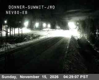
Image: California Department of Transportation (Caltrans)
More Waves on the Central and North Coasts
The weather service office in Los Angeles issued a new high surf warning early Sunday for San Luis Obispo County beaches and the central coast of Santa Barbara County, with breaking waves of 14 to 18 feet until 4 p.m. PST. A high surf advisory follows through Tuesday afternoon, with waves of 10 to 15 feet.
Forecasters there said a series of west-northwesterly swells would bring an extended period of large surf into the week, with warning-level waves possible again late Sunday night into Monday. They said widespread flooding was likely in low-lying areas such as Oceano Dunes and that breaking waves could hit the Cayucos and Pismo Beach piers and the entrance to Morro Bay Harbor.
On the North Coast, the weather service office in Eureka said a high surf warning for Del Norte, Humboldt and Mendocino counties, with breaking waves of 22 to 25 feet, expired early Sunday. But it warned that “another large swell is forecast to arrive to the shoreline late Sunday through Monday.”
The Los Angeles office urged people in its warning to stay off jetties, piers and other waterside structures.
Rain Spreads South Sunday
A frontal band of rain tied to a low-pressure system off British Columbia was expected to reach the North Bay on Sunday morning, then spread across the San Francisco Bay Area in the afternoon and the South Bay and Monterey Bay areas in the evening, the weather service said.
Forecasters said steady rain could linger into Monday morning’s commute in parts of the interior East Bay, South Bay and Central Coast. Expected totals range from 1 to 1.25 inches in the Sonoma coastal ranges and half an inch to 1 inch in the central Bay Area, Marin, Sonoma and Santa Cruz counties.
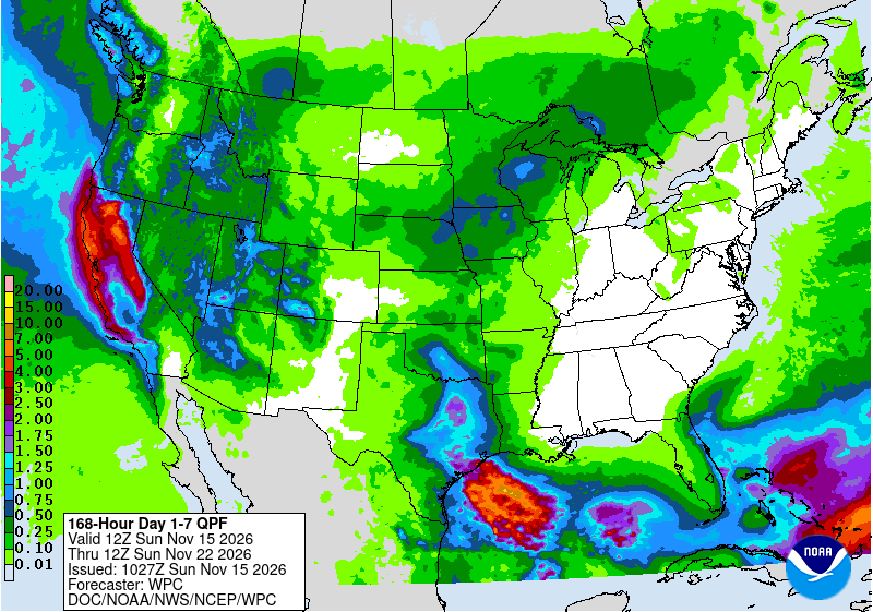
Image: NOAA/National Weather Service/Weather Prediction Center
Winds will not be as strong as in Friday’s storm, with gusts of 20 to 30 mph along the coast and on ridgetops, the forecast said.
In Southern California, the Los Angeles office said rain would move from the Central Coast into Los Angeles and Ventura counties late Monday, with about a third of an inch or less expected in most areas.
Snow Returns to the Sierra
In the mountains, the weather service office in Sacramento issued a winter weather advisory from 4 p.m. PST Sunday through 10 p.m. Monday for the northern Sierra and southern Cascades above 6,000 feet, including Interstate 80, Highway 50, State Route 4, State Route 108 and Lassen Volcanic National Park.
The advisory calls for 2 to 7 inches of snow, with up to 16 inches near Lassen Park, and wind gusts as high as 40 mph. Forecasters said snow levels would start between 6,500 and 7,500 feet Sunday and drop to 5,000 to 6,000 feet Monday, with the heaviest snow late Sunday night into Monday morning.
“The hazardous conditions will impact travelers this evening, as well as the Monday morning and evening commutes,” the advisory said.
The Sierra already picked up snow from Friday’s storm. Caltrans reported 11 inches at Castle Peak and 7 inches at Kingvale along I-80 in the 24 hours ending Saturday morning, and Bear Valley Ski Resort reported 11 inches, according to weather service storm reports. A Caltrans camera at Donner Summit showed snow lining I-80 before dawn Sunday.
The weather service office in Hanford has a separate advisory until 4 a.m. Tuesday for the southern Sierra above 6,000 feet, including Yosemite, Kings Canyon and Sequoia national parks, calling for up to 5 more inches of snow.
Stronger Storm Expected Midweek
Forecasters said the bigger concern is a storm arriving late Tuesday and lasting into Wednesday, Thursday and possibly early Friday.
The San Francisco Bay Area office said the system “is looking to be more impactful than the previous two.” It said the low-pressure system is expected to slow as it approaches California, allowing more rain to fall in any one place, while a strong jet stream aimed at Northern California could bring valley gusts of 30 to 40 mph.
The current forecast calls for 2 to 3 inches of rain across much of the Bay Area and Central Coast and 3 to 5 inches in the coastal ranges, forecasters said. They warned that flooding concerns would increase as soils become saturated and creeks and streams reach bankfull, and they put the chance of thunderstorms at 20% to 30% on Wednesday and Thursday.
In the Sierra, the Sacramento office said model probabilities of at least 12 inches of snow above 5,000 feet from Wednesday through Thursday night were 70% to 100%, with a 40% to 70% chance of 2 feet. Snow could accumulate as low as 4,000 feet, the office said.
Before that storm arrives, clearing skies could bring frost Tuesday morning, with lows in the low to mid-30s in the northern Sacramento Valley, the weather service said.
The weather service urged beachgoers to stay away from the water’s edge, keep off rocks, jetties and piers and never turn their backs to the ocean. Drivers heading into the mountains should check road conditions with Caltrans before traveling.
