Image: NOAA/NESDIS/STAR
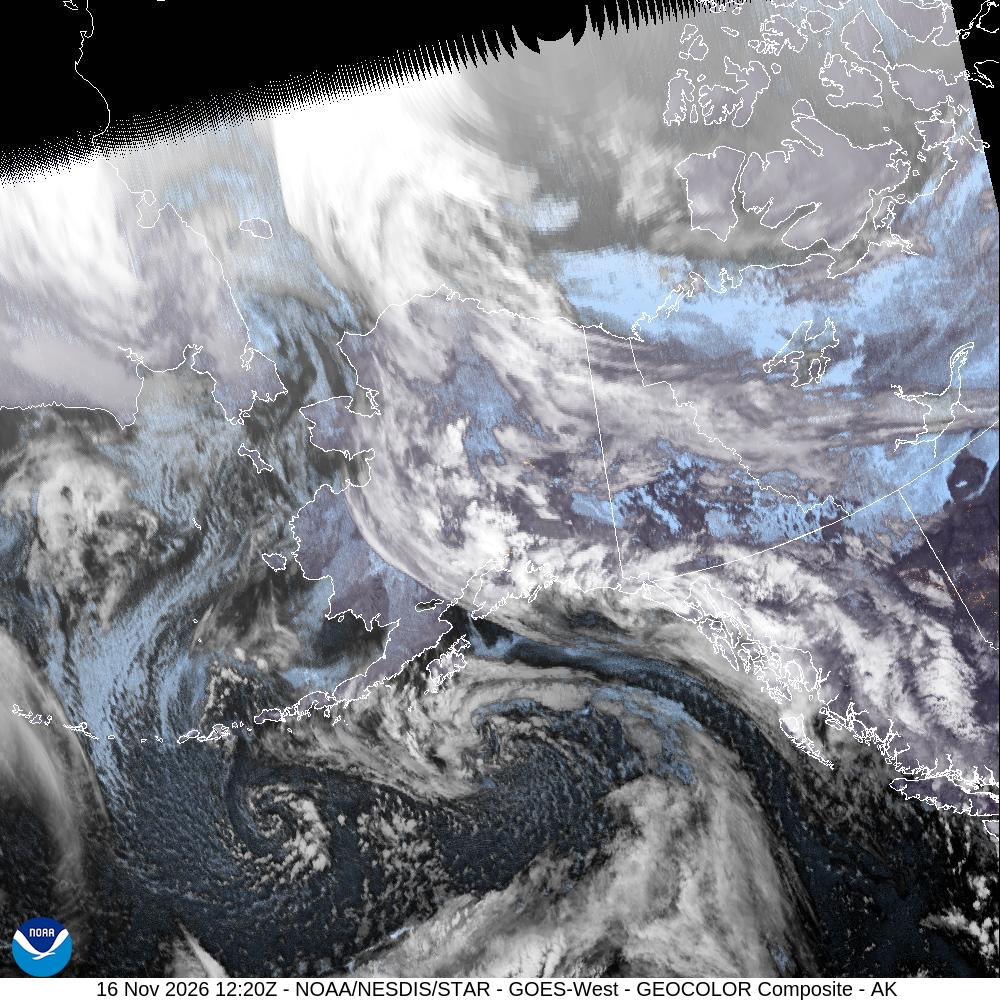
A strong storm moving into the Bering Sea is expected to bring hurricane-force wind gusts to the Aleutian and Pribilof islands and possible blizzard conditions and coastal flooding to western Alaska from Monday night into Thursday, the National Weather Service said.
The weather service has issued storm warnings for Bering Sea and Aleutian waters, high wind warnings for Adak, Atka and the Pribilof Islands, a winter storm watch for the Kuskokwim Delta coast and coastal flood watches for the Kuskokwim and Yukon delta coasts, including communities that were hit hard by a destructive storm last year.
The weather service office in Fairbanks said in its Monday morning forecast discussion that the low will be at its strongest, about 945 to 955 millibars, Tuesday night as it tracks east between St. Paul and St. Lawrence islands.
The storm is expected to weaken as it turns north Wednesday and Thursday.
The Anchorage office said the “large and strong low pressure system” will bring very strong storm-force winds to the Shemya and Adak area Monday night into Tuesday morning before its front pushes east.
A high wind warning for Atka and Adak runs from 6 p.m. Monday to 6 a.m. Tuesday, Alaska time. The warning calls for southwest winds of 45 to 60 mph with gusts as high as 80 mph, strongest at Adak, while Atka could see gusts near 60 mph. The Anchorage office said in a social media post that Adak’s winds would peak near 3 a.m. Tuesday.
The warning said high winds could move loose debris, damage property and cause power outages. “Travel will be difficult,” it said.
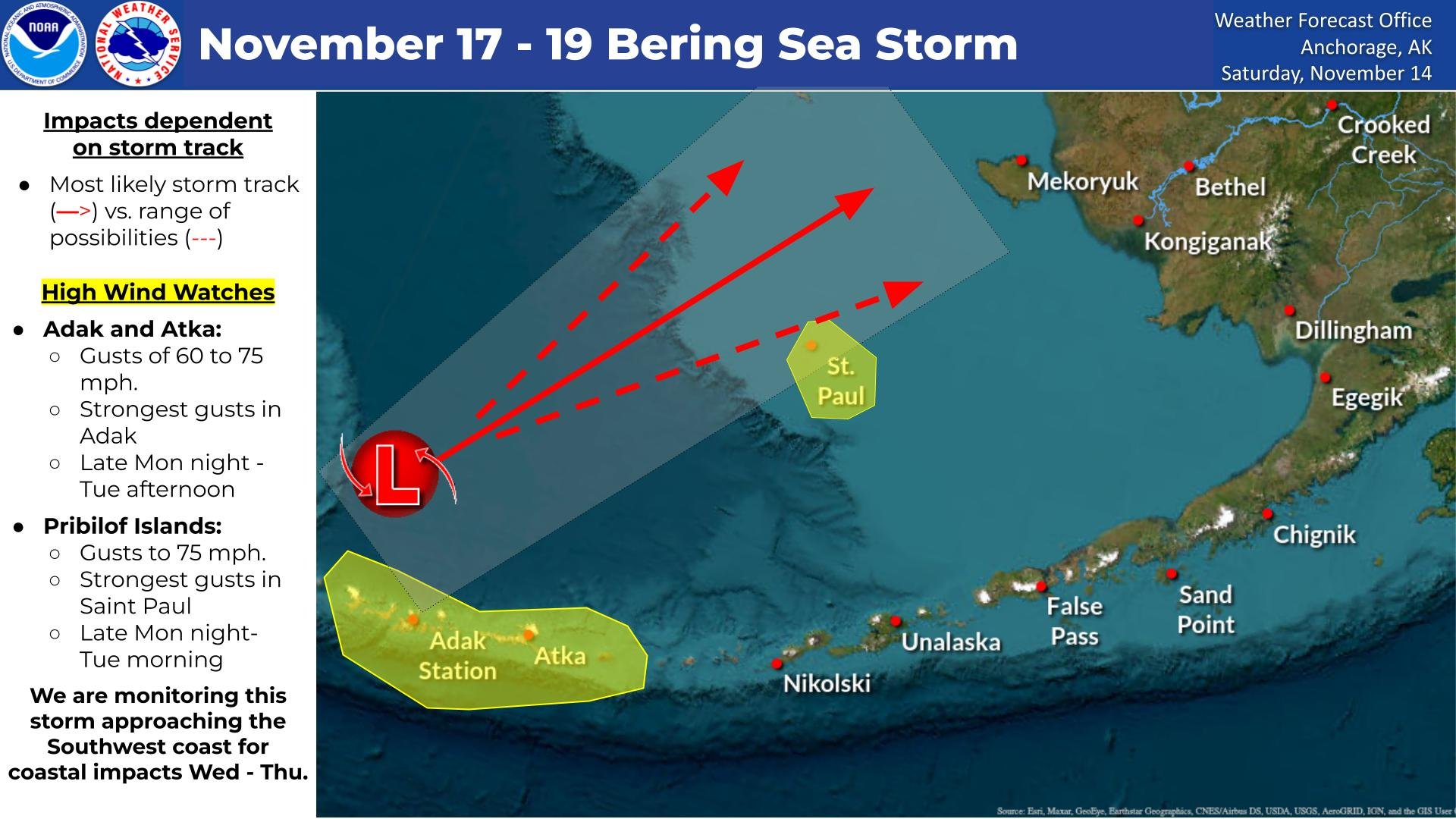
Image: NOAA/National Weather Service Anchorage
In the Pribilof Islands, a high wind warning from 3 a.m. to 9 a.m. Tuesday calls for southeast winds of 45 to 55 mph with gusts up to 75 mph. Forecasters said a second peak is likely Tuesday evening through Wednesday morning, with gusts potentially reaching 60 to 70 mph after winds shift to the west-southwest.
Because the low is expected to stall over the central or northern Bering Sea by Wednesday morning, the Anchorage office said a prolonged push of westerly gale- to storm-force winds could reach the Pribilofs through Thursday. That would keep wave heights of 20 to 30 feet within 15 to 20 nautical miles of St. Paul through Thursday morning, forecasters said. The warning urged residents to secure loose objects and “prepare for the possibility of widespread power outages.”
On the mainland, the storm’s front is expected to reach southwest Alaska Tuesday, bringing southeast gales to the coastline.
A winter storm watch for blizzard conditions covers the Kuskokwim Delta coast, Nunivak Island and the Goodnews Bay and Platinum area from Tuesday afternoon through Tuesday evening. Forecasters said only 1 to 3 inches of snow is expected, but gusts as high as 65 mph could cut visibility to a quarter-mile or less in blowing snow.
“Very strong winds could cause extensive damage to power lines,” the watch said.
Southerly winds will then carry warmer air inland, turning snow to a rain-snow mix or rain late Tuesday or early Wednesday, the Anchorage office said.
Image: Andrea Pokrzywinski via Wikimedia Commons
The shift in wind direction is what concerns forecasters most along the coast. The Anchorage office said the southeast winds Tuesday “will initially not be a favorable direction” for coastal flooding on the Kuskokwim Delta coast. But as winds turn south or southwest by Wednesday morning, the potential increases for flooding of low-lying areas, high surf and erosion.
A coastal flood watch for Kipnuk and Kwigillingok is in effect from 3 a.m. to 9 a.m. Wednesday, when forecasters said the strong winds will coincide with high tide. The watch calls for water levels 1 to 3 feet above the highest tide line, possible flooding of low-lying areas and coastal erosion.
Farther north, the weather service office in Fairbanks issued a coastal flood watch for the Yukon Delta coast, primarily Hooper Bay, from late Tuesday night through Thursday afternoon. The watch calls for water levels 3 to 5 feet above normal high tide, with southeast winds gusting as high as 55 mph.
“Moderate coastal flooding is possible,” the watch said, adding that roads may be closed and that low-lying property, including homes, businesses and some critical infrastructure, may be inundated.
The Fairbanks office said the strongest winds on its side of the storm will be from the east and southeast along the Yukon Delta coast and on St. Lawrence Island Tuesday night into Wednesday, with gusts of 60 to 70 mph on St. Lawrence Island. Gusts of 40 to 50 mph are likely over much of the West Coast through Thursday morning, and once the front moves ashore Wednesday morning, intermittent blizzard conditions are possible, forecasters said.
Model consensus calls for 3 to 6 inches of snow, though the Fairbanks office said one set of guidance would push totals higher in the terrain. Parts of the Yukon Delta could see mixed precipitation or rain Wednesday into Thursday. A special weather statement for the Western Interior calls for 2 to 4 inches of snow, locally up to 6 inches, and gusts to 35 mph Tuesday night through Wednesday night.
The storm’s reach extends well inland. The Fairbanks office issued a high wind watch for the eastern Alaska Range north of Trims Camp and for Windy Pass south of Healy from Tuesday night through Thursday afternoon, with southerly gusts up to 70 mph. Forecasters said south winds will also bring a chinook warming to areas north of the Alaska Range, with highs in the 30s in parts of the south-central Interior and widespread above-freezing temperatures likely Thursday.

Image: NOAA/National Weather Service Anchorage
At sea, conditions will be dangerous for mariners. Storm warnings cover large parts of the Bering Sea, including offshore waters east of 171 degrees west and waters around the central and western Aleutians, into early Tuesday. Dozens of gale warnings cover other Alaska coastal and offshore waters, and the Fairbanks office has heavy freezing spray warnings in effect for several northern marine zones, where ice can quickly build up on vessels.
The coastal flood watches carry particular weight in the Yukon-Kuskokwim region. In October 2025, the remnants of Typhoon Halong brought hurricane-force winds and record tidal-surge flooding to the area, forcing more than 1,000 people from their homes, the Anchorage Daily News reported at the time. Kipnuk and Kwigillingok, Yup’ik villages with about 1,100 residents combined, were the hardest hit, and more than 570 people were flown to Anchorage during a three-day evacuation effort, the newspaper reported, citing the state Division of Homeland Security and Emergency Management. Monday’s forecasts did not address the current state of recovery in those villages.
Forecasters stressed that this week’s impacts depend on the storm’s exact path. A weather service graphic issued Saturday showed a range of possible tracks across the Bering Sea and noted that impacts are “dependent on storm track.”
“Stay tuned to the forecast as we continue to monitor this impactful system,” the Anchorage office said.
Looking further ahead, the Anchorage office said model guidance points to an active pattern through the weekend, with a broad upper-level trough over the Bering Sea and western Alaska and strong North Pacific lows heading toward the Gulf of Alaska.
