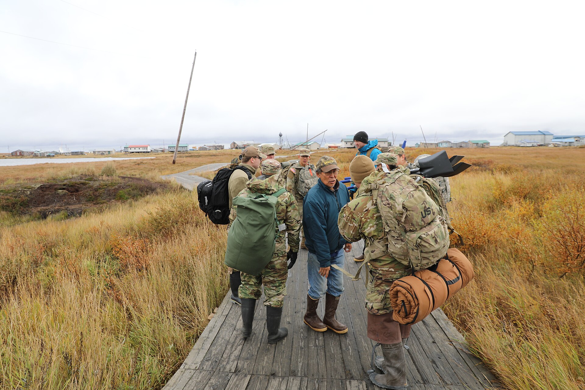
A strong storm churning across the Bering Sea is set to lash western Alaska on Tuesday and Wednesday with blizzard conditions, damaging winds and coastal flooding, with the Yukon Delta village of Hooper Bay facing the greatest flood threat, the National Weather Service said.
The weather service office in Fairbanks issued a coastal flood warning for the Yukon Delta coast, especially Hooper Bay, from 3 a.m. AKST Wednesday to 3 p.m. Thursday. Water levels of 4 to 6 feet above the normal high tide are expected at Hooper Bay, with 2 to 4 feet above normal high tide elsewhere along the coast, the warning said.
“Moderate coastal flooding is likely for Hooper Bay,” the warning said. “Roads may be closed with airstrip access and use limited. Low lying property including homes, businesses, and some critical infrastructure may be inundated. Shoreline erosion may occur.”
Hooper Bay will see two high tides Wednesday, and water levels during the second are expected to be slightly higher than the first, according to the weather service. Southeast winds could gust as high as 55 mph and are forecast to turn more southerly by Wednesday morning.
In its forecast discussion Monday afternoon, the Fairbanks office said “Hooper Bay is the main concern with this system, prompting a Coastal Flood Warning to be issued.” It said it was the office’s only coastal flood warning for the storm.
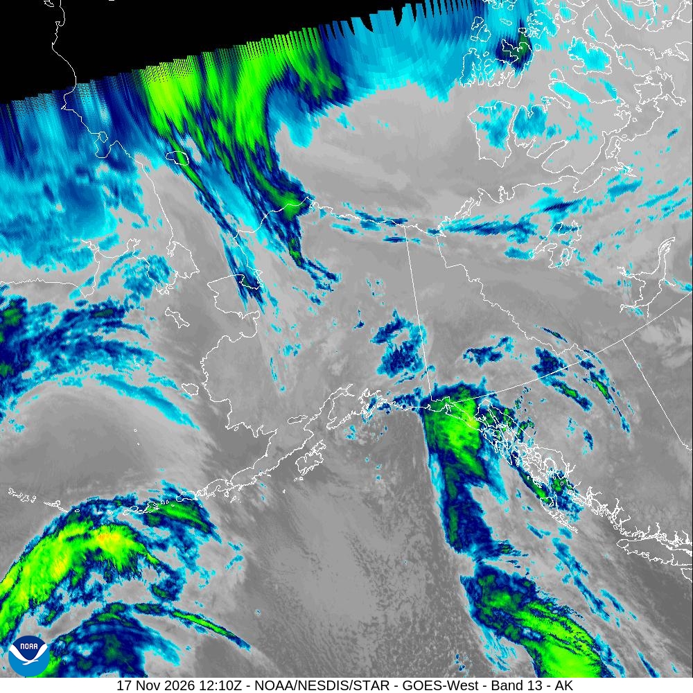
Image: NOAA/NESDIS/STAR
A Deep Low Over the Bering
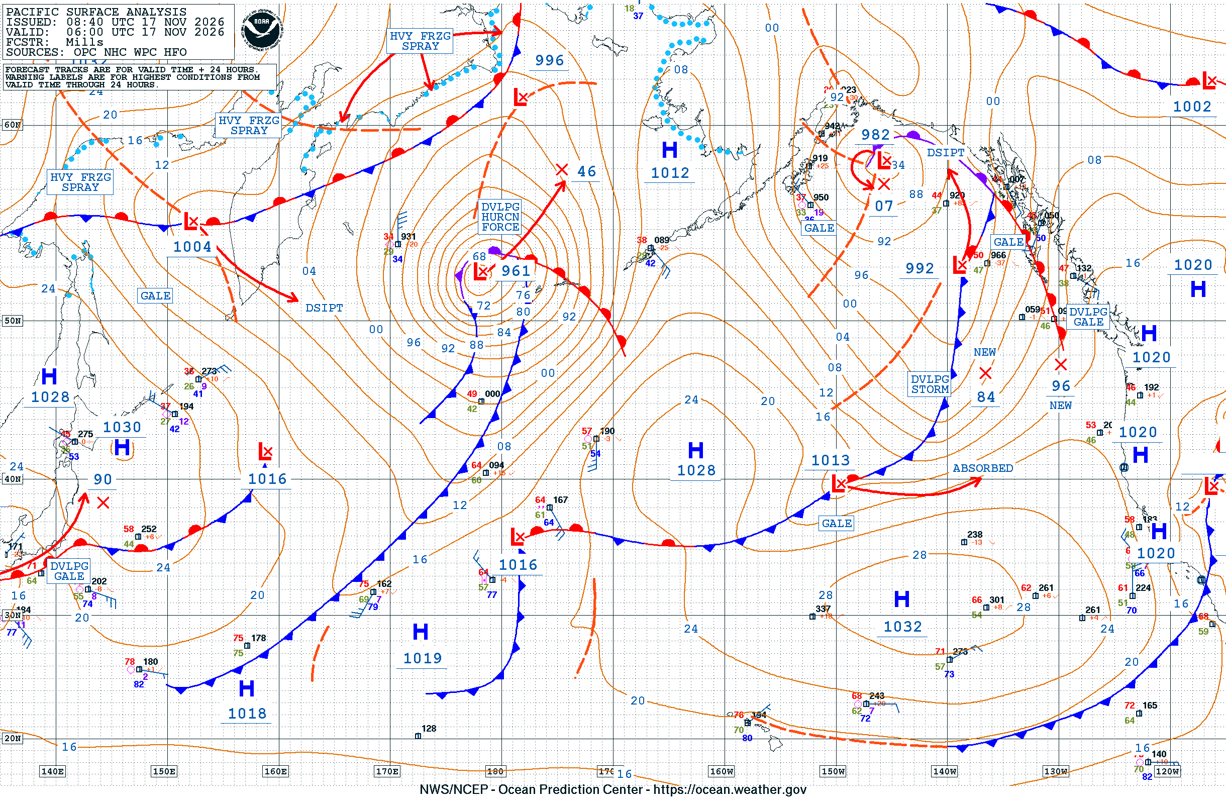
The Ocean Prediction Center’s surface analysis valid at 6 a.m. UTC Tuesday, which was 9 p.m. AKST Monday, showed a 961-millibar low near the western Aleutians, labeled as developing hurricane-force. The Fairbanks office described the storm as a 950-millibar low approaching the West Coast by Tuesday evening, with an occluded front sweeping north across St. Lawrence Island and the coast.
The Anchorage office said the low will slow as it moves into the central and northern Bering Sea on Wednesday. Models still differ on its track Thursday, the Fairbanks office said, with one taking it north toward the Gulf of Anadyr and another moving it toward the Seward Peninsula.
The weather service in Anchorage posted a hurricane force wind warning for waters on the Bering Sea side from Adak to Kiska, where it forecast southwest winds to 65 knots after midnight Monday night and seas building to 29 feet.
Winds Already Roaring in the Aleutians and Pribilofs
The storm’s effects arrived first in the Aleutian Islands and Pribilof Islands.
A high wind warning for Atka and Adak called for southwest winds of 45 to 60 mph with gusts as high as 80 mph through 6 a.m. AKST Tuesday, with the strongest winds at Adak. Weather service observations from the Adak airport recorded a gust of about 68 mph shortly before 2 a.m. local time Tuesday.
In the Pribilof Islands, a high wind warning runs from 3 a.m. Tuesday to 9 a.m. Wednesday, with southeast winds of 45 to 55 mph and gusts to 75 mph, turning westerly Tuesday evening. The St. Paul airport reported a gust of about 62 mph just after 3 a.m. Tuesday, according to weather service observations.
The Anchorage office said the long stretch of westerly winds will build waves of 20 to 30 feet within 15 to 20 nautical miles of St. Paul and St. George. A high surf advisory for western St. Paul warned that waves of 25 to 30 feet “may result in water overtopping the breakwater at Saint Paul Harbor, leading to minor flooding of low-lying coastal areas, particularly near the harbor.”
Blizzard Conditions Along the Coast
As the front reaches the mainland, forecasters expect snow and strong winds to combine into dangerous travel conditions.
A winter storm warning from the Anchorage office for the Kuskokwim Delta coast and Nunivak Island calls for blizzard conditions from 3 p.m. Tuesday to 1 a.m. Wednesday, with gusts as high as 65 mph and visibility of a quarter mile or less. “Very strong winds could cause extensive damage to power lines,” the warning said. A winter weather advisory covers Goodnews Bay and Platinum on Tuesday afternoon and evening.
On St. Lawrence Island, a blizzard warning runs from 3 p.m. Tuesday to 3 p.m. Thursday, with 2 to 5 inches of snow and gusts as high as 70 mph. “Strong winds could result in power outages,” the Fairbanks office said.
Winter storm warnings also cover the Lower Yukon River and Yukon Delta coast, starting at 9 p.m. Tuesday, and the southern Seward Peninsula coast, starting at 3 a.m. Wednesday. Forecasters called for 2 to 5 inches of snow, with 4 to 8 inches in the hills of the southern Seward Peninsula, and southeast gusts as high as 55 mph. Periods of blizzard conditions will be possible at times, the weather service said.
Winter weather advisories extend north to the Bering Strait coast, eastern Norton Sound, the Nulato Hills, Shishmaref, Kivalina and the Noatak and lower Kobuk valleys.
Warmer air is expected to follow the front. Rain may mix with snow at times Wednesday and Thursday, especially in the Yukon-Kuskokwim Delta, the Fairbanks office said.
Flooding and Erosion Risk Along a Long Coastline
Beyond Hooper Bay, forecasters warned of elevated water and erosion along much of the western coast.
The Anchorage office issued a coastal flood advisory for Kipnuk and Kwigillingok from 3 a.m. to 9 a.m. Wednesday, with water levels 1 to 3 feet above the highest tide line possible. Flooding could overtop the lowest portions of boardwalks, the advisory said. Forecasters said winds shifting more south to southwest by Wednesday morning will raise the potential for elevated water levels, high surf and erosion, particularly around the morning high tide.
High surf advisories extend north along the coast to Kivalina and include St. Lawrence Island, eastern Norton Sound, the southern Seward Peninsula, Shishmaref and the Bering Strait coast. The Fairbanks office said southeast gusts of 45 to 60 mph will keep water levels along much of the West Coast 4 to 6 feet above the normal high tide line, with levels peaking during Wednesday’s high tides.
The storm’s reach extends inland. The Fairbanks office posted a high wind warning for the eastern Alaska Range north of Trims Camp from midnight Tuesday night to 3 p.m. Thursday, with gusts up to 80 mph, and said southerly gusts of 65 to 80 mph are expected through Alaska Range passes.
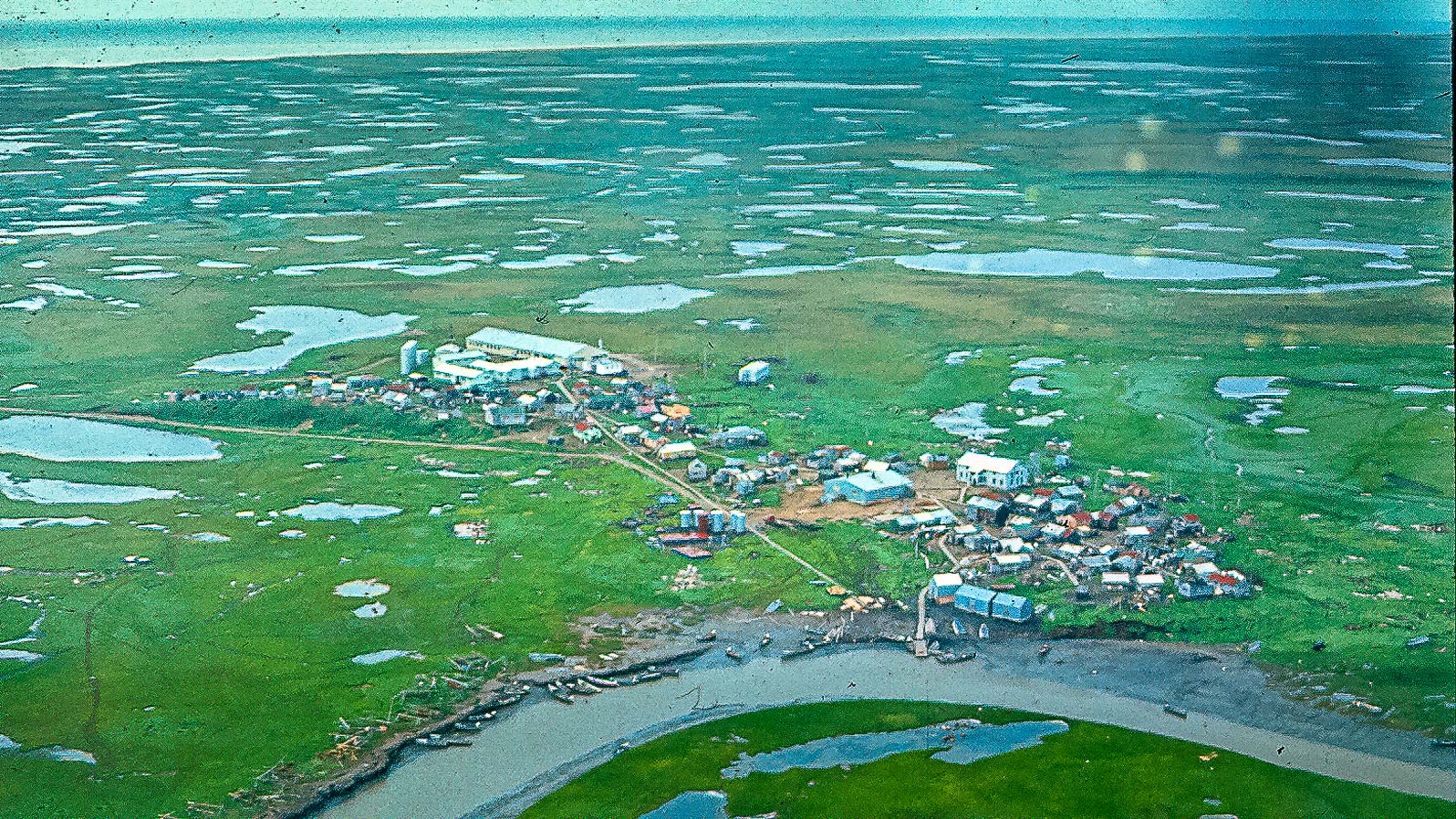
Image: Seabix, via Wikimedia Commons
A Coast with a History of Fall Storms
Fall storms in the Bering Sea have caused serious damage in western Alaska before. In September 2022, a disaster declaration was issued after the remnants of Typhoon Merbok struck the region, and about 100 members of the Alaska Organized Militia were activated to help communities, according to the Alaska National Guard. Guard members helped with debris cleanup in Newtok and made repairs in other coastal villages, the Guard said.
Forecasters said the weather should settle somewhat by late week. Drier weather returns to much of the Interior on Wednesday and Thursday, and another low pressure system could bring gusty winds and snow showers to the West Coast this weekend, the Fairbanks office said.
The weather service urged residents of flood-prone coastal areas to take steps to protect property and said that anyone who must travel should not drive around barricades or through water of unknown depth.
