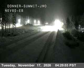
Image: Caltrans (California Department of Transportation)
A powerful Pacific storm is set to slam into Northern California and western Nevada on Wednesday, bringing up to 4 feet of snow to the Sierra Nevada, ridgetop wind gusts as high as 100 mph and the potential for whiteout conditions that forecasters said could make mountain travel nearly impossible through early Friday.
The National Weather Service office in Reno said in its forecast discussion early Tuesday that “the strongest winter storm of the season arrives Wednesday,” following a brief break in the weather Tuesday. The storm follows an earlier system that brought snow to the Sierra on Monday.
A winter storm warning for the greater Lake Tahoe area, including Truckee, Tahoe City, Incline Village, Stateline and South Lake Tahoe, takes effect at 4 a.m. PST Wednesday and runs until 4 a.m. Friday. The weather service said 2 to 4 feet of snow is expected above 7,000 feet, with 1 to 2 feet around lake level. Wind gusts of 30 to 40 mph are forecast for Truckee and lakeside communities, with ridgetop gusts reaching 100 mph and waves of 2 to 5 feet on Lake Tahoe.
“Travel could be very difficult to impossible,” the warning said. “The hazardous conditions will impact commutes Wednesday and Thursday. Strong winds could cause damage to trees and power lines.”
Forecasters in Reno said probabilistic guidance now shows a 100% chance of at least 12 inches of snow for the Sierra, with 3 to 4 feet along the crest. “Sierra ridge gusts of up to 100 mph will produce whiteout conditions at times,” the office said.
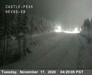
Image: Caltrans (California Department of Transportation)
Snow Totals Climb Along the Length of the Range
The warnings cover much of the Sierra Nevada and the mountains of far Northern California.
In Mono County, the weather service in Reno forecast 2 to 4 feet of snow west of U.S. 395, 10 to 20 inches along the highway and 2 to 10 inches east of it. Gusts could reach 55 mph in wind-prone areas along U.S. 395, with ridgetop gusts as high as 100 mph.
Farther north, a warning for Lassen, eastern Plumas and eastern Sierra counties calls for 6 to 12 inches of snow above 5,500 feet, with locally up to 2 feet west of U.S. 395 and ridgetop gusts as high as 70 mph.
On the western slope, the weather service office in Sacramento issued a winter storm warning for elevations above 4,000 feet in the northern Sierra and southern Cascades from 10 p.m. Tuesday until 4 a.m. Friday. That office forecast up to a foot of snow between 4,000 and 5,000 feet, 1 to 3 feet above 5,000 feet and up to 4 feet at the highest peaks. The warning area includes Interstate 80 and U.S. 50.
The Sacramento office said the heaviest snow is expected Wednesday morning and afternoon, with snowfall rates of 1 to 2 inches per hour and higher in stronger bands. Snow levels are forecast at 3,500 to 4,500 feet Tuesday night before rising to 4,500 to 5,500 feet Wednesday.
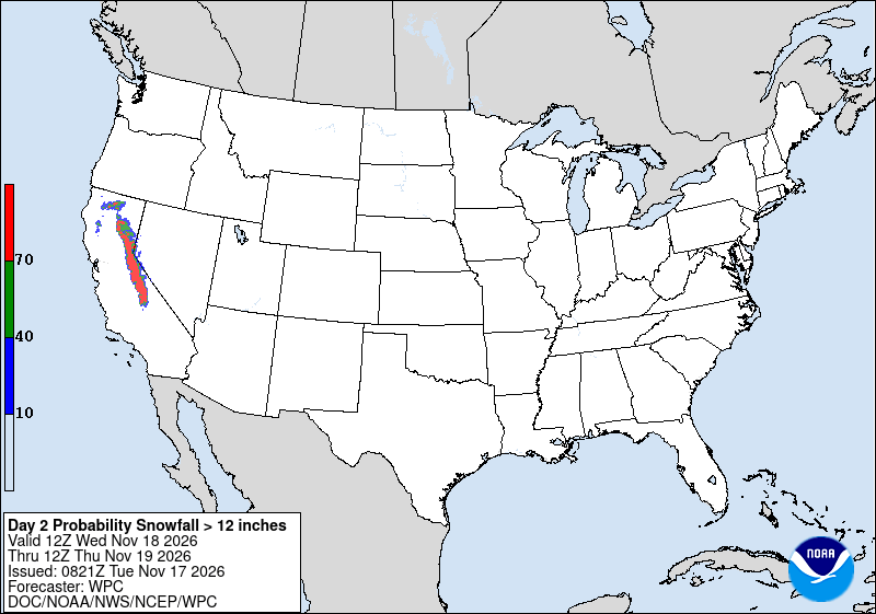
Image: NOAA/National Weather Service Weather Prediction Center
To the south, the weather service office in Hanford, California, posted a warning for the Sierra above 5,000 feet, including Yosemite National Park outside the valley and Kings Canyon and Sequoia national parks. It forecast 1 to 2 feet of snow above 5,000 feet and about 4 feet above 8,000 feet.
On the eastern side of the range, the weather service office in Las Vegas forecast 10 to 18 inches of snow between 5,000 and 8,000 feet on the Eastern Sierra slopes of Inyo County and 18 to 36 inches between 8,000 and 9,500 feet, with more at higher elevations. “Whiteout conditions are expected and will make travel treacherous and potentially life-threatening,” that warning said.
In far Northern California, forecasters called for 8 to 16 inches in the Shasta highlands and 8 to 12 inches above 4,000 feet in Trinity County.
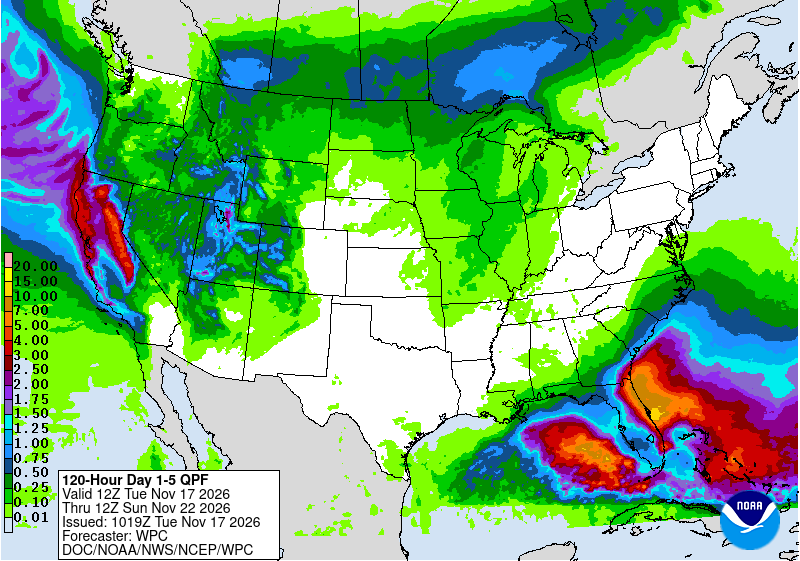
Image: NOAA/National Weather Service Weather Prediction Center
Damaging Winds Below the Snow Line
The storm also carries a strong wind threat at lower elevations.
The weather service in Medford issued a high wind warning for most of the Shasta Valley in central Siskiyou County, including portions of Interstate 5 and the communities of Weed, Gazelle, Grenada and Montague, from 4 p.m. Tuesday to 7 a.m. Wednesday. South winds of 35 to 50 mph with gusts up to 65 mph are possible.
“Damaging winds will blow down trees and power lines. Widespread power outages are expected,” that warning said.
In the San Francisco Bay Area, the weather service issued a high wind warning for the East Bay Hills through 1 p.m. Wednesday, with south winds of 25 to 35 mph and gusts up to 70 mph. Wind advisories cover the East Bay interior valleys and, through the Sacramento office, the Sacramento Valley, northern San Joaquin Valley, Delta and foothills, where gusts up to 50 mph are expected from 10 p.m. Tuesday to 4 p.m. Wednesday.
The Sacramento office forecast 1.5 to 2 inches of rain in the valley and foothills through early Friday, with isolated thunderstorms possible Wednesday and Thursday afternoons.
The Weather Prediction Center placed parts of coastal and northern interior California in a slight risk, level 2 of 4, for excessive rainfall from Wednesday morning to Thursday morning.
Valley Snow Possible in Western Nevada
East of the Sierra, the Reno office said valley floors in western Nevada have a 60% to 80% chance of 1 to 2 inches of snow, with some guidance suggesting up to 3 inches in leeside valleys such as Washoe Valley. Foothills could see 4 to 8 inches.
Snow levels Thursday are forecast to fall to 4,500 to 5,000 feet, which could affect both the morning and evening commutes, the office said.
A preview arrived early Tuesday. The Reno office said a narrow band of snow developed over Carson City, Washoe Valley and Dayton shortly after 2 a.m., with visibility at Carson City Airport dropping to three-quarters of a mile. Nevada Department of Transportation cameras showed snow accumulating across Carson City, forecasters said.
On the California side, the Sacramento office said lingering snow showers were moving over the Donner Pass area early Tuesday and that “some chain controls may continue this morning.” Caltrans highway cameras on Interstate 80 at Donner Summit and Castle Peak showed snow lining the roadway before dawn Tuesday.
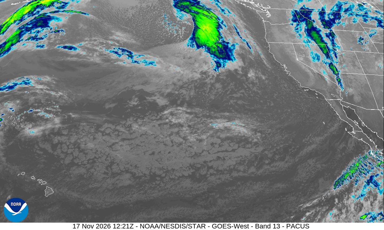
Image: NOAA/NESDIS/STAR
Travel Window Closing
Forecasters urged anyone planning a mountain trip to go Tuesday or wait.
“If you have travel plans, today is your best window for travel, especially over the Sierra,” the Reno office said Tuesday. The Sacramento office advised travelers to check Caltrans QuickMap for current road conditions and chain controls, and said, “This is the time to make adjustments to travel, find alternative routes, and re arrange plans.”
For ski areas, the snow is welcome. Palisades Tahoe announced Monday it would open Nov. 21 instead of the originally planned Nov. 25, KGO-TV reported.
Temperatures will stay 10 to 15 degrees below average through Friday, the Reno office said.
Snow is forecast to taper off early Friday, but forecasters said the pattern will remain active. The Reno office said another storm takes shape for late Saturday into Sunday with light snowfall and that it “will land around the Thanksgiving travel window.” The Sacramento office cited an “increasing potential for unsettled weather to continue into next weekend and into the following week.”
The weather service urged drivers to check Caltrans and the Nevada Department of Transportation for the latest conditions before leaving.
