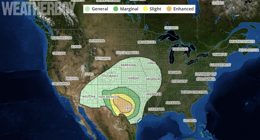
Another outbreak of severe weather is expected across the country this week as a vigorous area of low pressure moves from west to east. Thunderstorms are expected to produce large hail, damaging winds and a few tornadoes this afternoon over parts of southeastern New Mexico and far west Texas. The threat will transition mostly to severe wind as a complex of storms crosses west-central Texas tonight. Tomorrow, the risk area will shift east, with the severe weather threat arriving on the East Coast by Wednesday.
Today, in eastern New Mexico and western Texas, surface-based thunderstorms are expected to develop initially in the mid/late afternoon in a broken arc from central/northwestern New Mexico to higher terrain from south-central/southeastern New Mexico in far west Texas near the Guadalupe, Davis, and Chisos Mountains. Initially some of this activity should be discrete, yielding fast-moving supercells, some with large hail. Potentially significant and destructive hail over 2 inches in diameter is possible over this area, given the strong shear, early supercell modes steep low/middle-level lapse rates, and favorable inflow-layer water content. A few tornadoes also are possible, along with severe wind gusts.
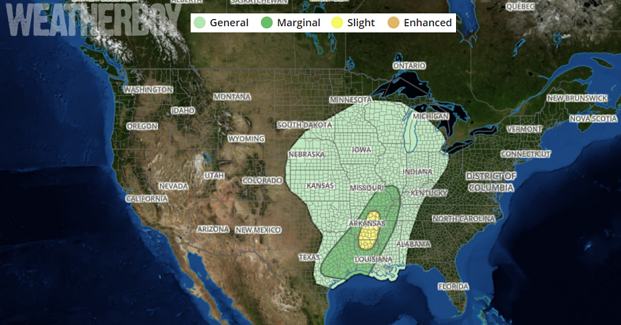
Tomorrow, the strong mid-to-upper level low and attendant trough will lift north/northeast across the Plains to Upper Midwest vicinity by Thursday morning. At the surface, an intense low will track east/northeast from eastern Colorado to western Iowa. A cold front will shift east/southeast across the central and southern Plains during the afternoon into overnight hours. Ahead of this feature, convection will likely be ongoing along a dryline from south-central Oklahoma into central Texas. This activity will shift east/northeast across eastern Oklahoma/Texas into the Lower and Middle Mississippi Valley and some threat for strong to potentially severe storms will exist during the afternoon into early evening on Wednesday.
On Thursday, the area of severe weather will shift east, bringing the threat of damaging winds, large hail, and the chance of isolated tornadoes to the East Coast.
