• Skip to primary navigation
  • Skip to main content
  • Skip to primary sidebar

Weatherboy

Weatherboy Weather News, Maps, RADAR, Satellite, and Forecasts.

  • Local
  • Earth Science News
  • RADAR
  • Current Warnings
  • Satellite
  • Current Maps
  • Forecast Maps
  • Video

Limited Threats of Severe Weather, Flooding from Soaking Storm

by Weatherboy Team Meteorologist - December 13, 2019

While some rains could be moderate to heavy at times, the threat of any excessive rainfall is limited to marginal risk in a small portion of eastern Maine. Image: NWS
While some rains could be moderate to heavy at times, the threat of any excessive rainfall is limited to marginal risk in a small portion of eastern Maine and extreme southeastern New Hampshire. Image: NWS


A soaking storm will impact portions of the East Coast tonight into tomorrow. While rains will be moderate to heavy at times, the threat of severe weather will diminish tonight in the southeast with no severe storms expected within the storm system tomorrow. Additionally, there is only a moderate risk of excessive rainfall over the next 36 hours which will keep the threat of flash flooding and river flooding low.

While thunderstorms are possible in the light green shaded area, no severe weather is expected on Saturday.  Image: weatherboy.com
While thunderstorms are possible in the light green shaded area, no severe weather is expected on Saturday. Image: weatherboy.com

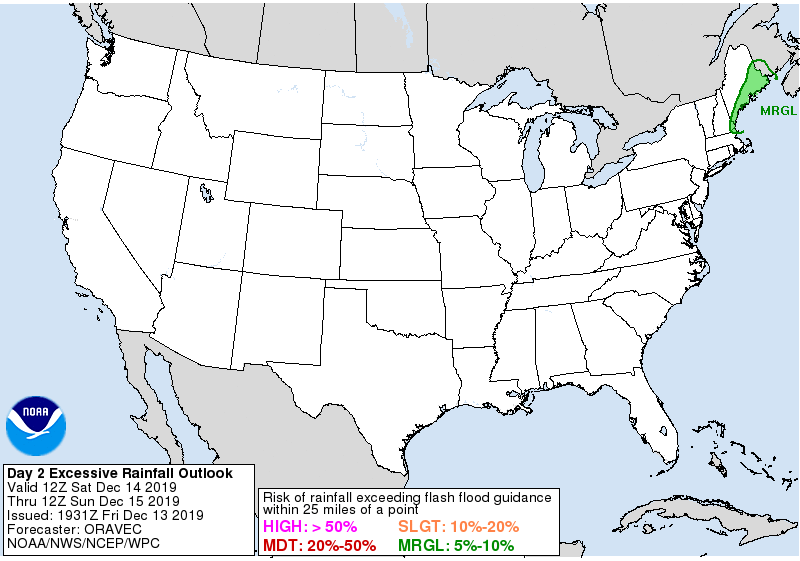
A rapidly deepening surface low pressure system will lift through Pennsylvania early Saturday with its cold front moving eastward through southern New England. An embedded surface wave developing along the front will ride the eastern New England coast into coastal Maine preceded by a relatively quick but impressive surge in moisture as the upper trough takes on a negative tilt. There’s considerable moisture to work with; as an example, precipitable water values around 1.50″ would be about 4 standard deviations above average for mid-December in coastal Maine.  Despite the lack of instability, strong dynamics with the system would encourage locally heavy rain to lift northeastward early Saturday north of Boston along I 95. With >200% of normal precipitation over the past couple of weeks, an additional 1-2+ inches of rain may cause some localized flash flooding concerns; however, those concerns are limited to extreme eastern Maine and southeastern New Hampshire. Elsewhere across the Northeast and Mid Atlantic, a flood threat isn’t expected to materialize.


While some thunder is possible in southeastern New England and the central Mid Atlantic states tomorrow, storms are not expected to reach severe limits there or elsewhere in the country.

Primary Sidebar

Sponsored Ad

Search

Latest News

  • Winter Storm Warning Up in Hawaii as Kona Low Brings 10″ Snow, 60 mph+ Winds
  • PM Thunderstorms Breaking Out Across Pennsylvania And Nearby Areas
  • Morning Quake Rattles New York
  • Another Catastrophe in Hawaii; Epic Flooding, Heavy Snow Returns; Dam Failure Imminent; Evacuations Ordered
  • Overnight Earthquake Rattles Alabama
  • Today Wraps Up Winter; Spring 2026 Arrives Tomorrow
  • Earthquake Rattles South Carolina Near Critical Dam
  • Geomagnetic Storm Watch Issued for Earth for March 19-21
About | Careers | Contact | Contests
Terms | Privacy | Ad Choices
Weatherboy is a (R) Registered Trademark of isarithm LLC, All Rights Reserved.
All content herein is Copyright by Isarithm LLC 1997-2022

Insert/edit link

Enter the destination URL

Or link to existing content

    No search term specified. Showing recent items. Search or use up and down arrow keys to select an item.