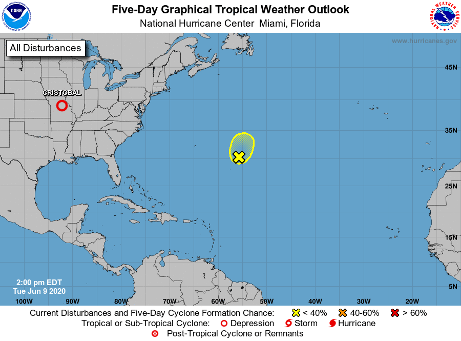
After creating three named storms during and before the first week of the Atlantic Hurricane Season, the basin is taking a pause for now. The National Hurricane Center in Miami, Florida believes there’s little chance any tropical cyclone will form over the next 5 days.
Tropical Depression Cristobal is located well inland now, located near latitude 38.9 north, longitude 92.2 west in central Missouri. It is moving to the north-northeast near 25 mph and this motion is expected to accelerate over the next 24 hours. Maximum sustained winds are around 30 mph with higher gusts. The estimated minimum central pressure is 992 mb or 29.30 inches.
Because of Cristobal, the National Weather Service has issued a Flash Flood Watch in effect for areas in and near the length of the Mississippi Valley. Wind Advisories are also up for the Lower Mississippi Valley up into the Upper Great Lakes. On the lakes themselves, a Gale Warning is up for much of Lake Michigan, portions of eastern Lake Superior, and for portions of Lake Huron.
While heavy rain of 2-4″ with isolated amounts to 6″ possible in the path of Cristobal, along with gusty winds and the threat of isolated tornadoes, the Atlantic Hurricane Basin is relatively quiet.
The National Hurricane Center is tracking one disturbance in the middle of the Central Atlantict . A non-tropical area of low pressure located over the central Atlantic Ocean a few hundred miles east of Bermuda is being tracked. According to the National Hurricane Center, development of this system as a subtropical cyclone appears unlikely due to unfavorable environmental conditions, and the low is expected to dissipate in a few days.
Beyond that one disturbance in the central Atlantic, there are no other areas showing any organization anywhere in the Atlantic Hurricane Basin.