After a prolonged quiet period in the Atlantic Hurricane Basin, things could be perking up; while some computer forecast models are suggesting the possibility of U.S. landfalls, the National Hurricane Center (NHC) has also updated their Tropical Outlook to discuss the possibility of two areas of potential tropical cyclone development.
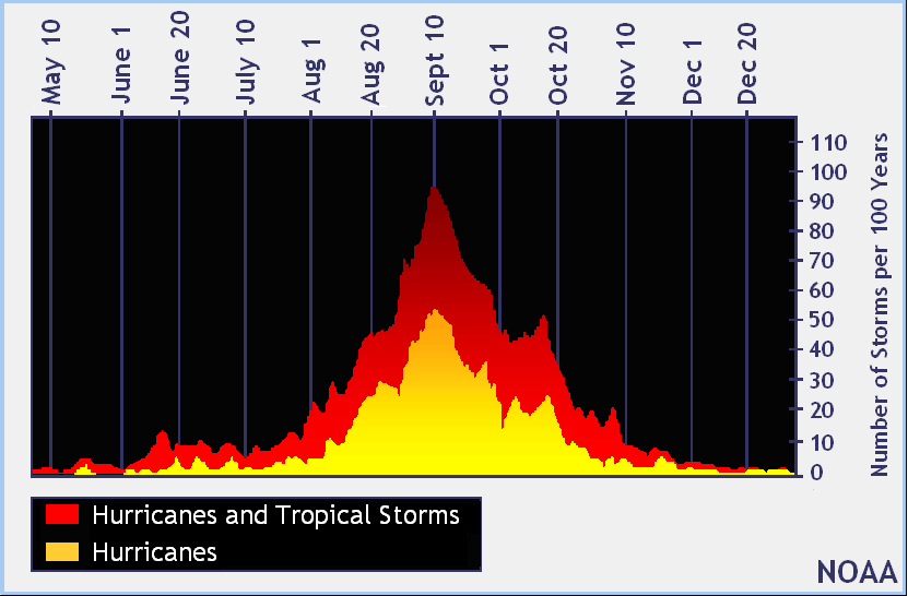
For the first time since 1982, the Atlantic hurricane basin has had no named tropical storms or hurricanes during the period stretching from July 3 to August 23. Traditionally, early to mid September is the typical peak of the Atlantic hurricane season. The lack of storms to date isn’t indicative on how the balance of the season will go nor does it reflect on how strong storms could become.
Today marks the 30th anniversary of catastrophic Hurricane Andrew’s impact onto southeast Florida. Andrew was the first named storm of the 1992 season, underscoring both how late a destructive season could start and how destructive just a single storm could be within the entire season.
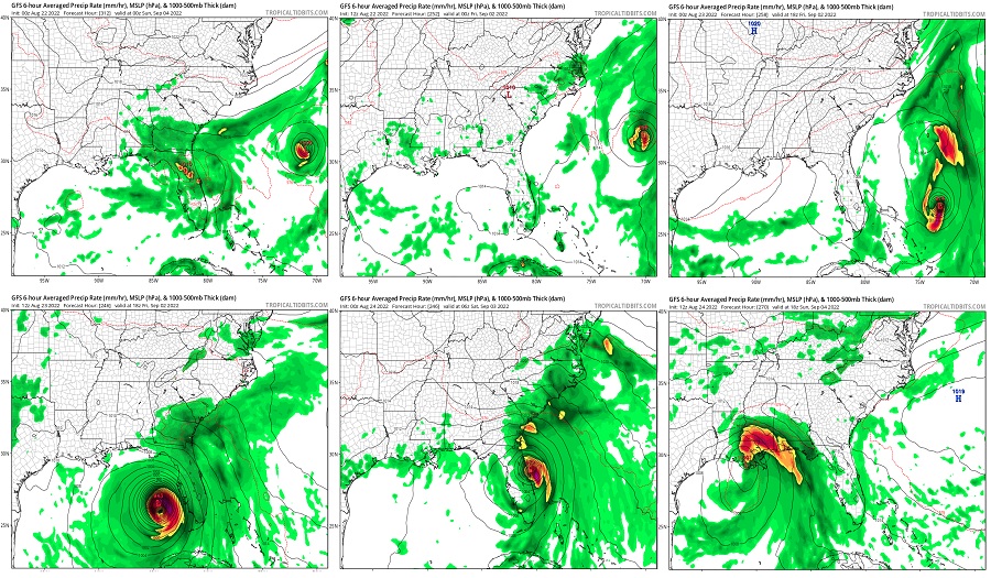
Computer forecast guidance used by meteorologists to aid in their forecasting does show the Atlantic perking up in the coming weeks. The ECMWF model, produced in Europe, indicates in the extended range that Atlantic tropical cyclone activity will pick up in the last days of this month and the early weeks of September. The GFS model, produced in the United States, is even showing the possibility of a tropical cyclone approaching the U.S. coast as soon as the Labor Day holiday weekend. However, the GFS has offered-up radically different solutions with each model run, casting doubt on whether it has an accurate handle on how things will unfold. The ECMWF and GFS are also not completely reliable in the extended range, which adds another layer of caution to those who wish to look too deeply into the computer forecast output.
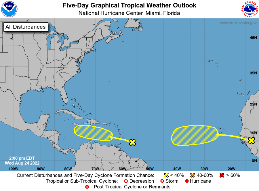
For now, the National Hurricane Center (NHC) in Miami, Florida has issued a Tropical Outlook identifying areas of concern in the near term.
The first area being watched is east of the Windward Islands. According to the NHC, shower and thunderstorm activity remains disorganized associated with a tropical wave located a few hundred miles east-southeast of the Windward Islands. However, the NHC adds that environmental conditions could become more conducive for slow development of this system in several days after it crosses the Windward Islands and moves across the eastern and central Caribbean Sea late this week into early next week. For now, the NHC says it is unlikely a tropical cyclone will develop here in the next 48 hours, but those chances grow to 20% over the next 5 days.
The second area being monitored by the NHC for potential tropical cyclone development is in the far eastern Tropical Atlantic. There,a tropical wave is forecast to move off the west coast of Africa in the next day or so. According to the NHC, Environmental conditions could support some slow development of this system late this week or over the weekend while it moves westward at 10 to 15 mph. As with the first system, odds of immediate development are low. There’s no chance of formation over the next 48 hours and a 20% chance of tropical cyclone formation over the next 5 days.
Elsewhere, the Atlantic Hurricane Basin remains quiet and it is unlikely a tropical cyclone will develop anywhere within it over the next 5 days.
The 2022 Atlantic Hurricane Season runs through to the end of November.
