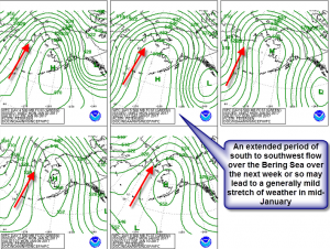
Before Christmas, some meteorologists were busy keeping an eye on the weather near the Bering Sea to understand that the weather would be a few weeks later on the US east coast. (A discussion of the Bering Sea Rule from December 21 can be found here.) On December 21st a pattern change accompanied by a pair of storms about 17-21 days in the future was advertised because of what was going on in the Bering Sea at that time. That pattern change and storms accompanying it can now be clearly seen in the short range forecast.
At the end of December 2016,, much of the eastern two-thirds of the US was at or a bit above normal in terms of temperature. This weather pattern was foretold by the Bering Sea Rule (BSR for short) in the few weeks before December 21 as an area of high pressure had been in control over the sea southwest of Alaska. This particular area of high pressure teleconnected to an area of high pressure over the Deep South that allowed mild, Pacific air to be in control across much of the East and Central US over the last 2 weeks or so.
Now a pattern change and a pair of storms is being seen right at the time the BSR said it would occur. According to Joseph Renken, who has authored papers on the BSR, “The first storm that will travel across the Deep South this weekend and the second on its heels for early next week were foretold by the BSR. Even the fact that the second storm would be slightly further north could of been predicted by what was going in the Bering Sea in mid to late December.”
There is plenty of attention being played to these pair of storms over the next week or so in the meteorological community. But Renken is already looking past these storms into mid-January and beyond, “Look for another repeat of the holiday week weather pattern in mid-January as a broad, long-lived period of south to southwest flow across the East may result starting mid to late next week and potentially lasting for ten days or so, through or beyond the twenty second.” Renken added, “This pattern that will setup is remarkably similar to what happened around the holidays. No record-breaking warmth is likely but no Arctic shots will threaten either . With the cold air being dumped over the West, any chill trying to get East will be greatly modified by the relatively mild land of the Lower Forty Eight.”
So while much deserved brainpower and effort is on these pair of storms that may bring wintry weather to the South and East over the next week, there are experts in the field that are already looking at what may follow. Fans of wintry weather across the East and the South may be disappointed right in the climatological heart of winter.