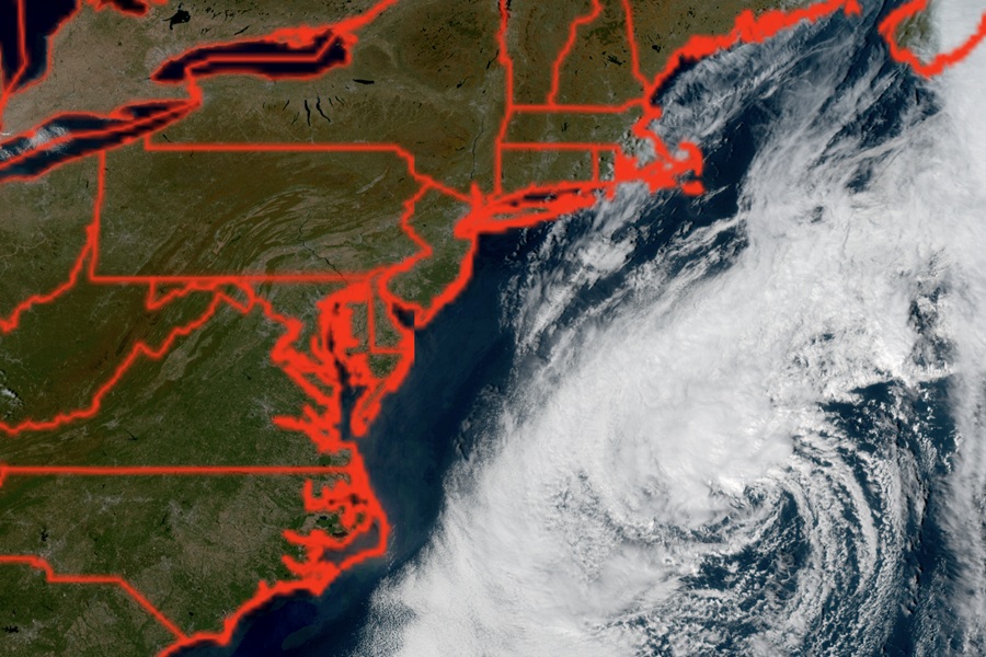
A coastal storm that has been far enough off shore to keep the coast dry but close enough to pound the coast with surf, beach erosion, and coastal flooding, could still develop into a subtropical storm. The National Hurricane Center said today in their latest Tropical Outlook that the disturbance which has been drifting off the Mid Atlantic Coast has a 40% chance of developing into a subtropical storm.
According to the National Weather Service, a subtropical storm is a non-frontal low-pressure weather system that blends characteristics of both tropical cyclones and extratropical mid-latitude cyclones. Like a tropical storm, the National Hurricane Center issues names to them once maximum sustained winds reach 39 mph or greater.
The National Hurricane Center says a storm-force non-tropical low pressure area located a few hundred miles off the North Carolina coast is producing some shower and thunderstorm activity primarily west of its center. Recent satellite wind data indicated the low is still frontal. Over the next couple of days, the National Hurricane Center believes the low could develop some showers and thunderstorms near the low-level center and gradually lose its frontal features while it moves slowly north-northeastward over the Gulf Stream, allowing the system to briefly develop subtropical characteristics. By the end of the week, the system is expected to accelerate northeastward away from the the eastern United States, where environmental conditions are expected to become unfavorable for any additional subtropical or tropical development.
Regardless of the status of the system, high winds, coastal flooding, and dangerous surf are expected along portions of the U.S. East Coast during the next few days.
