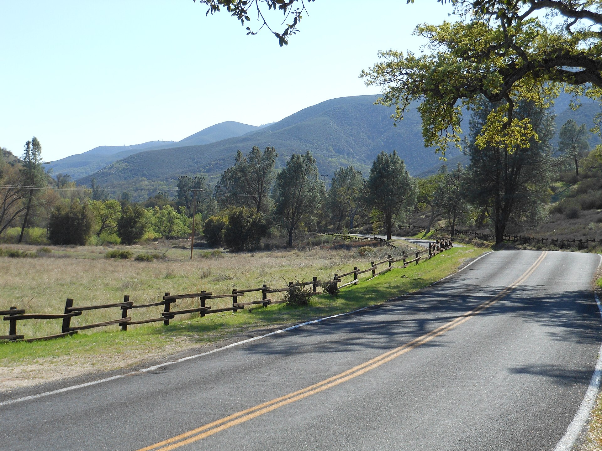
Image: Ken Lund via Wikimedia Commons
A magnitude 5.0 earthquake shook central California late Thursday near Pinnacles, setting off phone alerts across the region and drawing thousands of “felt” reports from the Monterey Bay area to the Central Coast, the U.S. Geological Survey said.
The quake struck at 10:49 p.m. PST Thursday (12:49 a.m. CST Friday) about 6 miles (10 kilometers) northwest of Pinnacles at a depth of about 4 miles (6.7 kilometers), according to the USGS. It was preceded by two smaller quakes and followed by a string of aftershocks that continued into early Friday.
The National Tsunami Warning Center said there was no tsunami danger. KSBY-TV reported no injuries or damage in San Luis Obispo or Santa Barbara counties, where viewers said they felt light shaking.
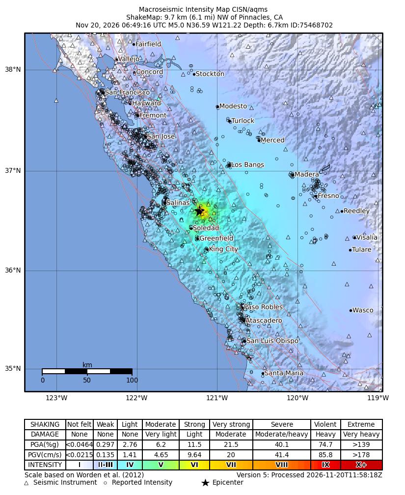
Image: U.S. Geological Survey/California Integrated Seismic Network
Foreshocks, Then the Main Quake
The sequence began quietly Thursday evening with tiny quakes northwest of Pinnacles. A magnitude 3.1 struck at 9:53 p.m. PST and a magnitude 3.3 followed at 10:12 p.m., according to the USGS. The magnitude 5.0 hit 37 minutes later.
The USGS initially estimated the quake at magnitude 5.1 before revising it to 5.0, KSBW-TV reported. The agency’s reviewed moment magnitude is 4.98.
Aftershocks followed quickly. The USGS recorded a magnitude 3.0 at 10:52 p.m. and a magnitude 3.4 at 11:14 p.m., along with a series of quakes between magnitude 2.5 and 2.7 through the night. A magnitude 3.1 struck at 12:35 a.m. Friday, and a magnitude 2.5 followed at 2:49 a.m.
In all, the USGS catalog listed 55 earthquakes of all sizes within about 9 miles (15 kilometers) of the epicenter from late Thursday afternoon through early Friday, most of them too small to be felt.
The nearest communities listed by the USGS were Pinnacles, about 6 miles away; Soledad, about 13 miles south-southwest; and Gonzales, about 14 miles west-southwest. Hollister and Salinas are within about 25 miles of the epicenter.

Image: U.S. Geological Survey
Felt Across a Wide Area
The USGS “Did You Feel It?” system had collected 3,300 responses by early Friday. Its community intensity maps showed reports scattered from the San Francisco Bay Area and Stockton to Fresno and San Luis Obispo. The highest reported intensity was VI, which corresponds to strong shaking, the USGS said.
The agency’s ShakeMap estimated that the strongest shaking near the epicenter reached intensity VI, with peak ground acceleration of about 0.29 times the force of gravity in the hardest-shaken area. That level of shaking is felt by everyone and can cause light damage, according to the USGS intensity scale.
A Marina resident told KSBW that they received a ShakeAlert notice and felt shaking. The alert advised people to “drop, cover, hold on” if shaking intensified, KSBW reported.
NBC Bay Area reported that several aftershocks between magnitude 2.5 and 3.4 followed the main shock and that a tsunami was not expected.
KSBY reported that viewers in Morro Bay, Creston, Paso Robles, Templeton and south Santa Maria called to say they felt light shaking.
How the Early Warning Worked
ShakeAlert, the earthquake early warning system for the West Coast that the USGS operates with state and university partners, issued its first alert message about 5 seconds after the quake began, according to the USGS ShakeAlert event summary. The system’s initial estimate was magnitude 5.1. The summary noted the alert was distributed through the Wireless Emergency Alerts system.
The summary estimated that people in Gonzales had about 1.6 seconds of warning before strong waves arrived, while Hollister had about 4.6 seconds and Salinas about 6.5 seconds. San Francisco, about 105 miles away, had an estimated 43 seconds of warning, but shaking there was expected to be weak.
Early warning gives people a few seconds to take protective action, such as dropping to the ground and taking cover, before the strongest shaking arrives, according to the USGS. Places closest to an epicenter often get little or no warning.
Image: U.S. Geological Survey
Low Risk of Damage
The USGS Prompt Assessment of Global Earthquakes for Response, or PAGER, system issued a green alert. That is its lowest level, and it indicates a low likelihood of casualties and damage.
The USGS ground failure products, which estimate the potential for earthquake-triggered landslides and liquefaction, were also green, the lowest level.
The National Tsunami Warning Center in Palmer, Alaska, issued a single tsunami information statement at 10:51 p.m. PST saying there was “NO tsunami danger from this earthquake.” The quake struck inland, about 30 miles southeast of Monterey, the center said.
What to Expect Next
The USGS issued an aftershock forecast at 2:49 a.m. PST Friday. For the following week, the agency estimated a 79% chance of at least one aftershock of magnitude 3 or larger and a 19% chance of one of magnitude 4 or larger. It put the chance of a magnitude 5 or larger quake during that week at about 2%.
The forecast said the number of magnitude 3 or larger aftershocks in the coming week could range from none to as many as eight, with about two most likely. Aftershock forecasts are updated as new data come in.
The USGS notes that any earthquake can be followed by a larger one, though that outcome is uncommon. Its aftershock forecasts include that small chance.
A Seismically Active Region
The quake struck in the hills east of the Salinas Valley, near Pinnacles National Park and the San Andreas fault, one of the most closely monitored fault systems in the country.
The USGS has long documented aseismic creep, a slow and steady slip of the San Andreas fault that happens without large earthquakes, near Hollister, about 20 miles north of the epicenter.
Small and moderate quakes are common in the area, but a magnitude 5.0 is large enough to be felt across several counties. The event’s significance score on the USGS feed was 1,002, reflecting its magnitude and the large number of felt reports.
Officials encourage residents of earthquake-prone areas to secure heavy furniture, keep emergency supplies on hand and practice “drop, cover and hold on.” Residents who felt the quake can still submit reports to the USGS “Did You Feel It?” system, which helps scientists map shaking.
