
Image: California Highway Patrol – Truckee
Bands of snow slickened roads around Reno and Carson City on Friday morning as a powerful early-season storm wound down over the Sierra Nevada, leaving 2 to 3 feet of snow on Lake Tahoe-area peaks and chain controls on mountain highways.
The National Weather Service in Reno extended a winter storm warning for the greater Lake Tahoe area and northeastern California until 10 a.m. PST Friday, calling for up to 6 more inches along the Sierra crest and up to 2 inches in the Tahoe Basin. A winter weather advisory covered the Reno-Carson City-Minden area until 10 a.m., with up to an inch of snow and locally 3 inches under heavier bands.
The storm, which arrived midweek, shut down Interstate 80 over Donner Summit for most of Thursday, closed schools and state offices in northern Nevada and prompted a backcountry avalanche warning around Lake Tahoe.
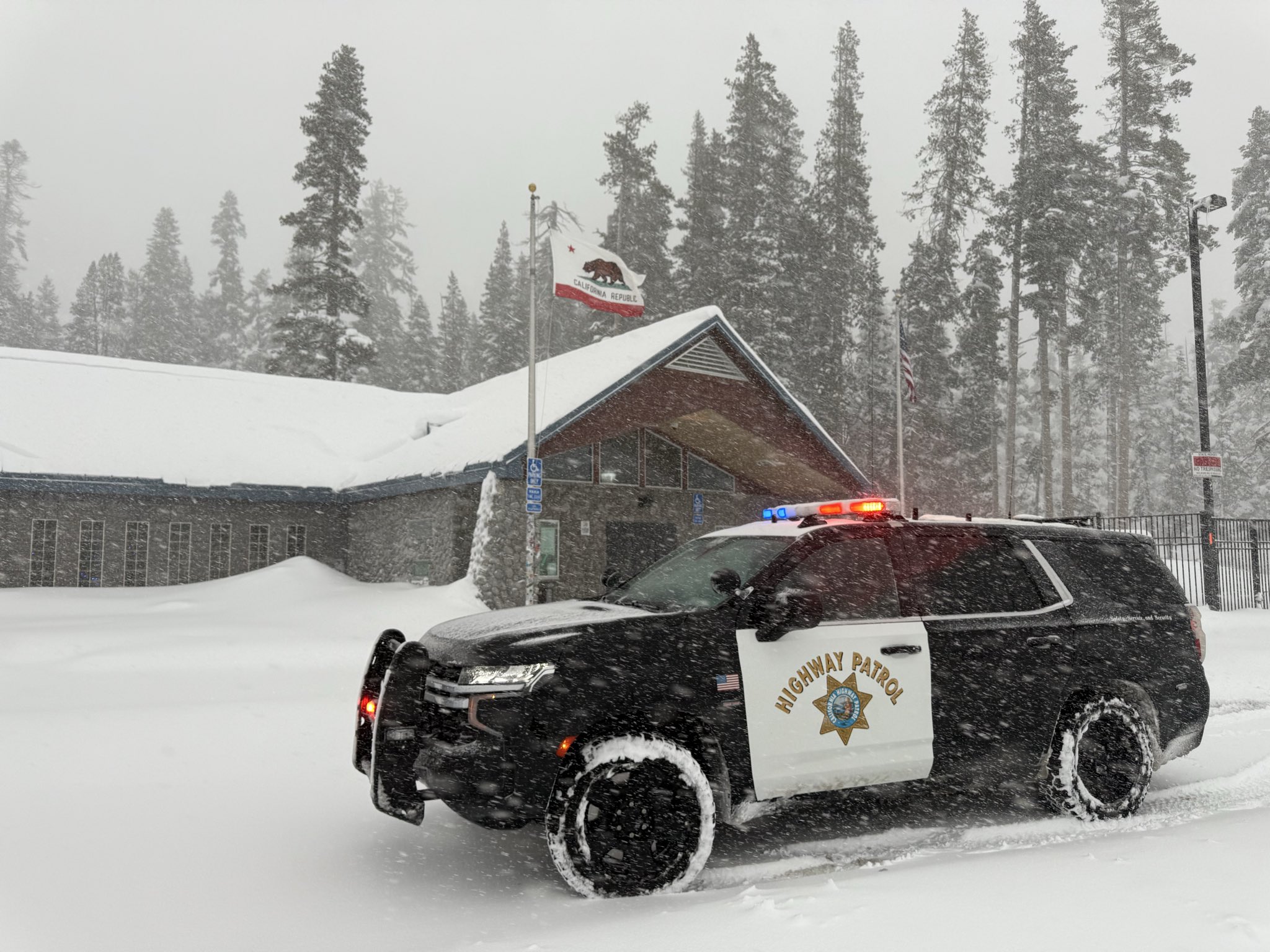
Image: California Highway Patrol – Truckee
Snow Bands Hit the Morning Commute
At 3:46 a.m. PST, the weather service said a lake-enhanced snow band coming off Lake Tahoe was producing accumulating snow across Washoe Valley and could shift into Carson City. The agency said the band could affect Interstate 580 between Carson City and Galena and U.S. 50 between Spooner Summit and Dayton.
Snow was also accumulating in west and north Reno, Washoe Valley and Carson City early Friday, the weather service said. “Where these bands set up is uncertain, so snow amounts will vary greatly over short distances,” the agency said in its advisory.
The office later posted road camera images showing snow building up on I-580 in Washoe Valley and on U.S. 395 between Reno and Stead. “Drive slow & allow extra time to get to your destination this morning,” the weather service said.
In the Sierra, the weather service said a disturbance pivoting through the region would bring another 2 to 5 inches of snow to the crest Friday morning from Plumas County south to the Tahoe Basin, with up to 2 inches in Truckee and Lake Tahoe communities. Heavier bands were possible near I-80 from Donner Summit to Truckee and along Tahoe’s east shore, where snow could fall at up to an inch an hour, forecasters said.
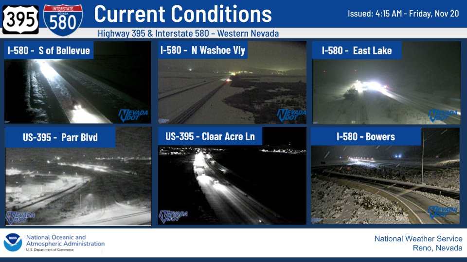
Image: NOAA/National Weather Service Reno
Highways Still Under Chain Controls
As of 4:33 a.m. PST Friday, the California Department of Transportation required chains on all vehicles except four-wheel-drive vehicles with snow tires on I-80 from 3.4 miles east of Gold Run to Truckee. Chains were also required on U.S. 50 from west of Kyburz to Meyers.
Caltrans said State Route 89 remained closed by snow between Emerald Bay State Park and Bliss State Park on Tahoe’s west shore and between U.S. 395 and Monitor Pass.
I-80 over Donner Summit was closed in both directions for most of Thursday before reopening with chain controls, KTVN-TV reported. AccuWeather reported that more than 30 semitrailers were stuck in heavy snow after multiple spinouts forced the interstate to shut down near Donner Pass during the storm.
“Good news! Eastbound and westbound traffic is being released over Donner Summit!” the California Highway Patrol’s Truckee office posted Thursday afternoon, adding that chain controls remained in effect.
Caltrans also reminded drivers to stay at least four car lengths behind snowplows after one of its plows was hit by a vehicle on State Route 89 during the storm. In Nevada, Washoe County sheriff’s deputies responded to numerous crashes over the course of the storm, KTVN reported.
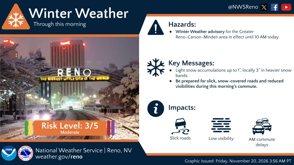
Image: NOAA/National Weather Service Reno
Totals Measured in Feet
Storm snowfall reports the weather service compiled Thursday morning included 30.3 inches 1 mile east of Soda Springs, 32 inches at the Mount Rose ski base, 25.5 inches near Incline Village, 22 inches at the Northstar ski base and 22 inches north of Washoe City. Mammoth Mountain’s base reported 20 inches and Bodie had 15 inches. In the Reno area, Verdi reported 6.8 inches and north Reno 1.4 inches.
Ski resorts reported even more at higher elevations. Sugar Bowl measured 34 inches at its summit over 24 hours, Kirkwood 27 inches and Palisades Tahoe 25 inches, KCRA-TV reported. Mt. Rose Ski Tahoe reported 32 to 36 inches of new snow in 24 hours, the Reno Gazette Journal reported.
KCRA meteorologist Ophelia Young said snow depth was about 1 to 2 feet around lake level and 2 to 3 feet on the peaks.
The storm also packed strong wind. The weather service recorded a gust of 76 mph near the base of Mammoth Mountain and 66 mph near the Mount Rose summit on Wednesday, along with a 54-mph gust southeast of Reno.
Schools, offices and power
The storm disrupted daily life across northern Nevada on Thursday. Nevada state government offices closed in Carson City and in Washoe, Storey, Douglas, Elko and Humboldt counties, according to the Reno Gazette Journal. Schools in the Tahoe Truckee and Lake Tahoe Unified school districts closed, Washoe County schools opened two hours late and the University of Nevada, Reno canceled in-person classes.
NV Energy reported unplanned outages affecting more than 3,200 customers in Washoe, Douglas and Humboldt counties and Carson City on Thursday morning, the newspaper reported.
The Sierra Avalanche Center issued a backcountry avalanche warning for the central Sierra from Yuba Pass to Ebbetts Pass, including the greater Lake Tahoe area, through early Friday. The center said large avalanches were expected in backcountry terrain. The warning did not apply to ski areas or highways with avalanche control programs.
Bitter Cold, Then Another Storm
The snow was expected to taper off Friday afternoon, opening what the weather service described as “a brief period of dry, but very chilly weather” through Saturday morning.
Friday night will be “especially frigid,” the agency said, with lows in the single digits and teens. Cold-prone places such as Truckee, Bodie, Bridgeport and the Carson Valley could approach subzero temperatures, and freezing fog was possible in Sierra valleys. Forecasters warned that roads would ice over at night as daytime snowmelt refreezes.
A weaker storm is forecast to arrive in two waves, the first Saturday afternoon and evening and a more widespread round Sunday afternoon and evening. The weather service put the chance of 6 inches of snow on passes such as Donner and Carson at 40% or higher and the chance of 2 inches at lake level at 20% to 50%. Reno has a 10% to 30% chance of a trace to an inch by Monday, forecasters said.
Monday and Tuesday may offer the best window for Thanksgiving travel, the weather service said, because more storms are possible around the holiday.
The new snow is a boost for ski areas. Palisades Tahoe planned to open Saturday, and several other resorts planned to open this weekend or for season pass holders before Thanksgiving, according to KCRA and the Reno Gazette Journal.
Officials urged drivers to check road conditions with Caltrans QuickMap and the Nevada Department of Transportation before heading into the mountains.
