
Image: U.S. Army Corps of Engineers, Los Angeles District
Floodwater from Arizona’s historic rains in late October and early November is still draining from Painted Rock Dam, and the controlled release is expected to keep low-water crossings along the lower Gila River flooded or closed into next week.
The National Weather Service office in Phoenix has extended its flood warning for the Gila River downstream of the dam to 11 a.m. MST Tuesday, Nov. 24. The warning covers Maricopa County and northeastern Yuma County. Releases from the dam continue “with flow peaking around 3000 cfs,” the weather service said, and a stream gauge just below the dam showed a stage near 10 feet.
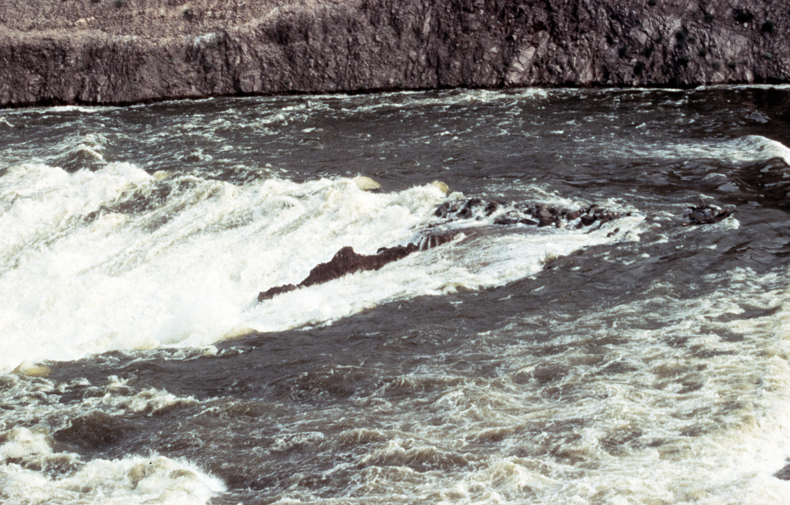
Image: U.S. Department of Defense/PVT. Richard Wright, via National Archives and Wikimedia Commons
“Low-water crossings are likely to become inundated with water and may not be passable,” the warning said. Farmland and low-water crossings along the river are among the places expected to flood, it said.
Painted Rock Dam, an earthen flood-control dam northwest of Gila Bend, is operated by the U.S. Army Corps of Engineers’ Los Angeles District. The reservoir behind it is normally dry. The Corps began releasing water Nov. 10 to lower the pool ahead of possible rain, Phoenix TV station KPNX reported, citing the agency.
Half the Reservoir Drained
The Corps’ real-time data showed the reservoir at an elevation of about 564 feet at 8 p.m. Wednesday, holding about 34,569 acre-feet of water, or about 1.5% of its capacity. Outflow was about 3,004 cubic feet per second.
That’s about half of what the reservoir held earlier this month. Yuma Informed, a local news site that tracks the Corps’ data, reported that the reservoir held about 7 acre-feet through Nov. 4. Water began pouring in early Nov. 5, and storage peaked at about 70,600 acre-feet by the morning of Nov. 9. The site said that peak amounted to about 23 billion gallons.
The Corps told KPNX that the release would last about two weeks and that peak discharges would reach 3,000 cubic feet per second. It said 13 road crossings along the 126-mile stretch of the Gila from the dam to the Colorado River would be closed because of the higher flows. The Corps also said the release schedule and discharge rates could change because of weather or other operational needs.
The Yuma Sun reported Nov. 9 that once releases reached 3,000 cubic feet per second, emptying the reservoir would take about 12 to 15 days. The Wellton-Mohawk Irrigation and Drainage District told the paper it would work with Yuma County Public Works to remove 13 road crossings to make room for the flows.
What the Gauges Show
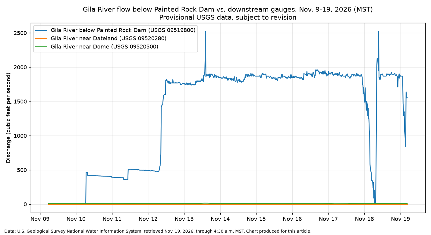
Provisional data from the U.S. Geological Survey show how slowly the water is moving down the river.
The USGS gauge just below the dam measured roughly 1,900 cubic feet per second for most of Wednesday and early Thursday, at a stage near 10 feet. The readings dropped briefly early Wednesday and again early Thursday before recovering. USGS labels the numbers provisional and subject to revision. They don’t match the Corps’ outflow figure, which is common when agencies measure at different points with different equipment.
Farther downstream, the USGS gauge on the Gila near Dateland showed no flow as of 4:30 a.m. MST Thursday. Near Dome, close to where the Gila joins the Colorado River east of Yuma, the gauge showed about 10 cubic feet per second.
That fits estimates the irrigation district gave the Yuma Sun. The district said water would take about 14 to 15 days to reach Dateland, with flows up to 2,000 cubic feet per second, and about 18 to 19 days to reach Avenue 57E. It said reaching Dome would take about 21 to 23 days, with up to 1,000 cubic feet per second flowing through Dome Valley. The paper said those estimates could change.
The Arizona Republic reported that some of the water may eventually reach the Colorado River, a rare link between the state’s two largest rivers.
Roads Closed Along the River
Maricopa County’s transportation department began closing roads near the dam as releases ramped up Nov. 12. It closed Rocky Point Road between Painted Rock Dam Road and Oakman Road “due to water release from Painted Rock Dam.” It also posted closures for Poco Dinero Road at Painted Rock Dam Road and west of the Gila River low-flow crossing because of flooding.
Officials have told drivers to obey barricades, plan other routes and never drive or walk into moving water. The state’s AZ511 traveler information system lists current closures.
Yuma County has dealt with this before. In 2023, during an earlier controlled release from Painted Rock, the county closed all of the low-flow river crossings in the eastern part of the county, Yuma Informed reported, citing a county newsletter.
The pace of the release also has a history. According to the irrigation district’s own history page, cited by Yuma Informed, the Corps’ original operating rules called for releases of at least 2,500 cubic feet per second to empty the reservoir quickly. The district said most releases have been kept lower because of potential damage to its land and to two other districts downstream.
Where the Water Came From
The water behind Painted Rock fell weeks ago and hundreds of miles away. Gov. Katie Hobbs declared a statewide emergency Nov. 2 after 72 hours of historic rain that began Oct. 30, KJZZ reported. Her declaration released $200,000 in state emergency funds.
During that storm, Sedona ordered mass evacuations as Oak Creek Canyon flooded, and Winslow, Cottonwood and Camp Verde were also under evacuation orders, the station reported. The state said seven counties and five tribal nations were affected.
Runoff from the storms moved down the Verde and Salt rivers into the Gila and then to Painted Rock. Salt River Project released water from Bartlett Dam on the Verde on Nov. 2, ABC15 reported. High water on the Salt River also led to closures at Tempe Town Lake, KPNX reported.
How unusual is this? The Bureau of Reclamation’s draft 2027 operating plan says no water reached or was released from Painted Rock in the water year that ended Sept. 30, Yuma Informed reported.
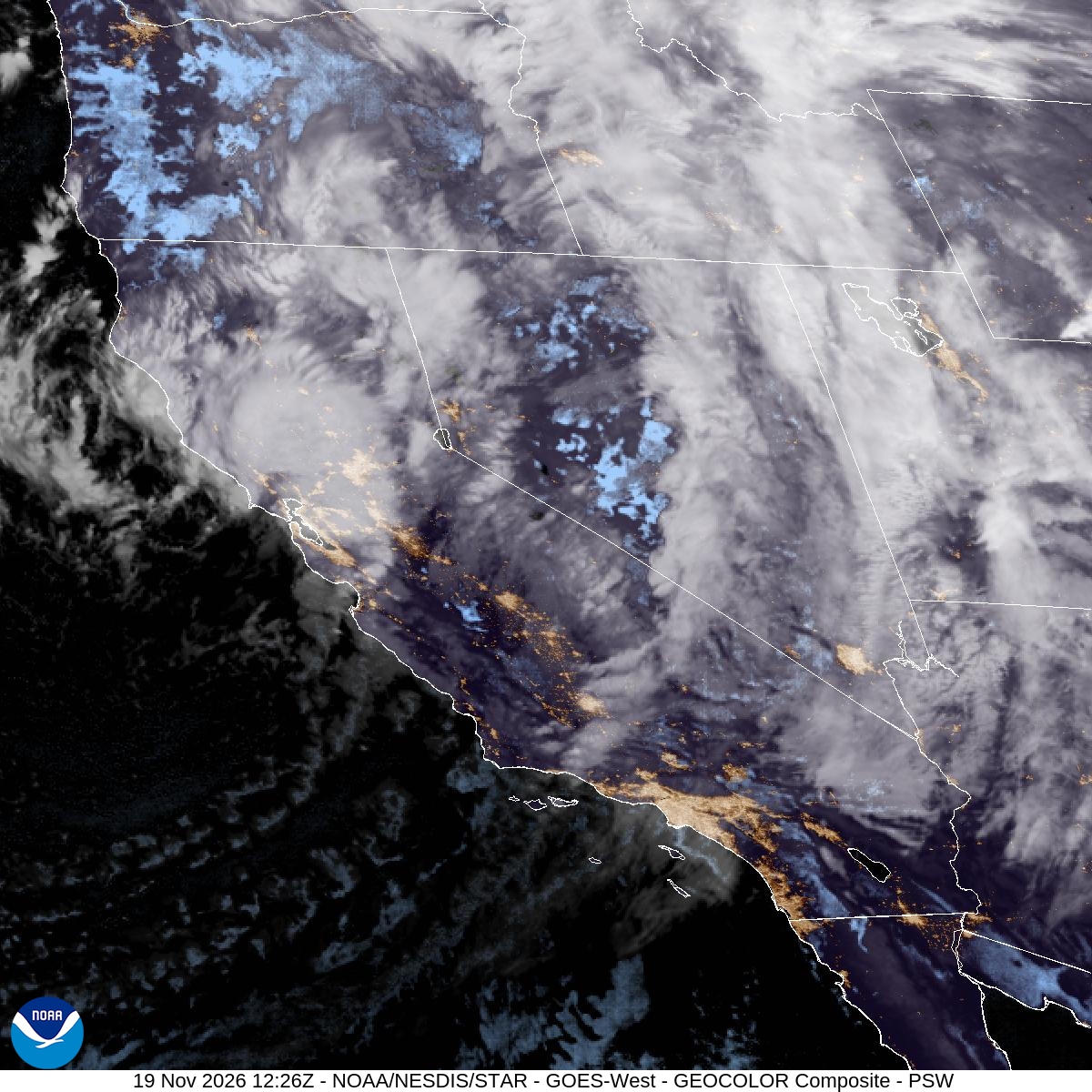
Image: NOAA/NESDIS/STAR
Dry Weather Helps
The forecast is on the side of the people managing the release. In its Thursday morning forecast discussion, the Phoenix weather service office said the Pacific storm now crossing California and the Great Basin would mostly miss Arizona. A cold front would bring little rain tonight into Friday, it said.
“The weather pattern for the rest of the week and well into next week will support overall dry and quiet weather conditions across the bulk of the Desert Southwest,” the office wrote.
Forecasters said highs in the lower deserts should dip to about 70 degrees Friday, with lows in the 40s Friday night into Saturday morning. Parts of Joshua Tree National Park and eastern Gila County are likely to drop below freezing. Some computer models show a Pacific storm late next week, but forecasters said dry weather was the most likely outcome.
Dry weather means less new water flowing toward the reservoir while the Corps finishes draining it. Still, the weather service warning makes clear the river will stay high below the dam through at least Tuesday, and possibly longer downstream as the water moves west.
