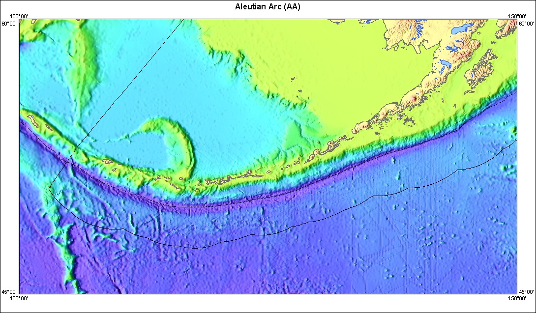
Image: U.S. Geological Survey
A magnitude 5.2 earthquake struck beneath the North Pacific south of Alaska’s westernmost Aleutian Islands on Wednesday, the U.S. Geological Survey said. It was the strongest U.S. earthquake recorded in the 20 hours ending Thursday morning.
The quake struck at 21:28:47 UTC, or 11:28 a.m. Hawaii-Aleutian Standard Time Wednesday, Nov. 18. That was 12:28 p.m. in Anchorage and 3:28 p.m. CST. The USGS placed the epicenter about 105 miles, or 169 kilometers, south of Attu Station, at 51.34 degrees north latitude and 172.86 degrees east longitude.
The USGS said its solution, a moment magnitude of 5.2, had been reviewed by a seismologist. The agency used 105 seismic stations to locate the quake. Magnitudes and locations can still be revised as seismologists analyze more data.
The USGS assigned the quake a depth of 10 kilometers, or about 6 miles. The agency labels that depth “operator assigned,” a standard value seismologists use when the true depth can’t be well determined. That’s common for offshore earthquakes far from the nearest seismometers.
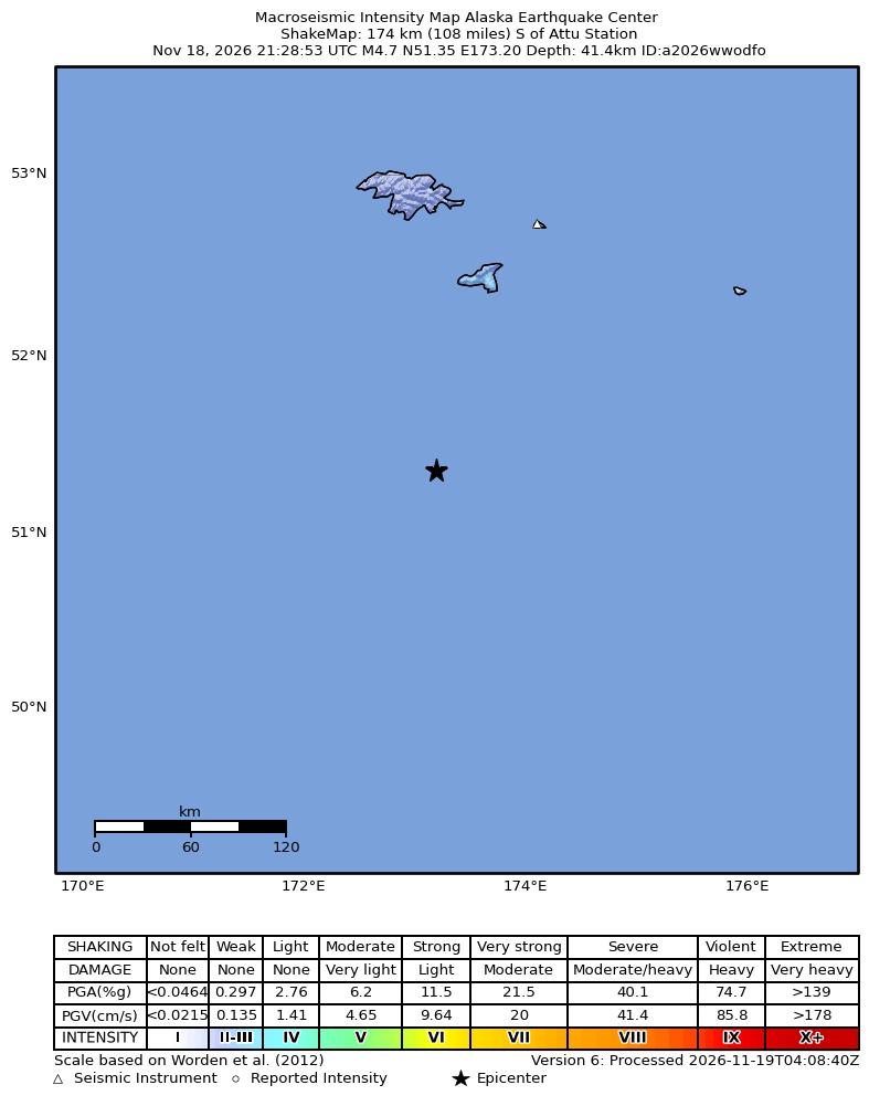
Image: Alaska Earthquake Center, University of Alaska Fairbanks, via U.S. Geological Survey
No Felt Reports, No Tsunami Flag
The epicenter was far from any community. The USGS “Did You Feel It?” system, which collects reports from the public, had received no reports from people who felt the quake as of Thursday morning. The USGS listed no PAGER alert, the system the agency uses to estimate deaths and economic losses after an earthquake, and its event summary did not carry a tsunami flag.
A ShakeMap from the Alaska Earthquake Center at the University of Alaska Fairbanks, distributed through the USGS, estimated a peak intensity of about 2.8 on the Modified Mercalli scale, which is weak shaking. That peak was over open ocean near the epicenter. The center’s map, version 6, shows the nearest islands well outside any zone of noticeable shaking.
The Alaska Earthquake Center’s own solution, shown on that map, was slightly different from the USGS solution. It listed a magnitude of 4.7 at a depth of about 41 kilometers, roughly 26 miles. Early estimates from different agencies often differ like this, especially for distant offshore quakes. The USGS lists its own reviewed magnitude of 5.2 as the preferred value.
Attu Island is the westernmost of the Aleutians, about 1,100 miles west of the Alaska mainland. Attu Station was the site of a U.S. Coast Guard long-range navigation, or LORAN, station. The 2010 census counted 20 people on the island, all at the station, and they left later that year when it closed. The island has had no permanent residents since.
A Quiet Stretch Broken
Earthquakes of this size aren’t unusual in the Aleutians, one of the most seismically active regions of the United States. But this particular stretch of sea floor had been quiet lately.
A search of the USGS earthquake catalog found 23 earlier earthquakes of magnitude 5 or larger within 100 kilometers, or about 62 miles, of Wednesday’s epicenter since 1970. The most recent was a magnitude 5.1 quake on Nov. 16, 2015, about 87 kilometers south-southeast of Attu Station. Before that, a magnitude 5.0 struck in the area in July 2012.
The catalog also lists much larger historical quakes nearby. They include a magnitude 7.4 on Sept. 2, 1907, about 151 kilometers south of Attu Station, and a magnitude 6.9 in November 1911. Magnitudes from those early years were estimated from far fewer instruments than are in use today.
In the 30 days before Wednesday’s quake, the catalog showed no earthquakes of magnitude 2.5 or larger within 100 kilometers of the epicenter. Through 12:30 UTC Thursday, about 15 hours after the main shock, no aftershocks of magnitude 2.5 or larger had been recorded within that radius either.
Aftershock Forecast
The USGS issued an automatic aftershock forecast for the earthquake. The agency put the chance of at least one magnitude 3 or larger aftershock in the week after the quake at about 51%. It put the chance of a magnitude 4 or larger at about 10%, and of a magnitude 5 or larger at about 1%.
The chance of an aftershock larger than the main shock, magnitude 6 or above, was about 0.1% over the week, according to the forecast. The forecast also gave lower odds for the first day alone: about 29% for magnitude 3 or larger and about 4% for magnitude 4 or larger.
Aftershock forecasts are based on statistics from past earthquake sequences and are updated as new data come in, the USGS says. Any aftershocks this far offshore would likely go unfelt.
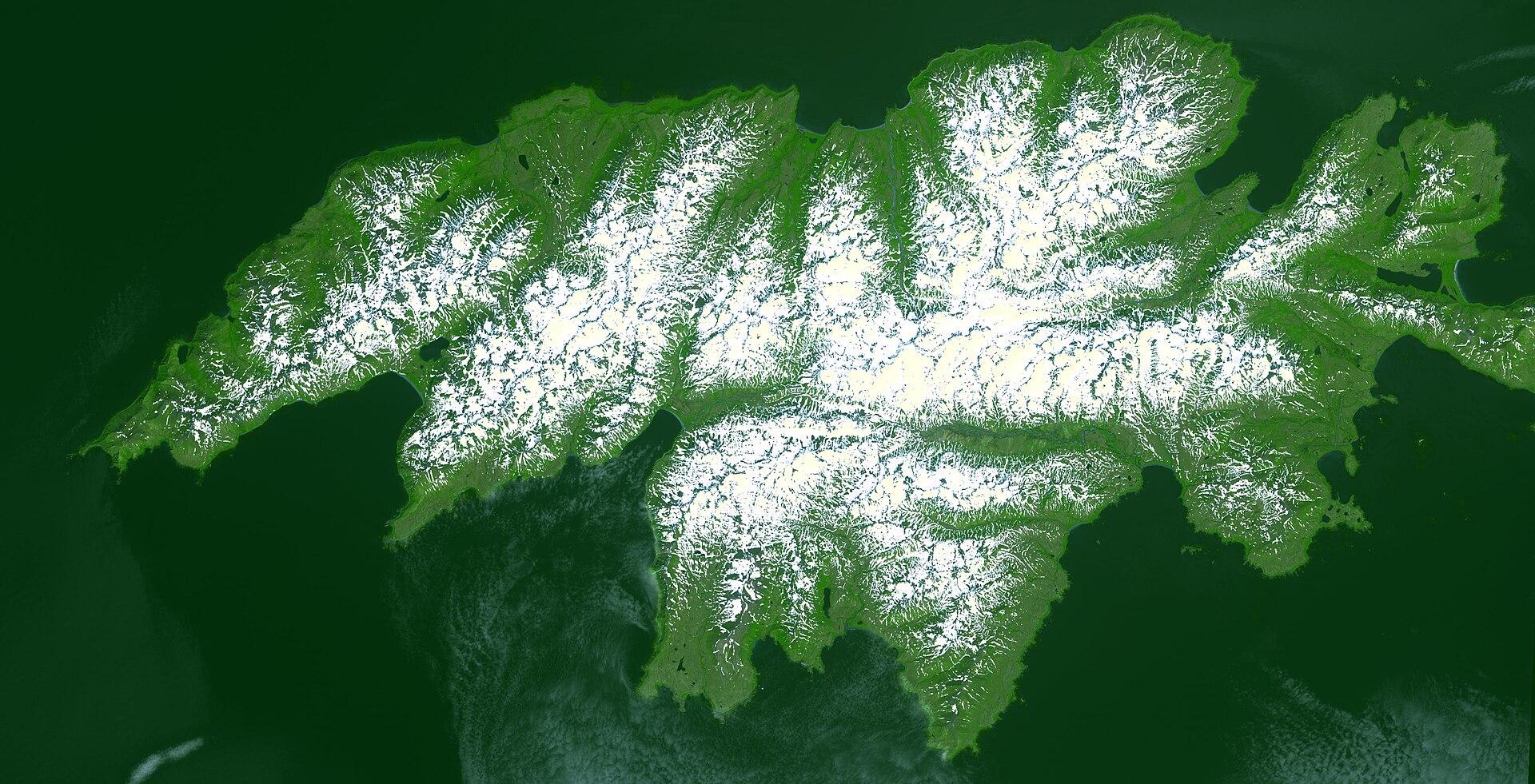
Image: NASA/METI/AIST/Japan Space Systems and U.S./Japan ASTER Science Team, via Wikimedia Commons
Why the Aleutians Shake
The Aleutian Islands mark the boundary where the Pacific Plate sinks beneath the North American Plate. The Aleutian Trench, a deep sea-floor trough, runs south of the island chain. In the western Aleutians, the Pacific Plate moves nearly parallel to the plate boundary, so much of the motion is sideways. The region produces frequent moderate quakes along with occasional very large ones.
The western Aleutians have generated some of the largest earthquakes in U.S. history. The USGS catalog lists the Western Aleutian Islands (Hawadax/Rat Islands) earthquake of Feb. 4, 1965, at magnitude 8.7.
Other U.S. Activity in the Window
Several smaller earthquakes were recorded across the U.S. in the same 20-hour window, which ran from 16:30 UTC Wednesday to 12:30 UTC Thursday.
A magnitude 3.4 quake struck about 11 miles east-northeast of Borrego Springs, California, at 3:39 p.m. PST Wednesday. It drew about 50 “Did You Feel It?” reports, the most of any U.S. quake in the period, with a top community intensity of 3, or weak shaking. A magnitude 3.4 struck about 26 miles north of Kernville, California, at 10:40 p.m. PST Wednesday, drawing six reports.
In Alaska, a magnitude 3.7 quake struck about 42 miles south of Ugashik on the Alaska Peninsula at 9:49 p.m. AKST Wednesday. A magnitude 3.0 struck about 16 miles south of Port Graham on the Kenai Peninsula at 7:22 p.m. AKST. Neither drew felt reports on the USGS site.
The USGS volcano notification system showed no alert-level changes at U.S. volcanoes during the period. In its daily update at 8:45 a.m. HST Wednesday, the USGS Hawaiian Volcano Observatory said Kilauea’s summit eruption remained paused after an episode of lava fountaining Nov. 5. The observatory said the summit had begun deflating slowly around midnight, which pushed the forecast window for the next fountaining episode to Nov. 20-23. The observatory said Kilauea’s summit released about 2,600 metric tons of sulfur dioxide a day on Nov. 17. The Nov. 5 episode sent lava fountains as high as about 660 feet, all from the north vent, it said. The eruption has stayed within a closed area of Hawaii Volcanoes National Park. Kilauea remains at the advisory alert level, aviation color code yellow.
The National Weather Service says people in coastal areas, including coastal Alaska, should know the natural warning signs of a tsunami. Those include strong shaking that makes it hard to stand or a sudden rise or fall of the ocean. If they notice those signs, they should move to high ground right away without waiting for an official warning. Neither applied to Wednesday’s distant quake.
