Image: NOAA/NESDIS/STAR
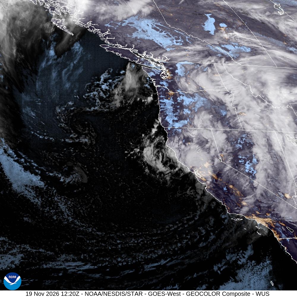
The Pacific storm that soaked California this week moved into the Great Basin on Thursday, bringing record snow to northeastern Nevada and winter storm warnings for mountains from Las Vegas to Elko. Strong winds raked the desert, and Utah’s mountains were bracing for up to 2 feet of snow.
Elko got 2.5 inches of snow Wednesday, tying the city’s daily snowfall record for Nov. 18, the National Weather Service office in Elko said early Thursday. The record was set in 1955.
The snow was the first wave of a storm expected to last through Friday. In its forecast discussion early Thursday, the Elko office said the Thursday evening commute would almost certainly be affected.
It’s the same system that brought heavy rain, Sierra Nevada snow and flash flood watches to California earlier this week.
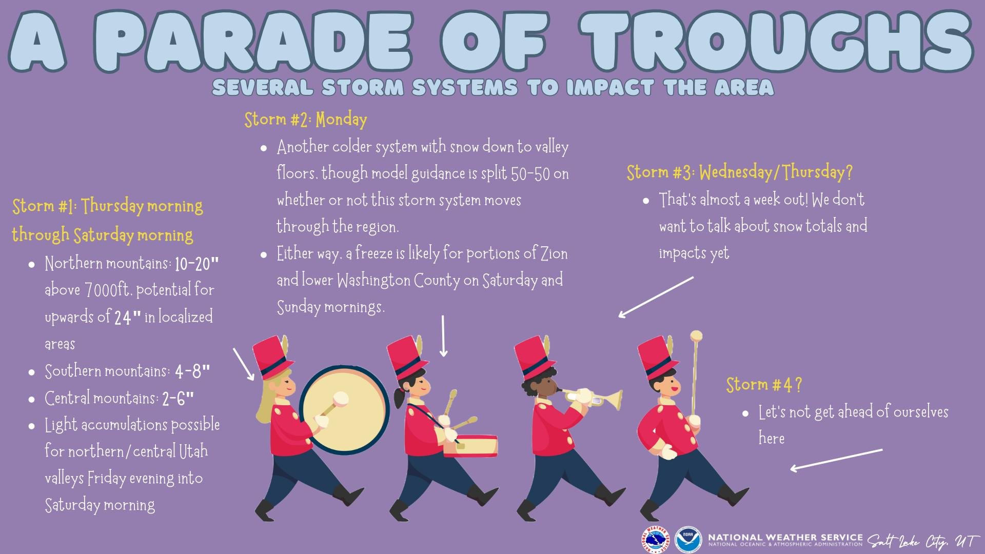
Image: NOAA/National Weather Service Salt Lake City
Snow and Blowing Snow Across Northern Nevada
The Elko office said the first round of snow showers reached valley floors across central and northern Nevada late Wednesday into early Thursday.
A winter storm warning for the Ruby Mountains and East Humboldt Range in Elko County runs until 4 p.m. PST Friday. Forecasters expect 8 to 18 inches of snow there, with wind gusts up to 40 mph. The weather service said travel could be “very difficult to impossible,” with visibility dropping below a quarter-mile in falling and blowing snow at times.
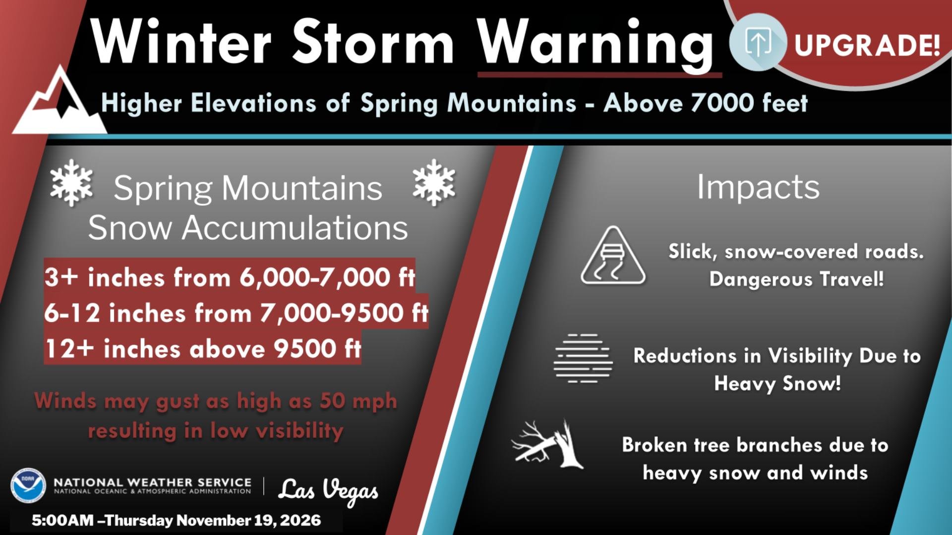
Image: NOAA/National Weather Service Las Vegas
A winter weather advisory covers much of the rest of northern and central Nevada, including Humboldt, Elko, White Pine, Lander and Eureka counties. Forecasters expect 1 to 5 inches of snow in valleys, depending on location, and 3 to 7 inches on higher passes and summits. In central Nevada, south to southwest winds of 20 to 30 mph with gusts to 40 mph could cause blowing and drifting snow, the weather service said.
The Elko office said a cold front would cross the region Friday, possibly bringing convective snow showers and snow squalls that could boost local snow totals. Temperatures are expected to fall sharply after the storm. The office forecast lows in the teens to lower 20s and highs only in the lower to middle 30s through early next week.
Reno Area: a Slick Commute
In western Nevada, the weather service office in Reno issued a winter weather advisory for the Greater Reno-Carson City-Minden area until 7 p.m. PST Thursday. Forecasters called for up to 3 inches of snow below 5,000 feet and 2 to 6 inches above 5,000 feet, including foothill communities such as Virginia City. Up to 10 inches could fall above 6,000 feet.
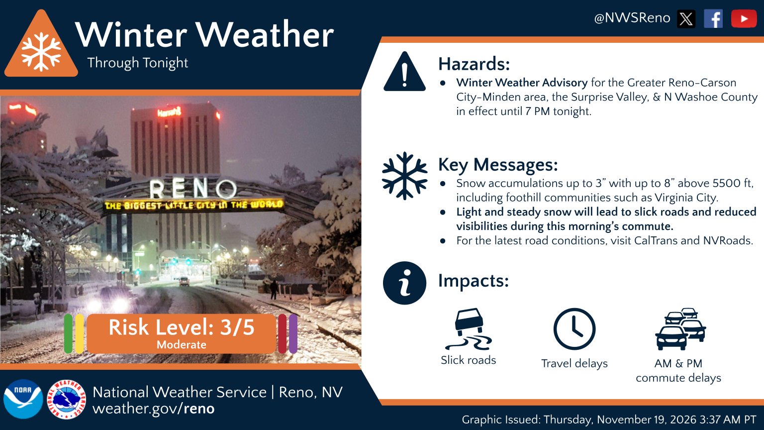
Image: NOAA/National Weather Service Reno
Light snow was expected to become steadier around Reno between 5 a.m. and 10 a.m. Thursday, “greeting the morning commute with slick, snow-covered roads and reduced visibilities,” the Reno office wrote in its forecast discussion. Forecasters said bursts of heavier snow in the afternoon and evening could make the evening commute difficult again.
The Sierra Nevada, which straddles the California-Nevada border, is still getting the most snow. A winter storm warning for the Greater Lake Tahoe area calls for 15 to 30 more inches above 7,000 feet and 8 to 14 inches around lake level through 4 a.m. Friday. Ridgetop gusts could reach 100 mph, the weather service said.
The Reno office expects a brief break Friday afternoon through Saturday morning, but warned of icy roads and freezing fog. It said lows could drop into the single digits to teens, and some of the region’s coldest spots, such as Bodie, Bridgeport and Truckee, could flirt with below-zero temperatures early Saturday.
Las Vegas: Mountain Snow and Desert Wind
In southern Nevada, the weather service office in Las Vegas upgraded a winter weather advisory for the Spring Mountains to a winter storm warning after raising its snowfall forecast. The warning runs until 4 a.m. PST Friday. Forecasters expect 6 to 12 inches between 7,000 and 9,500 feet, including the community of Mount Charleston, and up to 3 inches between 6,000 and 7,000 feet. Gusts could reach 50 mph, and blowing snow could sharply reduce visibility.
The office’s forecast for Mount Charleston called for 3 to 6 inches Thursday and 1 to 3 inches Thursday night, for a storm total of up to 11 inches. Visibility could drop to a quarter-mile or less in heavy snow Thursday evening, with gusts near 60 mph, forecasters said.
The Las Vegas office also issued winter storm warnings for higher terrain in Esmeralda and central Nye counties, where 4 to 8 inches is expected at Lida Summit.
Most of the Las Vegas Valley will see less than a tenth of an inch of rain, forecasters said, but wind is the bigger issue there. Wind advisories cover western Clark and southern Nye counties until midnight, with gusts up to 45 mph, as well as southern Clark County, parts of the Mojave Desert and northwestern Arizona. The weather service warned of strong crosswinds on U.S. 95 between Indian Springs and Desert Rock-Mercury and on Interstate 40, plus blowing dust near dry lakebeds.
The storm comes during Formula One race week in Las Vegas. Clark County said major road closures around the Las Vegas Grand Prix circuit began Wednesday night and would continue through Nov. 22. KVVU-TV forecast that showers could linger into the start of Thursday’s practice sessions, with calmer, cool weather for Friday’s qualifying and Saturday’s race.
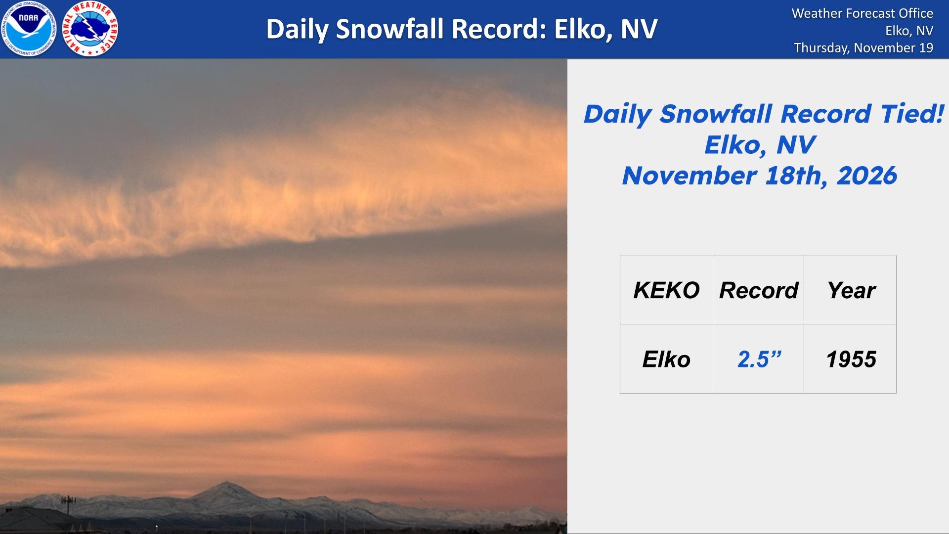
Image: NOAA/National Weather Service Elko
Utah Braces for Feet of Mountain Snow
The storm is expected to cross Utah in waves through Saturday morning. The weather service office in Salt Lake City issued a winter weather advisory for the Wasatch Mountains from 11 a.m. MST Thursday to 11 a.m. Saturday. Forecasters expect 10 to 20 inches of snow there, with more possible in the upper Cottonwood canyons, and 5 to 10 inches in the western Uinta Mountains.
Another advisory covers the Wasatch Back, where 4 to 8 inches could fall around Park City and Ogden Valley. A third covers southern Utah’s mountains, where forecasters expect 3 to 7 inches above 6,500 feet and up to 10 inches in the Tushar Mountains and around Brian Head.
“Owing to the relative long duration of this storm, snow amounts could become significant in the mountains,” the Salt Lake City office wrote. It added that “a general 1-2 feet seems like a good forecast at this time for the northern mountains.”
Valley snow is most likely Friday evening into Saturday morning, when colder air arrives behind the storm. Most lower valleys should get up to an inch, with up to 3 inches on the benches, the office said. Forecasters also said freezing temperatures were becoming more likely near Zion National Park on Saturday and Sunday mornings.
Wind Farther East, More Storms Ahead
The storm’s reach extends into Colorado. The weather service office in Pueblo issued a high wind watch for the southern Sangre de Cristo Mountains and Huerfano County from Thursday evening through Friday afternoon. Gusts there could reach 75 mph in the mountains and 65 mph along Interstate 25 near Walsenburg. Forecasters said damaging winds were most likely from 5 a.m. to 11 a.m. MST Friday.
The Salt Lake City office called the coming pattern “a parade of troughs,” with more systems possible Monday and midweek. The Reno office said a weaker storm would arrive Saturday afternoon, with more storms possible during Thanksgiving week. The Elko office urged travelers to watch the forecast and adjust holiday travel plans.
