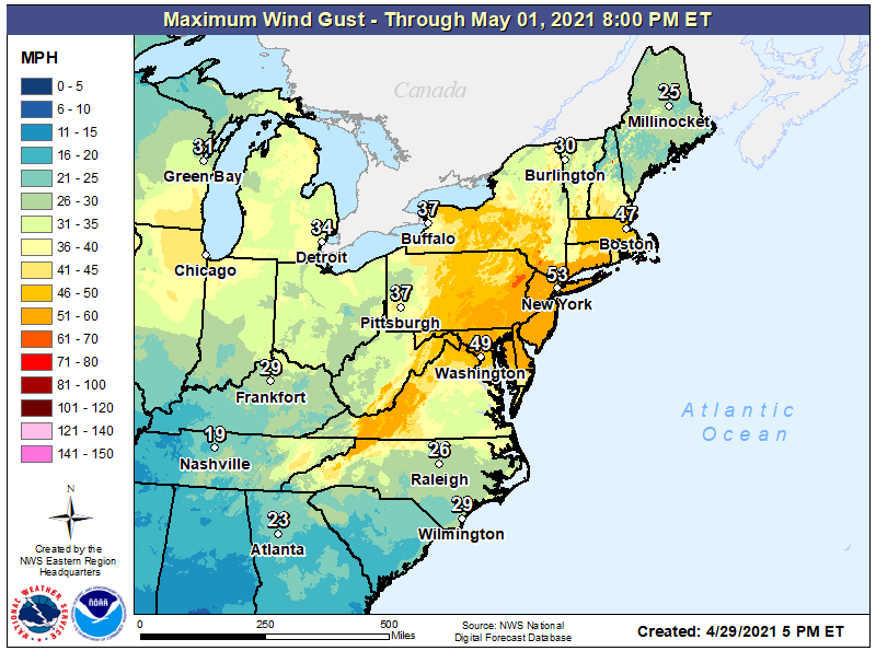
A damaging wind event is likely in portions of the eastern U.S. on Friday, possibly leading to tree damage and power outage. Because of the threat, the National Weather Service is issuing High Wind Watches and Wind Advisories for an area that spreads across many states.
A dynamic weather system is to blame for the hazardous weather expected on Friday. A cold
front will clear the coast by Friday morning with a strong shortwave trough and associated vorticity maximum rotating through the Mid Atlantic during the afternoon hours. This vorticity maximum will help drag a reinforcing cold front through the northeast. The approaching shortwave and good jet stream dynamics will help drive the rapid intensification of the low pressure departing into the Canadian maritimes. At the same time, high pressure will be moving into the Great Lakes, which combined with the deepening low to the northeast, will create a
very strong pressure gradient, maximized over the mid-Atlantic.
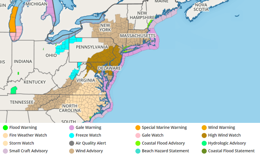
Image: weatherboy.com
While Friday morning will be breezy for many, with gusts of 20-30 mph expected, the real wind arrives during the afternoon with that secondary cold frontal passage. Along and just ahead of the front, a rain shower or squall is possible, any of which may contain enhanced winds over 50 mph if they form. Behind the front, the low level wind field will strengthen significantly in the late afternoon and evening.
These strong winds, gusting up to or just over 60 mph, could cause damage. Power outages are possible as trees and tree branches fall. Residence should secure any outdoor objects: garden decorations, children’s toys, garbage cans, and anything else not firmly anchored should be secured or brought indoors.
By late Friday, the atmosphere will begin to stabilize. As the atmospheric pressures balance out, wind gusts will diminish over night.
