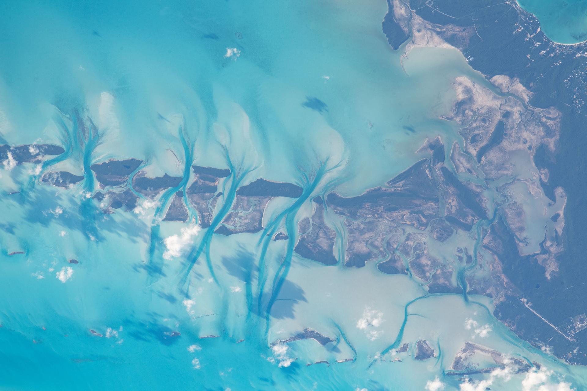
Image: NASA
An automated earthquake-monitoring network based in Haiti reported a magnitude 5.2 earthquake late Wednesday in the waters between Grand Bahama and the Abaco Islands. As of Thursday morning, though, the event had not appeared in the catalogs kept by the U.S. Geological Survey or Europe’s two main monitoring centers, and no tsunami message was issued.
The quake was detected by Ayiti-Séismes, a real-time monitoring system run by scientists in Haiti and France. Its automated system put the event at 05:07:22 UTC Thursday, Nov. 19. That is 11:07 p.m. CST Wednesday, Nov. 18, and 12:07 a.m. EST Thursday in Nassau.
The system placed the epicenter at 26.55 degrees north and 77.74 degrees west, over the shallow Little Bahama Bank. That spot is about 60 miles (96 kilometers) east of Freeport, about 42 miles (67 kilometers) west of Marsh Harbour on Great Abaco and about 107 miles (172 kilometers) north of Nassau. VolcanoDiscovery described the location as 15 kilometers (about 9 miles) east of Lightbourn’s Cay.
The network gave a depth of 5 kilometers (3.1 miles). Automated systems often use that as a default when depth is poorly constrained.
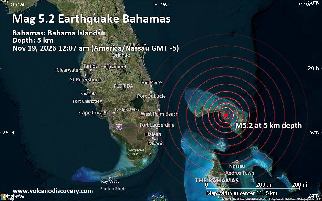
Image: VolcanoDiscovery
VolcanoDiscovery, a private website that collects earthquake reports from many agencies, posted the event about 11 minutes after the reported origin time. It said Ayiti-Séismes was “the first seismological agency to report it.” As of Thursday morning, Ayiti-Séismes was still the only agency listed in the site’s table comparing reports from different agencies.
VolcanoDiscovery’s own event page lists the quake’s status as “unconfirmed (uncertain whether an earthquake with these data happened).”
What Official Catalogs Show
The USGS National Earthquake Information Center routinely locates quakes of magnitude 4.5 and larger worldwide, and many smaller ones near the United States. As of about 7:15 a.m. CST Thursday, the USGS catalog had no event within roughly 500 miles (800 kilometers) of the reported epicenter since midday Wednesday.
The European-Mediterranean Seismological Centre and Germany’s GFZ Helmholtz Centre for Geosciences, which runs the GEOFON network, also had no matching event in their public catalogs.
The U.S. National Tsunami Warning Center, which covers the U.S. Atlantic and Gulf coasts and Puerto Rico, issued no message for the region.
No damage or injuries had been reported. Bahamas authorities had not commented publicly on the event as of publication.
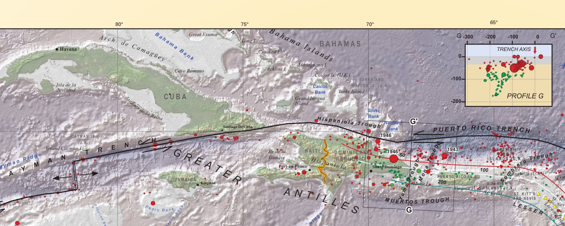
Image: U.S. Geological Survey
Felt Reports
VolcanoDiscovery said it had received five user reports for the event, all from the United States. Two of those people said they felt shaking. The reports came from Palm City, Florida, about 160 miles (260 kilometers) west of the reported epicenter, and Chiefland, Florida, about 370 miles (600 kilometers) to the northwest.
The site’s map shows one shaking report, near Florida’s Atlantic coast. The reports are self-submitted and unverified, and none came from the Bahamas.
The website also published modeled estimates of possible shaking, including light shaking in Cooper’s Town and Treasure Cay on Abaco and weak shaking in Freeport and Lucaya. Those figures come from the reported magnitude and location. They are not observations.
A Second Detection Near Mayaguana
The same network reported a second, smaller event about 38 minutes later. That was a magnitude 3.5 at 05:45:21 UTC, or 11:45 p.m. CST Wednesday and 12:45 a.m. EST Thursday. It was located about 28 miles (45 kilometers) south of Mayaguana in the southeastern Bahamas, near the Turks and Caicos Islands.
VolcanoDiscovery lists that event as “preliminary (automatic detection),” with no felt reports. It did not appear in the USGS or EMSC catalogs as of Thursday morning either.
What Ayiti-Séismes Is
Ayiti-Séismes launched in August 2019. It grew out of a citizen-seismology project in Haiti after the devastating 2010 earthquake, which killed tens of thousands of people.
Volunteers across Haiti host low-cost Raspberry Shake seismometers in homes, schools and businesses. The instruments stream data over the internet in real time.
Engineers at the Géoazur laboratory of Université Côte d’Azur in France built the detection system. It combines the citizen stations with conventional seismic stations run by agencies in Haiti, the Dominican Republic, Jamaica, Cuba, the Bahamas and Puerto Rico.
According to the project’s partners, automated software called SeisComP determines locations and magnitudes. A seismologist double-checks the results later. A peer-reviewed description of the project in Frontiers in Earth Science said automatic detection “can be quite complex” with Raspberry Shake stations, whose noise levels “can vary significantly” from one station to another.
The network was built to watch Haiti and the island of Hispaniola. Researchers say it has located roughly 4,000 Haitian earthquakes, including the deadly magnitude 7.2 Nippes quake in August 2021 and its aftershocks.
The project’s public website could not be reached Thursday morning, so its current listing for the Bahamas event could not be checked directly.
Why Automatic Reports Can Differ
Automated systems pick up seismic waves at a set of stations and solve for a location and magnitude within minutes, without a human in the loop.
Results are most reliable inside a network’s footprint, where stations surround a quake. The reported Bahamas epicenter lies well north of the area Ayiti-Séismes was designed to cover, so few of its stations were close.
At the edges of a network, a small error in timing or a misread signal can shift a solution by large distances or inflate the magnitude. Seismic waves from a distant large quake, ocean noise or local interference at a sensitive home station can also be mistaken for a regional event. That is why agencies review automatic solutions. Some are revised, others are merged with reports from other networks, and some are deleted.
A quake of magnitude 5.2 about 145 miles from West Palm Beach, Florida, would normally be recorded by stations in Florida, the Bahamas, Cuba and the wider U.S. network. That makes a USGS listing the main thing to watch for in confirming the event.
A Quiet Corner of the Caribbean
The Bahamas islands rise from a thick limestone platform on the North American plate. They sit far from the edge where that plate grinds past the Caribbean plate. That boundary runs south of the Bahamas, along a system of faults through southeastern Cuba, northern Hispaniola and the Puerto Rico Trench, where most of the region’s strong earthquakes occur.
The northern Bahamas is among the quietest areas in the region, seismically speaking. A search of the USGS catalog since 1900 found only two quakes of magnitude 3 or greater within about 185 miles (300 kilometers) of the reported epicenter.
One was a magnitude 3.2 on Feb. 22, 1992, about 17 miles (27 kilometers) southwest of Freeport. The other was a magnitude 4.0 on Feb. 8, 2024, offshore about 106 miles (171 kilometers) east of Cape Canaveral, Florida. People submitted about 250 “Did You Feel It?” reports to the USGS for that event.
If confirmed, a magnitude 5.2 near Grand Bahama and Abaco would be the largest quake in that area in the USGS record. Farther south, closer to the plate boundary, larger quakes are more common. The USGS recorded a magnitude 5.0 off Cuba’s north coast in November 2022 and a magnitude 5.6 near Moa, Cuba, in December 1998.
The USGS, EMSC and GFZ catalogs are public, and any new or revised listing would appear there.
