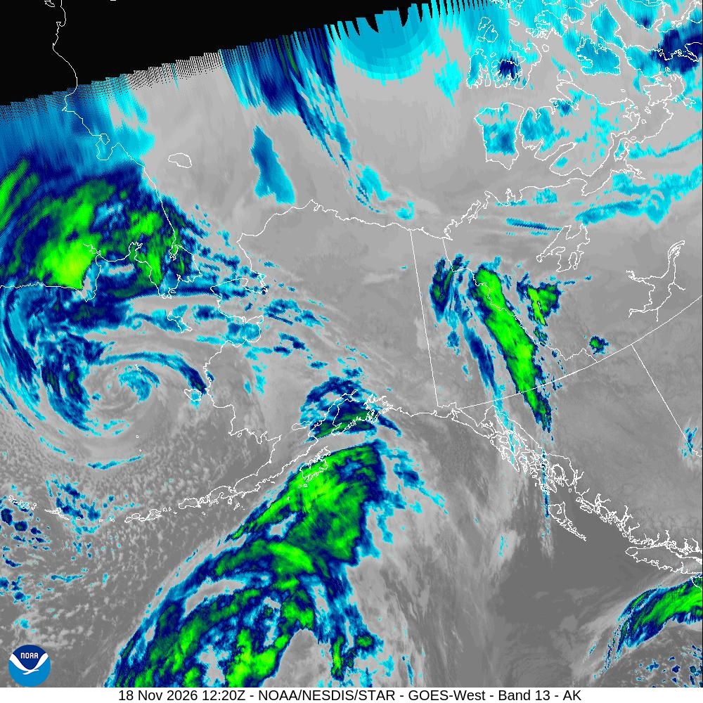
Image: NOAA/NESDIS/STAR
A strong Bering Sea storm pushed into western Alaska on Wednesday, bringing high winds, blowing snow and rising seas that forecasters said could flood low-lying parts of Hooper Bay and push water toward homes in Nome during the day’s high tides.
The National Weather Service office in Fairbanks said in a forecast discussion Tuesday afternoon that “a strong coastal storm approaches the West Coast tonight, bringing with it strong winds, heavy snow, and areas of high surf/coastal erosion along the West Coast from Kivalina south.”
Of all the coastal communities in the storm’s path, forecasters singled out Hooper Bay, a village on the Bering Sea coast of the Yukon-Kuskokwim Delta, as the place of greatest concern.
Hooper Bay Under Coastal Flood Warning
A coastal flood warning for the Yukon Delta coast took effect at 3 a.m. AKST Wednesday and runs until 3 p.m. AKST Thursday. The weather service forecast water levels 4 to 7 feet above the normal high tide at Hooper Bay and 2 to 5 feet above normal elsewhere along the coast, with southeast winds gusting as high as 55 mph.
“Moderate coastal flooding is likely for Hooper Bay,” the warning said. “Roads may be closed with airstrip access and use limited. Low lying property including homes, businesses, and some critical infrastructure may be inundated. Shoreline erosion may occur.”
The warning added: “With the worst case scenario, the fuel tanks could be at risk for flooding.”
Hooper Bay will see two high tides Wednesday, and forecasters said water levels during the second are expected to be slightly higher than the first. Winds were forecast to shift from southeast to more southerly Wednesday morning, the warning said.
As of early Wednesday, the Fairbanks office had not issued any local storm reports of flooding from the storm. Its most recent storm report was issued Sunday.
A winter storm warning covering the Yukon Delta coast and the lower Yukon River, including Hooper Bay, Scammon Bay, Chevak, Kotlik and Emmonak, runs until 3 p.m. AKST Thursday. The weather service forecast 2 to 5 inches of snow and said blowing snow could cut visibility below half a mile, with “periods of blizzard conditions” possible. Rain could mix with the snow at times Wednesday and Thursday as warmer air moves in from the south.
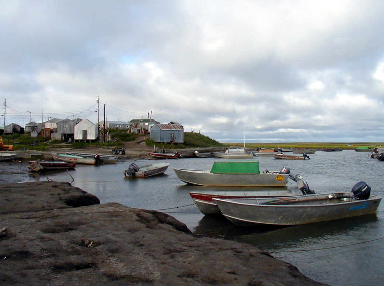
Image: CTLiotta via Wikimedia Commons
Nome Braces for High Water
Farther north, a coastal flood advisory for the southern Seward Peninsula coast, including Nome and Golovin, runs until 3 p.m. AKST Thursday. Forecasters expect water 4 to 6 feet above the normal high tide.
“In Nome, water will approach homes in the Belmont Subdivision, portions of the port area will have standing water, and wave run-up will push water much higher than normal,” the advisory said. “In Golovin, water will approach beach property.”
NOAA’s tide gauge at Nome showed water rising ahead of the peak. Preliminary data showed the water level reached about 1.8 feet above mean higher high water late Tuesday night and was about 1.2 feet above that mark at 3:30 a.m. AKST Wednesday. Forecasters said winds would peak on Wednesday before weakening into Thursday.
The same area is under a winter storm warning until 3 p.m. AKST Friday, with 2 to 6 inches of snow and southeast gusts as high as 55 mph. Weather service meteorologist Carter MacKay told KNOM Radio earlier this week that the storm’s most significant impacts were expected Wednesday.
“Gusts up to 50 miles an hour and heavy snow will create hazardous travel conditions, particularly throughout those daytime hours on Wednesday,” MacKay said. He said Nome could see about 4 inches of snow between Tuesday and Friday.
Blizzard on St. Lawrence Island
The storm’s strongest winds are expected on St. Lawrence Island in the northern Bering Sea, home to the villages of Gambell and Savoonga. A blizzard warning there runs until 3 p.m. AKST Thursday, with gusts up to 70 mph and 2 to 5 inches of snow.
“Travel should be restricted to emergencies only,” the warning said, adding that snow and blowing snow could cut visibility below a quarter mile and that “strong winds could result in power outages.” A high surf advisory for the island called for water levels 2 to 4 feet above normal high tide.
High surf advisories also cover the Bering Strait coast and Shishmaref, eastern Norton Sound, and Kivalina, the Red Dog Dock and the northern Seward Peninsula, where forecasters warned of localized beach erosion. Offshore, the weather service in Anchorage posted storm warnings for much of the Bering Sea and a high wind warning for the Pribilof Islands.
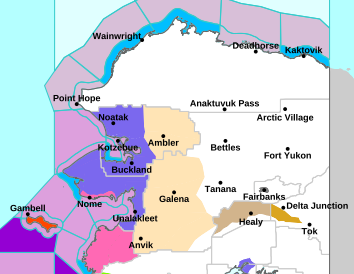
Image: NOAA/National Weather Service Fairbanks
Little Sea Ice to Blunt The Waves
By mid-November, sea ice is usually beginning to form along Alaska’s western coast, where it can act as a natural barrier against storm surge and waves. This year, that protection is largely missing.
“We typically expect to see the Kotzebue Sound, Norton Sound, completely full of ice,” MacKay told KNOM. “When taking a look back at our median ice edge around that 1980, 2010, 2020 range, but obviously this year we’re well below normal on sea ice given the warmer temperatures.”
Climatologist Rick Thoman of the Alaska Center for Climate Assessment and Preparedness told the station in an email that sea ice extent this year is the lowest since 2020 and that he expects the storm to break up and melt ice that has begun to form along the coast.
The storm comes four years after the remnants of Typhoon Merbok struck in September 2022. NOAA said officials tallied damage to 40 towns and villages along some 1,300 miles of coastline from the Bering Strait region to the mouth of the Kuskokwim River.
Atmospheric River Aims at Southcentral
The storm’s reach extends well beyond the west coast. The weather service in Anchorage issued flood watches for the southern Kenai Peninsula, including the city of Seward, from Wednesday morning through Thursday afternoon, citing an atmospheric river expected to bring 2 to 4 inches of rain, with locally higher amounts at elevation.
Forecasters said rain falling on new snowpack “may cause flooding along smaller streams and creeks, in low-lying and poor drainage areas, and cause ponding of water on roadways.”
In Anchorage and much of Southcentral, a winter weather advisory takes effect Wednesday morning. Alaska’s News Source meteorologist Aaron Morrison said mixed precipitation could leave a glaze of ice of a few hundredths of an inch on surfaces after several days of subfreezing temperatures, with gusts up to 60 mph possible along the Anchorage Hillside Wednesday evening through Thursday.
In the Interior, a high wind warning for the eastern Alaska Range north of Trims Camp calls for gusts up to 75 mph through Thursday afternoon, with the strongest winds near Isabel Pass.
What Comes Next
Forecasters in Fairbanks said winds should mostly subside by early Friday, though snow is expected to continue in the western Interior through Friday. They warned of “a fairly active weather pattern through the weekend with additional rounds of snowfall and gusty winds.”
Residents along the coast were urged to protect flood-prone property and avoid floodwaters. “If travel is required, do not drive around barricades or through water of unknown depth,” the coastal flood warning said.
